Webcams Current Snow Report Avalanche Report Weather & Traffic
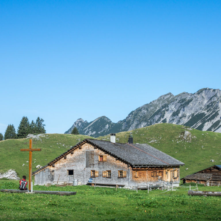
Alpe Laguz, Großes Walsertal © Helmut Düringer / Vorarlberg Tourismus
Hike to gourmet stations and Alpine pastures

Hikes to alpine pastures

Enjoyment at every turn

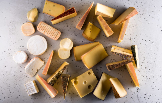
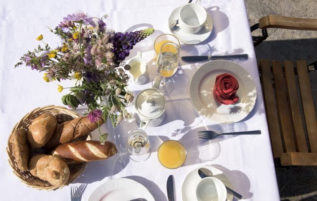
Mountains and Alpine pastures have been a part of the cultivated landscape in Vorarlberg for hundreds of years.Today, Alpine agriculture is still practiced in three stages. Animals, such as cows, are driven to graze on higher lying meadows in early summer. In the height of summer, these animals populate the high Alpine meadows, while in autumn the animals return to the valley.Start your day of hiking in Vorarlberg on the right foot! Enjoy a mountain breakfast at a restaurant with a view or at a rustic Alpine farm or hut. Interested in hiking to a mountain hut or Alpine farm where cheese is produced and can be sampled? Our hiking-trail tips lead guests to one or numerous gourmet stations where local delicacies can be tried.Some stations are located at the beginning or end of the trail. Still others are located somewhere in between.

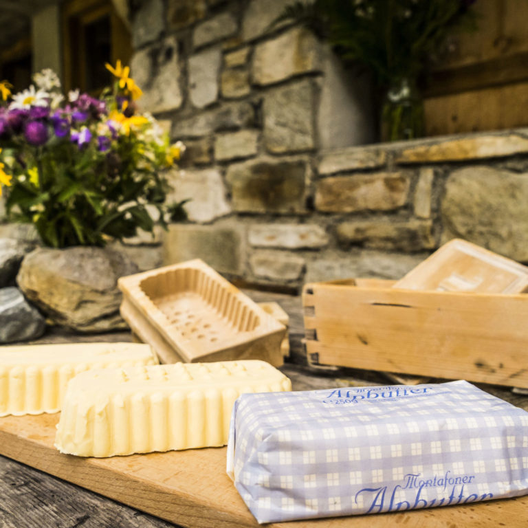
Alpwandern, frische Butter, Alpe Garnera, Montafon © Dietmar Denger
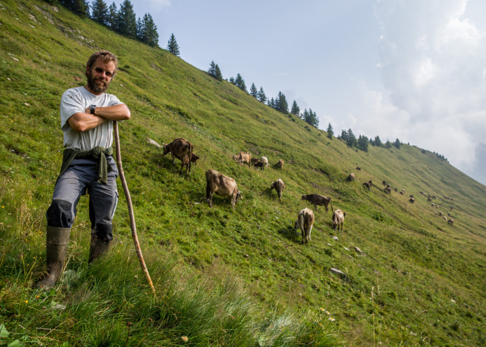
Hirte im Alpgebiet der Zafernalpe, Faschina © Vorarlberg Tourismus GmbH

Climb the highest peaks, hike from farm to farm, collect and learn about herbs, observe the cheese-making process and sample aromatic cheese varieties - Bon appétit!

Tips for the right behavior with respect to animals on Alpine pastures: Information brochure (in German only)
    • Im Gamperdonatal - Alpsiedlung Nenzinger Himmel mit Panülerkopf im Hintergrund

      Alpine Pasture Hike l Nenzinger Himmel

      The Nenzinger Himmel («Himmel» means heaven) not only provides an impressive mountain landscape, but…

      • 10.09 km

      • 4.2 h

      • mittel

      Difficulty: mittel
      Distance: 10.09 km
      Ascent: 664 m
      Descent: 523 m
      Duration: 4.2 h
      Deepest point: 1340 m
      Highest point: 1780 m
      Condition:

      Experience:

      Landscape:

      Alpine Pasture Hike l Nenzinger Himmel

      The Nenzinger Himmel («Himmel» means heaven) not only provides an impressive mountain landscape, but also…

      Start of tour

      Nenzing, Nenzinger Himmel

      End of tour

      Nenzinger Himmel

      Description

      The Nenzinger Himmel («Himmel» means heaven) not only provides an impressive mountain landscape, but also numerous alpine pastures. The track leads from the beautiful isolated alpine settlement up to breathtaking heights. Step by step closer to heaven.

      Best season
      JAN FEB MAR APR MAY JUN
      JUL AUG SEP OCT NOV DEC
      All route info
    • Auf dem Weg zur Bernhards Gemstelalpe

      Alpine Pasture Hike l From alp to alp in…

      A comfortable hike across a picturesque alpine landscape. The Gemsteltal is a naturalist valley…

      • 6.32 km

      • 2 h

      • leicht

      Difficulty: leicht
      Distance: 6.32 km
      Ascent: 195 m
      Descent: 195 m
      Duration: 2 h
      Deepest point: 1150 m
      Highest point: 1320 m
      Condition:

      Experience:

      Landscape:

      Alpine Pasture Hike l From alp to alp in Gemsteltal at Kleinwalsertal

      A comfortable hike across a picturesque alpine landscape. The Gemsteltal is a naturalist valley surrounded…

      Start of tour

      Mittelberg – Bödmen bus station

      End of tour

      Mittelberg, Bödmen

      Description

      The circular track begins in Mittelberg-Bödmen and passes several possibilities for rest and refreshment: Bernhard’s Gemstelalpe (1310 m), Hintere Gemstelhütte (1320 m) and Naturalpe Gemstel-Schönesboden (1310m), Bernhard’s Gemstelalp offers homemade products such as organic mountain cheese, milk, yoghurt, soups, different sausages, bread, omelet, «Kaiserschmarrn» and cakes. You can enjoy a hearty lunch break, cakes and traditional Austrian apple strudel at the Hintere Gemstelhütte at the foot of the Widderstein. There…

      Best season
      JAN FEB MAR APR MAY JUN
      JUL AUG SEP OCT NOV DEC
      All route info
    • Ausblick vom Hengstig

      Alpine Pasture Hike l Sibratsgfäll – Krähenberg

      Very peaceful hike that includes the elements of water, forests and meadows. Easy and…

      • 10.5 km

      • 3.3 h

      • leicht

      Difficulty: leicht
      Distance: 10.5 km
      Ascent: 322 m
      Descent: 322 m
      Duration: 3.3 h
      Deepest point: 837 m
      Highest point: 1078 m
      Condition:

      Experience:

      Landscape:

      Alpine Pasture Hike l Sibratsgfäll – Krähenberg

      Very peaceful hike that includes the elements of water, forests and meadows. Easy and family-friendly…

      Start of tour

      Parking lot near Krähenberg cableway to the Rubach

      End of tour

      Parking lot near Krähenberg cableway

      Description

      The track leads from the parking lot up to the Bilgeris Krähenberg Alpe (camping and snack station with Alpjause, cheese, milk, butter and drinks) past the Ifer-Krähenbergalpe. Shortly before Schönenbach you walk past the Sackalpe and down the Hengstig to the Auenalpen. The Untere Auenalpe provides service with Jause (snack) and drinks. Cross the Subersach near the impressive waterfall at the Alpe Leugehr. You get back to the path from…

      Best season
      JAN FEB MAR APR MAY JUN
      JUL AUG SEP OCT NOV DEC
      All route info
    • Weg zur Weißenbachalpe

      Alpine Pasture Hike l Schnepfau – Weißenbachtal – Au

      Hike from Schnepfau through the Weißenbachtal to the Weißenbachalpe with the beautiful view to…

      • 14.19 km

      • 5.3 h

      • mittel

      Difficulty: mittel
      Distance: 14.19 km
      Ascent: 855 m
      Descent: 825 m
      Duration: 5.3 h
      Deepest point: 737 m
      Highest point: 1528 m
      Condition:

      Experience:

      Landscape:

      Alpine Pasture Hike l Schnepfau – Weißenbachtal – Au

      Hike from Schnepfau through the Weißenbachtal to the Weißenbachalpe with the beautiful view to the…

      Start of tour

      Schnepfau, Dorfmitte

      End of tour

      Au, Kirche

      Description

      Up on the 1193 m high Weißenbachalpe you will be rewarded with a beautiful view of Mellau and Kanisfluh. Here you can take a rest and taste some milk, alpine butter and cheese as well as Sennsuppe (soup), which is available here after the cheese production. You can also visit the dairy. After crossing the Stoggersattel you reach the Satteleggalpe that also provides milk, alpine butter, cheese, Sennsuppe, Alpjause (snack)…

      Best season
      JAN FEB MAR APR MAY JUN
      JUL AUG SEP OCT NOV DEC
      All route info
    • Blick auf das Alpgebiet der Breitenalpe

      Alpine Pasture Hike l Schoppernau: Diedams- and Hornbachalpen

      This easy trail leads from the cableway mid-station to the Breitenalpe and past a…

      • 11.81 km

      • 4 h

      • mittel

      Difficulty: mittel
      Distance: 11.81 km
      Ascent: 258 m
      Descent: 1076 m
      Duration: 4 h
      Deepest point: 838 m
      Highest point: 1710 m
      Condition:

      Experience:

      Landscape:

      Alpine Pasture Hike l Schoppernau: Diedams- and Hornbachalpen

      This easy trail leads from the cableway mid-station to the Breitenalpe and past a small…

      Start of tour

      Schoppernau, mid-station Diedamskopf cableway

      End of tour

      Schoppernau, valley station Diedamskopf cableway

      Description

      From the middle station of the Diedamskopfbahn it goes on easy way to the Breitenalpe. Milk, cheese, goat’s cheese, various snacks and drinks are offered here. Not only does Falzalpe have a magnificent view, but there are also Alpine breakfasts, mountain cheeses, bacon, milk and refreshing drinks. You pass the Neuhornbachhaus, which offers regional warm and cold delicacies in addition to a beautiful mountain panorama, and go back down the…

      Best season
      JAN FEB MAR APR MAY JUN
      JUL AUG SEP OCT NOV DEC
      All route info
    • Blick auf Elsenalpstube, Mittagsspitze und Hohes Licht

      Alpine Pasture Hike l Damüls/Ugaalpe – Mellau/Rossstelle

      Take a hike through a diverse landscape and make use of the public transportation…

      • 10.16 km

      • 3.3 h

      • mittel

      Difficulty: mittel
      Distance: 10.16 km
      Ascent: 279 m
      Descent: 717 m
      Duration: 3.3 h
      Deepest point: 1387 m
      Highest point: 1839 m
      Condition:

      Experience:

      Landscape:

      Alpine Pasture Hike l Damüls/Ugaalpe – Mellau/Rossstelle

      Take a hike through a diverse landscape and make use of the public transportation such…

      Start of tour

      Damüls, top station Uga cableway

      End of tour

      Mellau, top station of Mellau cableways

      Description

      After a leisurely descent from the Uga-Express top station, you are already at the first Alpine Pasture, the Ugaalpe. Family Metzler offers a hearty Jause (snack) and drinks for refreshment (milk, buttermilk, alpine butter, cheese, yoghurt). The tour starts off on a manageable downhill track to the Laubenbach and after a short climb you reach the Mittelargenalpe where you can enjoy a typical Alpjause (snack), drinks or a Sennsuppe (soup).…

      Best season
      JAN FEB MAR APR MAY JUN
      JUL AUG SEP OCT NOV DEC
      All route info
    • Blick von der Steffisalpbahn auf Warth

      Alpine Pasture Hike l Warth-Schröcken – around the Karhorn

      Hike on the footsteps of the Walser from Warth to Bürstegg, the highest situated…

      • 13.13 km

      • 4.3 h

      • leicht

      Difficulty: leicht
      Distance: 13.13 km
      Ascent: 443 m
      Descent: 664 m
      Duration: 4.3 h
      Deepest point: 1564 m
      Highest point: 1947 m
      Condition:

      Experience:

      Landscape:

      Alpine Pasture Hike l Warth-Schröcken – around the Karhorn

      Hike on the footsteps of the Walser from Warth to Bürstegg, the highest situated Walser…

      Start of tour

      Warth, valley station Steffisalp-Express

      End of tour

      Schröcken-Warth, Hochtannbergpass

      Description

      From the top station in the area of the Steffisalpe the track takes you south below the Warther Horn to the small settlement of Bürstegg. The Bitschnau family provides hikers with an Alpjause (snack) and its homemade bacon, sausages, Warther cheese as well as drinks. Via the Auenfeldsattel you first reach the serviced Untere Auenfeldalpe that provides hikers with an Alpjause including buttermilk, milk and drinks. The tour continues along…

      Best season
      JAN FEB MAR APR MAY JUN
      JUL AUG SEP OCT NOV DEC
      All route info
    • Blick auf die Wildmoosalpe

      Alpine Pasture Hike l Bezau/Baumgarten – Niedere – Sonderdach

      Upon arrival at the 1660 m high Seehöhe via cableway, you get a chance…

      • 9.83 km

      • 3 h

      • leicht

      Difficulty: leicht
      Distance: 9.83 km
      Ascent: 163 m
      Descent: 571 m
      Duration: 3 h
      Deepest point: 1214 m
      Highest point: 1695 m
      Condition:

      Experience:

      Landscape:

      Alpine Pasture Hike l Bezau/Baumgarten – Niedere – Sonderdach

      Upon arrival at the 1660 m high Seehöhe via cableway, you get a chance to…

      Start of tour

      Bezau, valley station Bezau

      End of tour

      Sonderdach, mid-station of the cableway Bezau

      Description

      After arriving via cableway (there is a new panoramic restaurant at Baumgarten) the first Alpine Pasture is only a few minutes away, the Vordere Niederalpe. You can get something to eat at the Bergrestaurant Niedere. The Feuerstein family offers mountain cheese, yoghurt, fresh milk, butter, Sennsuppe (a typical local soup), drinks and other home cooked meals. If you arrive around 11 o’clock you might get the chance to test a…

      Best season
      JAN FEB MAR APR MAY JUN
      JUL AUG SEP OCT NOV DEC
      All route info
    • Blick auf Obere Wiesalpe

      Alpine Pasture Hike l From Kanzelwand through the Wildental…

      Impressive hike with the help of cableways. This tour gives a good overview of…

      • 9.61 km

      • 3.3 h

      • mittel

      Difficulty: mittel
      Distance: 9.61 km
      Ascent: 201 m
      Descent: 1021 m
      Duration: 3.3 h
      Deepest point: 1125 m
      Highest point: 1949 m
      Condition:

      Experience:

      Landscape:

      Alpine Pasture Hike l From Kanzelwand through the Wildental in the Kleinwalsertal

      Impressive hike with the help of cableways. This tour gives a good overview of the…

      Start of tour

      Rietzlern, valley station Kanzelwandbahn

      End of tour

      Mittelberg-Höfle, bus station near Biohof Feuerstein

      Description

      The tour starts with a ride of the Kanzelwandbahn (cableway). Once you reach the top station you can enjoy the fantastic panoramic view. The hike leads via the Adlerhorst and Kuhgehrensattel into the valley Wildental, passing the Alpine Pastures Kuhgehren, Wannenalpe, Fluchtalpe and Wiesenalpen. The farmed pastures provide different views over the mountain landscape of the Kleinwalsertal.

      The inner Kuhgehrenalpe provides hearty local snacks with sausages and cheese, soups,…

      Best season
      JAN FEB MAR APR MAY JUN
      JUL AUG SEP OCT NOV DEC
      All route info
    • Ganeraalpe mit Blick auf die Plattenspitzen

      Alpine Pasture Hike l From Gaschurn to Garneratal

      The Garneratal is a south side valley of Montafon in the county of Gaschurn.…

      • 12.08 km

      • 4 h

      • mittel

      Difficulty: mittel
      Distance: 12.08 km
      Ascent: 318 m
      Descent: 832 m
      Duration: 4 h
      Deepest point: 965 m
      Highest point: 1674 m
      Condition:

      Experience:

      Landscape:

      Alpine Pasture Hike l From Gaschurn to Garneratal

      The Garneratal is a south side valley of Montafon in the county of Gaschurn. Nature-loving…

      Start of tour

      Gaschurn, mid-station of Versettla cableway

      End of tour

      Gaschurn, valley station of Versettla cableway

      Description

      A good hiking path leads from the mid-station of the cableway Versettlabahn Gaschurn (1480 m) via the Maisäß Lifinar to the Alpine Pasture Garnera (1680 m) and via the Maisäß Ganeu (1400 m) back to Gaschurn. The so-called «Sennkuchi» of the Garnera dairy produces traditional and innovative dairy products from fresh alpine milk. Next to the popular traditional products such as the skimmed cheese «Sura Kees» or alpine butter, the…

      Best season
      JAN FEB MAR APR MAY JUN
      JUL AUG SEP OCT NOV DEC
      All route info
    • Blick ins Rellstal, im Hintergrund Saulakopf und Lünerkrinne

      Alpine Pasture Hike | Vandans – Rellstal

      The Rellstal is one of the most beautiful nature and plant reserves. The valley…

      • 7.2 km

      • 2.8 h

      • mittel

      Difficulty: mittel
      Distance: 7.2 km
      Ascent: 506 m
      Descent: 506 m
      Duration: 2.8 h
      Deepest point: 1471 m
      Highest point: 1935 m
      Condition:

      Experience:

      Landscape:

      Alpine Pasture Hike | Vandans – Rellstal

      The Rellstal is one of the most beautiful nature and plant reserves. The valley is…

      Start of tour

      Vandans, hiking bus station near Golmerbahn or the train station of Vandans

      End of tour

      Vandans

      Description

      Montafon: A Thematic Trail with beautiful views

      A special hiking bus takes hikers to the Rellstal, where the hike begins at the Alpine Pasture Rellstal or at the crossing leading to the Heinrich-Hueter-Hütte. The trail takes you on a simple path through a spruce forest. Soon you arrive at the Vilifaualpe (no service) and the above mentioned Heinrich-Hueter-Hütte. You continue uphill through a landscape of mountain pines and sinkholes…

      Best season
      JAN FEB MAR APR MAY JUN
      JUL AUG SEP OCT NOV DEC
      All route info
    • .jpg.jpeg

      Alpine Pasture Hike | Faschinajoch: around Zafernhorn

      Faschina is the passage between Bregenz Forest and the Großwalsertal. The tour leads around…

      • 10.61 km

      • 5 h

      • mittel

      Difficulty: mittel
      Distance: 10.61 km
      Ascent: 633 m
      Descent: 633 m
      Duration: 5 h
      Deepest point: 1440 m
      Highest point: 1896 m
      Condition:

      Experience:

      Landscape:

      Alpine Pasture Hike | Faschinajoch: around Zafernhorn

      Faschina is the passage between Bregenz Forest and the Großwalsertal. The tour leads around 2107…

      Start of tour

      Fontanella, Faschinajoch

      End of tour

      Faschinajoch

      Description

      The round trip starts at the top of the pass and leads on a beautiful hiking path to the Bärenalpe and the Zafernmaisäß. We continue heading east to the Walser territory and the farmed Zafernalpe to enjoy alpine cheese, butter and drinks. The Zafernalpe is a typical pasture of the Walsertal. There are several huts (stables, dwellings) and a community Sennhaus (dairy). From here you need to walk back a…

      Best season
      JAN FEB MAR APR MAY JUN
      JUL AUG SEP OCT NOV DEC
      All route info
    • Eggatsbergvorsäß, Egg-Schetteregg

      Alpine Pasture Hike l Egg: round trip Schetteregg

      Easy and comfortable round trip in a gentle and intact nature landscape with diverse…

      • 6.52 km

      • 2 h

      • leicht

      Difficulty: leicht
      Distance: 6.52 km
      Ascent: 250 m
      Descent: 250 m
      Duration: 2 h
      Deepest point: 1069 m
      Highest point: 1302 m
      Condition:

      Experience:

      Landscape:

      Alpine Pasture Hike l Egg: round trip Schetteregg

      Easy and comfortable round trip in a gentle and intact nature landscape with diverse farmed…

      Start of tour

      Egg-Schetteregg, parking lot

      End of tour

      Schetteregg

      Description

      The first Alpine Pasture on this hike is the Eggatsbergvorsäß that is occupied from late-May to early-July and mid-September to early-October. You can buy cheese, milk and butter in the alpine dairy. At the alpine pasture Untere Falz (that is farmed from the beginning of July) the team also offers cheese, milk and butter. The Alpine Pasture Obere Falz welcomes guests into its beautiful alpine garden. The Schneider family indulges…

      Best season
      JAN FEB MAR APR MAY JUN
      JUL AUG SEP OCT NOV DEC
      All route info
    • Blick auf Schönenbach

      Alpine Pasture Hike l Bezau: Around Schönenbach

      Impressive round trip from Schönenbach around the Mohrenkopf. You mostly walk in the shadow…

      • 10.24 km

      • 3.5 h

      • mittel

      Difficulty: mittel
      Distance: 10.24 km
      Ascent: 531 m
      Descent: 531 m
      Duration: 3.5 h
      Deepest point: 1020 m
      Highest point: 1543 m
      Condition:

      Experience:

      Landscape:

      Alpine Pasture Hike l Bezau: Around Schönenbach

      Impressive round trip from Schönenbach around the Mohrenkopf. You mostly walk in the shadow at…

      Start of tour

      Bezau, Schönenbach (bus station)

      End of tour

      Schönenbach

      Description

      Schönenbach is an alpine settlement that still conforms to the local three-step farming tradition. The hike leads to the alpine region north of Hirschberg (1834 m) and Diedamskopf (2090 m).

      At first, we hike to the Vorderen Unterespitzalpe (farmed dairy) and further to the isolated area of the Almisguntenalpe that is located in a cirque underneath the steep Diedamskopf. Falling rocks regularly cover up valuable pastures. The tour leads…

      Best season
      JAN FEB MAR APR MAY JUN
      JUL AUG SEP OCT NOV DEC
      All route info
    • Auf dem Weg zur Gaudenzaalpe

      Alpine Pasture Hike l Amerlugalpe – Saminatal from Frastanz

      Alpine hike with a magnificent view of the border region Switzerland, Liechtenstein, Austria and…

      • 12.96 km

      • 5 h

      • mittel

      Difficulty: mittel
      Distance: 12.96 km
      Ascent: 740 m
      Descent: 740 m
      Duration: 5 h
      Deepest point: 856 m
      Highest point: 1503 m
      Condition:

      Experience:

      Landscape:

      Alpine Pasture Hike l Amerlugalpe – Saminatal from Frastanz

      Alpine hike with a magnificent view of the border region Switzerland, Liechtenstein, Austria and Germany.…

      Start of tour

      Frastanz-Amerlügen, parking lot just above Amerlügen

      End of tour

      Amerlügen

      Description

      Alpine hike with a magnificent view of the border region Switzerland, Liechtenstein, Austria and Germany. The forested Samina valley and the prominent rocks of the Drei Schwestern (three sisters) above Amerlügen characterize this tour. The Feldkircher hut and the Amerlugalpe are the tour’s highest points. From up here you have a great 360° degree view.

      Best season
      JAN FEB MAR APR MAY JUN
      JUL AUG SEP OCT NOV DEC
      All route info
    • Blick von der Hohen Kugel auf Rheintal und Bodensee

      Alpine Pasture Hike l Dornbirn-Ebnit – Hohe Kugel

      Hike from Ebnit across the Hohe Kugel and back to Ebnit. The round trip…

      • 12.04 km

      • 4.8 h

      • mittel

      Difficulty: mittel
      Distance: 12.04 km
      Ascent: 716 m
      Descent: 706 m
      Duration: 4.8 h
      Deepest point: 1053 m
      Highest point: 1645 m
      Condition:

      Experience:

      Landscape:

      Alpine Pasture Hike l Dornbirn-Ebnit – Hohe Kugel

      Hike from Ebnit across the Hohe Kugel and back to Ebnit. The round trip through…

      Start of tour

      Dornbirn, parking lot in Ebnin; if you travel by public transport, bus station Gasthof Heumöser (last stop)

      End of tour

      Ebnit

      Description

      Hike from Ebnit across the Hohe Kugel and back to Ebnit. The round trip through pristine nature provides an impressive view of the Hohe Kugel and various Alpine Pastures with regional homemade products.

      Best season
      JAN FEB MAR APR MAY JUN
      JUL AUG SEP OCT NOV DEC
      All route info
    • Blick auf Alpe Laguz

      Alpine Pasture Hike l Around the Rote Wand («Red…

      The idyllic Formarinsee is located at the end of the Zugertal, in the middle…

      • 15.21 km

      • 6.5 h

      • schwer

      Difficulty: schwer
      Distance: 15.21 km
      Ascent: 910 m
      Descent: 920 m
      Duration: 6.5 h
      Deepest point: 1552 m
      Highest point: 2093 m
      Condition:

      Experience:

      Landscape:

      Alpine Pasture Hike l Around the Rote Wand («Red Wall»)

      The idyllic Formarinsee is located at the end of the Zugertal, in the middle of…

      Start of tour

      Lech, Formarinsee

      End of tour

      Lech, Formarinsee

      Description

      The Formarinsee is located at 1793 m above sea level and below the southern walls of the Rote Wand. It is the starting point of our tour around the wall. We will pass numerous Alpine Pastures during this hike. The beautifully situated Laguzalpe (Sennalpe) with its huts invites you to a first break. The Alpine Pasture is also a popular destination for non-hikers. The Laguzstüble offers various snacks and drinks.…

      Best season
      JAN FEB MAR APR MAY JUN
      JUL AUG SEP OCT NOV DEC
      All route info
    • Blick auf Alpe Steris

      Alpine Pasture Hike l Sonntag-Stein mid-station – Alpe Steris…

      Very impressive round trip with support of the cableway in the alpine area of…

      • 10.24 km

      • 3.8 h

      • mittel

      Difficulty: mittel
      Distance: 10.24 km
      Ascent: 484 m
      Descent: 484 m
      Duration: 3.8 h
      Deepest point: 1300 m
      Highest point: 1703 m
      Condition:

      Experience:

      Landscape:

      Alpine Pasture Hike l Sonntag-Stein mid-station – Alpe Steris – Oberpartnomalpe – Sonntag-Stein

      Very impressive round trip with support of the cableway in the alpine area of Steris…

      Start of tour

      Sonntag-Stein, Seilbahn Talstation

      End of tour

      Sonntag-Stein, Seilbahn-Talstation

      Description

      From Sonntag-Stein you can take the cableway up to the alpine area. The first bit of the tour takes you to the Alpe Steris und continues past the Oberpartnomalpe and Breithornhütte and back to the cableway and the starting point of the tour.

      The Sennalpe Steris consists of several huts and a chapel. The Schwarzmann family spoils guests with homemade and regional products such as Alpjause (snack), cakes, Kässspätzle…

      Best season
      JAN FEB MAR APR MAY JUN
      JUL AUG SEP OCT NOV DEC
      All route info
    • Blick auf Ober-Überlutalpe und ins Metzgertobel

      Alpine Pasture Hike l Hinteres Großwalsertal

      Beautiful high-altitude hike with the impressive and natural Metzgertobel, also known as the valley…

      • 22.67 km

      • 9 h

      • schwer

      Difficulty: schwer
      Distance: 22.67 km
      Ascent: 1296 m
      Descent: 1297 m
      Duration: 9 h
      Deepest point: 880 m
      Highest point: 1945 m
      Condition:

      Experience:

      Landscape:

      Alpine Pasture Hike l Hinteres Großwalsertal

      Beautiful high-altitude hike with the impressive and natural Metzgertobel, also known as the valley of…

      Start of tour

      Sonntag-Buchboden

      End of tour

      Buchboden

      Description

      The tour leads you from Buchboden across the Bärenmaisäß to the Unter-Überlutalpe and further to the first farmed Alpine Pasture, the Ober-Überlutalpe. The team of Ober-Überlut provides Alpjausen (snacks), butter, mountain cheese and drinks. You reach the Alpe Außen-Ischkarnei via the Hinter-Ischkarneialpe. They offer alpine snacks, mountain cheese and drinks. On request, they also offer guided tours of the dairy. On your way to Metzgertobel you walk past Heimenwaldalpe where…

      Best season
      JAN FEB MAR APR MAY JUN
      JUL AUG SEP OCT NOV DEC
      All route info
This may also be of interest

More stories and tips