Cross-Country Ski Trail Map

Gliding Along Cross-Country Ski Trails

All Cross-Country Ski Trails in Vorarlberg - Route Recommendations

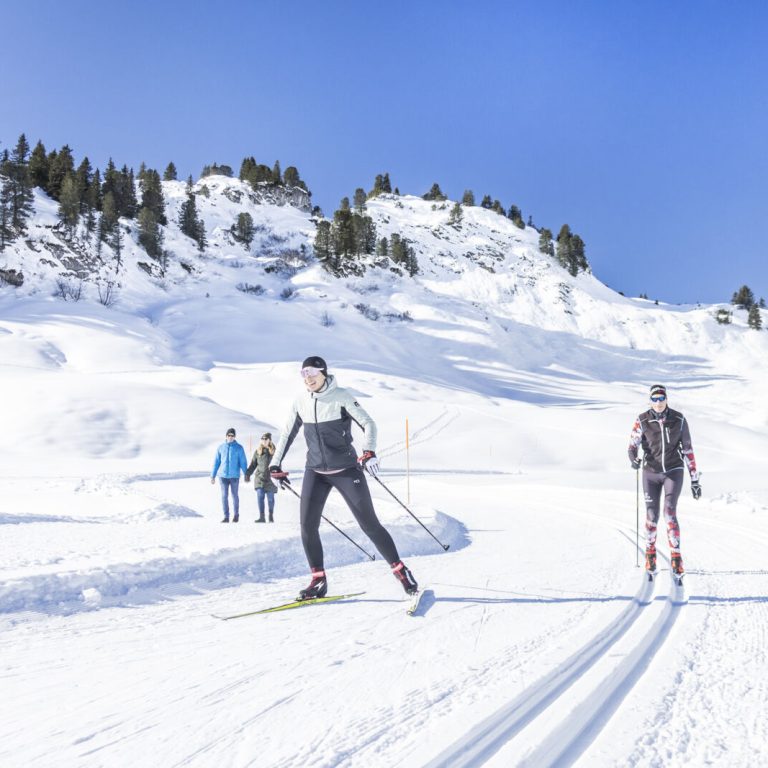
Cross-country skiers will find a diverse network of trails in all regions of Vorarlberg, with routes for both classic-style and skate-style skiers. Some cross-country skiing areas also extend across borders, for example from Hittisau in the Bregenzerwald to Balderschwang and from the Kleinwalsertal to Oberstdorf. Interactive maps and detailed descriptions provide information on over 120 trails in all regions of Vorarlberg. In addition to facts such as length and elevation profile, photos offer a glimpse of the respective landscapes.

Overview

Online Map

    • Langlaufen_Galtür_2024_©TVB-Paznaun-Ischgl(24).jpg

      No. 1: Cross-country ski trail Bielerhöhe-Galtür

      From the Silvretta-Bielerhöhe, the Vermunt Route 2 takes you down along Lake Silvretta toward…

      • 7.89 km

      • 2.2 h

      • Unbekannt

      Distance: 7.89 km
      Ascent: 237 m
      Descent: 237 m
      Duration: 2.2 h
      Deepest point: 1807 m
      Highest point: 2036 m
      Condition:

      Experience:

      Landscape:

      No. 1: Cross-country ski trail Bielerhöhe-Galtür

      From the Silvretta-Bielerhöhe, the Vermunt Route 2 takes you down along Lake Silvretta toward Wirl/Galtür…

      Start of tour

      Berggasthof Piz Buin, Silvretta-Bielerhöhe

      End of tour

      Berggasthof Piz Buin, Silvretta-Bielerhöhe

      Best season
      JAN FEB MAR APR MAY JUN
      JUL AUG SEP OCT NOV DEC
      All route info
    • Langlaufen_Galtür_2024_©TVB-Paznaun-Ischgl(24).jpg

      No. 2: Dam Trail Silvretta-Bielerhöhe

      From Silvretta-Bielerhöhe, the Dammloipe trail takes you along the dam of Lake Silvretta and…

      • 1.98 km

      • 0.6 h

      • Unbekannt

      Distance: 1.98 km
      Ascent: 82 m
      Descent: 82 m
      Duration: 0.6 h
      Deepest point: 2003 m
      Highest point: 2077 m
      Condition:

      Experience:

      Landscape:

      No. 2: Dam Trail Silvretta-Bielerhöhe

      From Silvretta-Bielerhöhe, the Dammloipe trail takes you along the dam of Lake Silvretta and back…

      Start of tour

      Berggasthof Piz Buin, Silvretta-Bielerhöhe

      End of tour

      Berggasthof Piz Buin, Silvretta-Bielerhöhe

      Best season
      JAN FEB MAR APR MAY JUN
      JUL AUG SEP OCT NOV DEC
      All route info
    • Langlaufen_Galtür_2024_©TVB-Paznaun-Ischgl(24).jpg

      No. 3: Silvretta high altitude trail, small

      On the Silvretta-Bielerhöhe, the short high-altitude cross-country trail takes you on a brief training…

      • 0.56 km

      • 0.2 h

      • Unbekannt

      Distance: 0.56 km
      Ascent: 13 m
      Descent: 13 m
      Duration: 0.2 h
      Deepest point: 2023 m
      Highest point: 2037 m
      Condition:

      Experience:

      Landscape:

      No. 3: Silvretta high altitude trail, small

      On the Silvretta-Bielerhöhe, the short high-altitude cross-country trail takes you on a brief training loop…

      Best season
      JAN FEB MAR APR MAY JUN
      JUL AUG SEP OCT NOV DEC
      All route info
    • Langlaufen_Galtür_2024_©TVB-Paznaun-Ischgl(24).jpg

      No. 4: Silvretta high trail, medium

      The Silvretta Intermediate Cross-Country Trail takes you on a roughly two-kilometer loop through the…

      • 2.01 km

      • 0.7 h

      • Unbekannt

      Distance: 2.01 km
      Ascent: 53 m
      Descent: 53 m
      Duration: 0.7 h
      Deepest point: 2008 m
      Highest point: 2056 m
      Condition:

      Experience:

      Landscape:

      No. 4: Silvretta high trail, medium

      The Silvretta Intermediate Cross-Country Trail takes you on a roughly two-kilometer loop through the high-alpine…

      Start of tour

      Berggasthof & Hotel Piz Buin, Silvretta-Bielerhöhe

      End of tour

      Berggasthof & Hotel Piz Buin, Silvretta-Bielerhöhe

      Best season
      JAN FEB MAR APR MAY JUN
      JUL AUG SEP OCT NOV DEC
      All route info
    • Langlaufen_Galtür_2024_©TVB-Paznaun-Ischgl(24).jpg

      No. 5: Silvretta high trail (large)

      Berggasthof Piz Buin - Barbara Chapel - towards Vermuntsee - Silvretta House - Berggasthof…

      • 4.02 km

      • 1.1 h

      • Unbekannt

      Distance: 4.02 km
      Ascent: 85 m
      Descent: 84 m
      Duration: 1.1 h
      Deepest point: 2009 m
      Highest point: 2056 m
      Condition:

      Experience:

      Landscape:

      No. 5: Silvretta high trail (large)

      Berggasthof Piz Buin - Barbara Chapel - towards Vermuntsee - Silvretta House - Berggasthof Piz…

      Start of tour

      Berggasthof Piz Buin, Silvretta-Bielerhöhe

      End of tour

      Berggasthof Piz Buin, Silvretta-Bielerhöhe

      Description

      The Silvretta-Bielerhöhe offers trails for every taste. Cross-country skiing strengthens the cardiovascular system and shapes the figure. Freshly groomed trails, a fantastic winter panorama, and unique views of the surrounding mountain world.

      Best season
      JAN FEB MAR APR MAY JUN
      JUL AUG SEP OCT NOV DEC
      All route info
    • Langlaufen_Galtür_2024_©TVB-Paznaun-Ischgl(24).jpg

      No. 6: Madlenerhaus Cross-Country Trail, moderate

      The middle Madlenerhaus cross-country trail takes you on a loop through the high-alpine winter…

      • 1.24 km

      • 0.3 h

      • Unbekannt

      Distance: 1.24 km
      Ascent: 2 m
      Descent: 2 m
      Duration: 0.3 h
      Deepest point: 1977 m
      Highest point: 1990 m
      Condition:

      Landscape:

      No. 6: Madlenerhaus Cross-Country Trail, moderate

      The middle Madlenerhaus cross-country trail takes you on a loop through the high-alpine winter landscape…

      Best season
      JAN FEB MAR APR MAY JUN
      JUL AUG SEP OCT NOV DEC
      All route info
    • Langlaufen_Galtür_2024_©TVB-Paznaun-Ischgl(57).jpg

      No. 7: Madlenerhaus Trail, short

      The short Madlenerhaus cross-country trail takes you on a brief practice loop through the…

      • 0.95 km

      • 0.3 h

      • Unbekannt

      Distance: 0.95 km
      Ascent: 20 m
      Descent: 20 m
      Duration: 0.3 h
      Deepest point: 1972 m
      Highest point: 1992 m
      Condition:

      Landscape:

      No. 7: Madlenerhaus Trail, short

      The short Madlenerhaus cross-country trail takes you on a brief practice loop through the high-alpine…

      Best season
      JAN FEB MAR APR MAY JUN
      JUL AUG SEP OCT NOV DEC
      All route info
    • Langlaufen_Galtür_2024_©TVB-Paznaun-Ischgl(57).jpg

      No. 8: Madlenerhaus Cross-Country Trail, Long

      The long Madlenerhaus cross-country trail takes you on an extended loop through the high-alpine…

      • 1.97 km

      • 0.5 h

      • Unbekannt

      Distance: 1.97 km
      Ascent: 29 m
      Descent: 29 m
      Duration: 0.5 h
      Deepest point: 1972 m
      Highest point: 1992 m
      Condition:

      Landscape:

      No. 8: Madlenerhaus Cross-Country Trail, Long

      The long Madlenerhaus cross-country trail takes you on an extended loop through the high-alpine winter…

      Best season
      JAN FEB MAR APR MAY JUN
      JUL AUG SEP OCT NOV DEC
      All route info
    • Langlaufen

      No. 9 Partenen Village Loop (Classic)

      The Partenen Village Loop takes you on a short, classic cross-country ski loop through…

      • 0.45 km

      • 0.1 h

      • Unbekannt

      Distance: 0.45 km
      Ascent: 7 m
      Descent: 7 m
      Duration: 0.1 h
      Deepest point: 1049 m
      Highest point: 1056 m
      Condition:

      Experience:

      Landscape:

      No. 9 Partenen Village Loop (Classic)

      The Partenen Village Loop takes you on a short, classic cross-country ski loop through the…

      Best season
      JAN FEB MAR APR MAY JUN
      JUL AUG SEP OCT NOV DEC
      All route info
    • Dorfrunde Partenen

      No. 10: Long Lifinar Loop (classic & skating)

      At the edge of Partenen’s town center, the Große Lifinar Runde trail takes you…

      • 0.75 km

      • 0.3 h

      • Unbekannt

      Distance: 0.75 km
      Ascent: 30 m
      Descent: 29 m
      Duration: 0.3 h
      Deepest point: 1052 m
      Highest point: 1081 m
      Condition:

      Experience:

      Landscape:

      No. 10: Long Lifinar Loop (classic & skating)

      At the edge of Partenen’s town center, the Große Lifinar Runde trail takes you along…

      Best season
      JAN FEB MAR APR MAY JUN
      JUL AUG SEP OCT NOV DEC
      All route info
    • Langlaufen

      No. 11: Short Lifinar Loop (classic)

      The Kleine Lifinar Loop takes you along a short, classic cross-country ski trail on…

      • 0.45 km

      • 0.1 h

      • Unbekannt

      Distance: 0.45 km
      Ascent: 9 m
      Descent: 9 m
      Duration: 0.1 h
      Deepest point: 1059 m
      Highest point: 1067 m
      Condition:

      Experience:

      Landscape:

      No. 11: Short Lifinar Loop (classic)

      The Kleine Lifinar Loop takes you along a short, classic cross-country ski trail on the…

      Best season
      JAN FEB MAR APR MAY JUN
      JUL AUG SEP OCT NOV DEC
      All route info
    • Langlaufloipe Gaschurn

      No. 13: The Great Trantraua Loop (Classic)

      The Große Trantrauas Loop is one of the longer cross-country skiing trails in the…

      • 4.01 km

      • 1.3 h

      • Unbekannt

      Distance: 4.01 km
      Ascent: 45 m
      Descent: 46 m
      Duration: 1.3 h
      Deepest point: 974 m
      Highest point: 1020 m
      Condition:

      Experience:

      Landscape:

      No. 13: The Great Trantraua Loop (Classic)

      The Große Trantrauas Loop is one of the longer cross-country skiing trails in the Montafon…

      Best season
      JAN FEB MAR APR MAY JUN
      JUL AUG SEP OCT NOV DEC
      All route info
    • Rifabecken Runde

      No. 13: Rifabecken round (classic & skating)

      The Rifa Reservoir Loop takes you on a short, classic cross-country ski trail along…

      • 1.29 km

      • 0.4 h

      • Unbekannt

      Distance: 1.29 km
      Ascent: 30 m
      Descent: 30 m
      Duration: 0.4 h
      Deepest point: 996 m
      Highest point: 1026 m
      Condition:

      Experience:

      Landscape:

      No. 13: Rifabecken round (classic & skating)

      The Rifa Reservoir Loop takes you on a short, classic cross-country ski trail along the…

      Best season
      JAN FEB MAR APR MAY JUN
      JUL AUG SEP OCT NOV DEC
      All route info
    • Trantrauras Rundkurs - Richtung Rifabecken

      No. 14: Small Trantraua Loop (Classic)

      The Kleine Trantrauas Loop is a challenging, classic cross-country ski trail with an elevation…

      • 2.54 km

      • 0.8 h

      • Unbekannt

      Distance: 2.54 km
      Ascent: 47 m
      Descent: 45 m
      Duration: 0.8 h
      Deepest point: 974 m
      Highest point: 1019 m
      Condition:

      Experience:

      Landscape:

      No. 14: Small Trantraua Loop (Classic)

      The Kleine Trantrauas Loop is a challenging, classic cross-country ski trail with an elevation gain…

      Best season
      JAN FEB MAR APR MAY JUN
      JUL AUG SEP OCT NOV DEC
      All route info
    • Rundtour

      No. 15: Mountain Beach Loop (classic & skating)

      The Mountain Beach Loop is an easy-to-navigate trail for classic and skate-style cross-country skiing.…

      • 1.43 km

      • 0.3 h

      • Unbekannt

      Distance: 1.43 km
      Ascent: 29 m
      Descent: 29 m
      Duration: 0.3 h
      Deepest point: 924 m
      Highest point: 952 m
      Condition:

      Experience:

      Landscape:

      No. 15: Mountain Beach Loop (classic & skating)

      The Mountain Beach Loop is an easy-to-navigate trail for classic and skate-style cross-country skiing. This…

      Best season
      JAN FEB MAR APR MAY JUN
      JUL AUG SEP OCT NOV DEC
      All route info
    • Rundkurs

      No. 18: Außerbach Runde (classic & skating)

      The Außerbach Loop is a flat cross-country ski trail in the Außerbach district of…

      • 3.78 km

      • 0.8 h

      • Unbekannt

      Distance: 3.78 km
      Ascent: 34 m
      Descent: 34 m
      Duration: 0.8 h
      Deepest point: 908 m
      Highest point: 942 m
      Condition:

      Experience:

      Landscape:

      No. 18: Außerbach Runde (classic & skating)

      The Außerbach Loop is a flat cross-country ski trail in the Außerbach district of Gaschurn.…

      Best season
      JAN FEB MAR APR MAY JUN
      JUL AUG SEP OCT NOV DEC
      All route info
    • Blick taleinwärts

      No. 19: Large Gortipohl loop (classic)

      Tennis court Gortipohl (Blendolmaweg) - Camping Rudigier - Außerbach - Leisure park Mountain Beach…

      • 1.55 km

      • 1.3 h

      • Unbekannt

      Distance: 1.55 km
      Ascent: 12 m
      Descent: 12 m
      Duration: 1.3 h
      Deepest point: 894 m
      Highest point: 906 m
      Condition:

      Experience:

      Landscape:

      No. 19: Large Gortipohl loop (classic)

      Tennis court Gortipohl (Blendolmaweg) - Camping Rudigier - Außerbach - Leisure park Mountain Beach Gaschurn…

      Start of tour

      Tennisplatz Gortipohl oder Mountain Beach in Gaschurn

      End of tour

      Tennisplatz Gortipohl oder Mountain Beach in Gaschurn

      Description

      A very attractive and flat route. Although 62 meters of altitude must be overcome on the 4.7 km long route, no climbs have to be mastered. These are always slightly ascending and not difficult to ride. Very scenic and no roads have to be crossed. Overall there are three large loops, one of which is the Mountain Beach loop. The entry can be from the tennis court Gortipohl or from…

      Best season
      JAN FEB MAR APR MAY JUN
      JUL AUG SEP OCT NOV DEC
      All route info
    • Die Loipe im Überblick

      No. 22: Galgenul Runde (classic)

      Near Gasthof Muntafunerhüsli - circular route towards the football stadium St. Gallenkirch - return

      • 2.47 km

      • 0.5 h

      • Unbekannt

      Distance: 2.47 km
      Ascent: 26 m
      Descent: 24 m
      Duration: 0.5 h
      Deepest point: 776 m
      Highest point: 802 m
      Condition:

      Experience:

      Landscape:

      No. 22: Galgenul Runde (classic)

      Near Gasthof Muntafunerhüsli - circular route towards the football stadium St. Gallenkirch - return

      Start of tour

      Einstiege Nähe Talstation Valisera Bahn (bei Bauhof Silvretta Montafon) bzw. Nähe Gasthof Montafonerhüsli, St. Gallenkirch

      End of tour

      Einstiege Nähe Talstation Valisera Bahn (bei Bauhof Silvretta Montafon) bzw. Nähe Gasthof Montafonerhüsli, St. Gallenkirch

      Description

      The trail entry can be made from the parking lot at the football field or at the Silvretta Montafon depot – about 300 meters on the connecting trail (if coming from Gaschurn on the connecting trail, cross the bridge) or when arriving by bus (Montafonerhüsli stop) cross the wooden bridge (direction Gargellen) and then immediately turn left. The Galgenul Runde is beautifully located on the Ill river. It is recommended…

      Best season
      JAN FEB MAR APR MAY JUN
      JUL AUG SEP OCT NOV DEC
      All route info
    • Die Dorfloipe führt durch das Zentrum von Silbertal

      No. 25: Village cross-country trail Silbertal (classic)

      Felsa Silbertal - Football field - Center - Kapell Bahn - return

      • 3.62 km

      • 1.1 h

      • Unbekannt

      Distance: 3.62 km
      Ascent: 80 m
      Descent: 80 m
      Duration: 1.1 h
      Deepest point: 856 m
      Highest point: 916 m
      Condition:

      Experience:

      Landscape:

      No. 25: Village cross-country trail Silbertal (classic)

      Felsa Silbertal - Football field - Center - Kapell Bahn - return

      Start of tour

      Kristberbahn, Talstation Kapell Bahn bzw. "Felsa" Parkplatz in Silbertal

      End of tour

      Kristberbahn, Talstation Kapell Bahn bzw. "Felsa" Parkplatz in Silbertal

      Description

      The village cross-country trail leads downhill along the Litzleicht from the Felsa parking lot to the valley station of Kapell Bahn and back – with short loops at both ends of the route. From the village center to the open-air stage of the Montafon Saga Festival, the trail is illuminated. Very snow-safe route as the trail is on the shaded side of the valley.

      The entry points are located at…

      Best season
      JAN FEB MAR APR MAY JUN
      JUL AUG SEP OCT NOV DEC
      All route info
    • große Zelfen Runde

      No. 30: Large Zelfen Route Tschagguns (classic & skating)

      Accessible via the small Zelfen route or a short section via the connecting trail.

      …

      • 1.31 km

      • 0.3 h

      • Unbekannt

      Distance: 1.31 km
      Ascent: 9 m
      Descent: 9 m
      Duration: 0.3 h
      Deepest point: 687 m
      Highest point: 696 m
      Condition:

      Experience:

      Landscape:

      No. 30: Large Zelfen Route Tschagguns (classic & skating)

      Accessible via the small Zelfen route or a short section via the connecting trail.

      Height…

      Description

      This snow-safe cross-country route leads you mostly over the golf course of the Golfclub Montafon. In shaded terrain and past residential houses, you do your rounds in classic or skating style. A beautiful valley view rewards your endurance.

      Entry point:

      You reach the large Zelfen route via the small Zelfen route and the connecting trail.

      Best season
      JAN FEB MAR APR MAY JUN
      JUL AUG SEP OCT NOV DEC
      All route info
    • klassisch und skating - im Hintergrund die Vandanser Steinwand

      No. 31: Small Zelfen Circuit Tschagguns (classic & skating)

      At Illstraße - Camping Zelfen - Golf Course

      Accessible via connecting trail from Aktivpark…

      • 0.89 km

      • 0.2 h

      • Unbekannt

      Distance: 0.89 km
      Ascent: 5 m
      Descent: 5 m
      Duration: 0.2 h
      Deepest point: 679 m
      Highest point: 684 m
      Condition:

      Experience:

      Landscape:

      No. 31: Small Zelfen Circuit Tschagguns (classic & skating)

      At Illstraße - Camping Zelfen - Golf Course

      Accessible via connecting trail from Aktivpark Montafon.

      Start of tour

      Höhe Illstraße (Winterwanderweg an der Ill), Zelfen/Tschagguns

      End of tour

      Höhe Illstraße (Winterwanderweg an der Ill), Zelfen/Tschagguns

      Description

      To Camping Zelfen, via the golf course and back at the level of the ski jump facility. This snow-safe circuit is ideal for beginners and especially varied. At the golf course, there is the possibility to switch to the large Zelfen circuit via a short connecting trail along the Ill.

      Start:

      Along the Ill via a short section on the connecting trail from Aktivpark Montafon or directly opposite the Montafon…

      Best season
      JAN FEB MAR APR MAY JUN
      JUL AUG SEP OCT NOV DEC
      All route info
    • Schrunser Feld mit Blick Richtung Zimba

      No. 33: Schrunser Field route (classic & skating)

      Football stadium - Alter Wuhrweg - Zamang Bahn parking lot - Widumweg - Football…

      • 2.86 km

      • 0.6 h

      • Unbekannt

      Distance: 2.86 km
      Ascent: 14 m
      Descent: 14 m
      Duration: 0.6 h
      Deepest point: 675 m
      Highest point: 689 m
      Condition:

      Experience:

      Landscape:

      No. 33: Schrunser Field route (classic & skating)

      Football stadium - Alter Wuhrweg - Zamang Bahn parking lot - Widumweg - Football stadium

      Start of tour

      Fußballstadion im Wagenweg in Schruns

      End of tour

      Fußballstadion im Wagenweg in Schruns

      Description

      The magnificent view over the open field and the sun make this easy route through the Schrunser field very popular. At a length of 2.9 km it is also the longest trail in the outer Montafon. A one-time short crossing of an access road does not affect the cross-country skiing fun.

      Starting point:

      Two starting points are located at the entrance to the football stadium or at the valley station…

      Best season
      JAN FEB MAR APR MAY JUN
      JUL AUG SEP OCT NOV DEC
      All route info
    • Gantners Bündta mit Blick Richtung Vandanser Steinwand

      No. 34: Village loop Schruns (classic)

      Funkaweg - loop heading south (Auweg) - Schruns station - Montafon Rehabilitation Clinic -…

      • 1.15 km

      • 0.3 h

      • Unbekannt

      Distance: 1.15 km
      Ascent: 10 m
      Descent: 10 m
      Duration: 0.3 h
      Deepest point: 671 m
      Highest point: 681 m
      Condition:

      Experience:

      Landscape:

      No. 34: Village loop Schruns (classic)

      Funkaweg - loop heading south (Auweg) - Schruns station - Montafon Rehabilitation Clinic - return

      Start of tour

      Reha Klinik Montafon oder Ende des Funkaweges (in der Nähe des Fußballstadions Schruns)

      End of tour

      Reha Klinik Montafon oder Ende des Funkaweges (in der Nähe des Fußballstadions Schruns)

      Description

      The village loop Schruns is sunny and centrally located. On the wide field in the middle of a residential area there are no road crossings required. Toilets and dining options are just a few meters from the Montafon Rehabilitation Clinic.

      Entry point:

      Either at the Montafon Rehabilitation Clinic or at the end of Funkaweg near the Schruns football stadium (cross Wagenweg)

      Best season
      JAN FEB MAR APR MAY JUN
      JUL AUG SEP OCT NOV DEC
      All route info
    • Gantschier Runde mit Blick Richtung Vandanser Steinwand

      Connecting trail Tschagguns-Vandans

      End Golfplatzweg Zelfen Tschagguns - End Illstraße - Aktivpark Montafon - Tschaggunser Au -…

      • 5.92 km

      • 1 h

      • Unbekannt

      Distance: 5.92 km
      Ascent: 1 m
      Descent: 57 m
      Duration: 1 h
      Deepest point: 630 m
      Highest point: 687 m
      Condition:

      Experience:

      Landscape:

      Connecting trail Tschagguns-Vandans

      End Golfplatzweg Zelfen Tschagguns - End Illstraße - Aktivpark Montafon - Tschaggunser Au - Tschagguns…

      Description

      The access points are located at the golf course, Aktivpark Montafon, Tschagguns train station, Kaltenbrunnen train station, Roter Stein, or in Bahnhofstraße in Vandans (slightly above the train station).

      The trails are mainly set for classic style; some sections are also possible for skating.

      Best season
      JAN FEB MAR APR MAY JUN
      JUL AUG SEP OCT NOV DEC
      All route info
    • __NO_NAME__

      Connecting cross-country trail Partenen – Gaschurn (classic style)

      The Partenen–Gaschurn connecting trail links the trails in the Partenen area with the large…

      • 1.75 km

      • 0.3 h

      • Unbekannt

      Distance: 1.75 km
      Ascent: 1 m
      Descent: 43 m
      Duration: 0.3 h
      Deepest point: 1000 m
      Highest point: 1043 m
      Condition:

      Experience:

      Landscape:

      Connecting cross-country trail Partenen – Gaschurn (classic style)

      The Partenen–Gaschurn connecting trail links the trails in the Partenen area with the large Trantrauas…

      Best season
      JAN FEB MAR APR MAY JUN
      JUL AUG SEP OCT NOV DEC
      All route info
    • Langlaufen-am-Kristberg-Kristbergbahn-Patrick-Saely-5Die Panoramaloipe für Dein Langlaufvergnügen

      Gaschurn-St. Gallenkirch-Galgenul Cross-Country Ski Trail

      The connecting trail links Gaschurn with St. Gallenkirch and offers you plenty of opportunities…

      • 6.12 km

      • 0.8 h

      • Unbekannt

      Distance: 6.12 km
      Descent: 140 m
      Duration: 0.8 h
      Deepest point: 801 m
      Highest point: 942 m
      Condition:

      Experience:

      Landscape:

      Gaschurn-St. Gallenkirch-Galgenul Cross-Country Ski Trail

      The connecting trail links Gaschurn with St. Gallenkirch and offers you plenty of opportunities to…

      Best season
      JAN FEB MAR APR MAY JUN
      JUL AUG SEP OCT NOV DEC
      All route info
    • Langlaufen im Brandnertal (Symbolbild)

      Cross-country ski trail “Innertal” | Brand

      Style: Classic

      • 3.2 km

      • 1 h

      • Unbekannt

      Distance: 3.2 km
      Ascent: 48 m
      Descent: 47 m
      Duration: 1 h
      Deepest point: 1025 m
      Highest point: 1072 m
      Condition:

      Experience:

      Landscape:

      Cross-country ski trail “Innertal” | Brand

      Style: Classic

      Start of tour

      Palüdbahn valley station or village centre, Brand

      End of tour

      Palüdbahn valley station or village centre, Brand

      Description

      The quiet version of skiing when you glide gently over the snow – this can be experienced on the “Innertal” cross-country trail in Brandnertal at the foot of the Mottakopf. The trail starts at the car park at the Palüdbahn valley station at the end of the village (entry is possible at several points, in good snow conditions also in the village centre at the Beck riding hall). First, turn…

      Best season
      JAN FEB MAR APR MAY JUN
      JUL AUG SEP OCT NOV DEC
      All route info
    • Langlaufen nach Zug

      Lech – Zugertal

      The beautiful cross-country ski run starts in Lech and leads along the banks of…

      • 2.8 km

      • 0.7 h

      • leicht

      Difficulty: leicht
      Distance: 2.8 km
      Ascent: 49 m
      Duration: 0.7 h
      Deepest point: 1440 m
      Highest point: 1490 m
      Condition:

      Experience:

      Landscape:

      Lech – Zugertal

      The beautiful cross-country ski run starts in Lech and leads along the banks of the…

      Start of tour

      Rüfiplatz

      End of tour

      Zug

      Description

      This fantastic cross-country trail, which starts directly in the centre of Lech at the covered wooden bridge, leads along the Lech directly to Zug. Even beginners will feel at home on this perfectly prepared route. The cross-country ski run has a few gradients and leads directly to Zug, past the fishpond. Experienced and ambitious skiers can continue the route to the Älpele Inn and enjoy a well-earned break with culinary…

      Best season
      JAN FEB MAR APR MAY JUN
      JUL AUG SEP OCT NOV DEC
      All route info
    • Langlaufen im Zugertal

      Zug – Älpele – Spullerwald – Zug

      The cross-country skiing trail leads from Zug through the beautiful natural jewel of the…

      • 6.64 km

      • 1.3 h

      • schwer

      Difficulty: schwer
      Distance: 6.64 km
      Ascent: 163 m
      Descent: 127 m
      Duration: 1.3 h
      Deepest point: 1488 m
      Highest point: 1608 m
      Condition:

      Experience:

      Landscape:

      Zug – Älpele – Spullerwald – Zug

      The cross-country skiing trail leads from Zug through the beautiful natural jewel of the Zug…

      Start of tour

      Zug

      End of tour

      Zug

      Description

      You can start your cross-country tour directly in Lech at the bridge at the cross-country starting point and walk along the Lech River to Zug. Alternatively, you can take the blue local bus to Zug and get on the cross-country trail from the terminus. Up to the Älpele Inn it goes evenly up to slightly uphill. At Älpele Inn you can take a break and get some refreshments. Then take…

      Best season
      JAN FEB MAR APR MAY JUN
      JUL AUG SEP OCT NOV DEC
      All route info
    • Langlaufen in Lech Zürs

      Zürs – Flexenpass – Zürs

      The cross-country skiing route is suitable for moderately advanced cross-country skiers and winter hikers.…

      • 2.19 km

      • 0.7 h

      • mittel

      Difficulty: mittel
      Distance: 2.19 km
      Ascent: 55 m
      Descent: 55 m
      Duration: 0.7 h
      Deepest point: 1715 m
      Highest point: 1773 m
      Condition:

      Experience:

      Landscape:

      Zürs – Flexenpass – Zürs

      The cross-country skiing route is suitable for moderately advanced cross-country skiers and winter hikers. The…

      Start of tour

      Zürs am Arlberg

      End of tour

      Zürs am Arlberg

      Description

      The somewhat challenging route Zürs – Flexenpass – Zürs is ideal for advanced cross-country skiers and winter hikers. Starting from Trittkopfbahn 1, follow the well-prepared cross-country trail and winter hiking trail south towards Flexenpass. Here you can either take a break in the rustic Flexenhäusl or follow the route further south. After the path makes a generous loop, the hilly route leads back to Zürs.

      Best season
      JAN FEB MAR APR MAY JUN
      JUL AUG SEP OCT NOV DEC
      All route info
    • Langlaufen im Winter ins Zugertal

      Cross country skiing through the Zuger Valley

      The cross-country skiing tour leads through the idyllic Tannlägeralpe and is popular with those…

      • 10.4 km

      • 2.8 h

      • schwer

      Difficulty: schwer
      Distance: 10.4 km
      Ascent: 244 m
      Descent: 119 m
      Duration: 2.8 h
      Deepest point: 1486 m
      Highest point: 1666 m
      Condition:

      Experience:

      Landscape:

      Cross country skiing through the Zuger Valley

      The cross-country skiing tour leads through the idyllic Tannlägeralpe and is popular with those seeking…

      Start of tour

      District Zug

      End of tour

      District Zug

      Description

      The cross-country skiing tour starts below the Zug church, directly on the Lech at the Zug mountain railway station. On the banks of the Lech, the route leads to Älpele inn. Here, one can decide whether one takes a short break or continues following the cross-country trail to the Tannlägeralpe. Partly, the track is hilly but to a large extent a dream come true for every cross-country skier. The trail…

      Best season
      JAN FEB MAR APR MAY JUN
      JUL AUG SEP OCT NOV DEC
      All route info
    • Langlauf Schwarzwasserloipe

      Blackwater Trail: Long Loop

      The Schwarzwasserloipe is the most challenging of the three trails in the valley. It…

      • 16.9 km

      • 2 h

      • schwer

      Difficulty: schwer
      Distance: 16.9 km
      Ascent: 357 m
      Descent: 357 m
      Duration: 2 h
      Deepest point: 1034 m
      Highest point: 1218 m
      Condition:

      Experience:

      Landscape:

      Blackwater Trail: Long Loop

      The Schwarzwasserloipe is the most challenging of the three trails in the valley. It is…

      Start of tour

      Hirschegg

      End of tour

      Hirschegg

      Description

      The Schwarzwasserloipe trail starts in Au and covers approximately 17 km, taking you on a circular route from the Riezler district of Egg through Ladstatt to Wäldele. With its many short but fairly steep ascents and descents, the Schwarzwasserloipe is the most challenging of the three trails in the Kleinwalsertal valley. It leads through unspoiled winter landscapes and the quiet, tranquil districts of the Kleinwalsertal valley.

      The Schwarzwasserloipe trail…

      Best season
      JAN FEB MAR APR MAY JUN
      JUL AUG SEP OCT NOV DEC
      All route info
    • Langlauf Schwendeloipe

      “Schwende Trail: Straußberg Loop [classic + skating]”

      Moderately difficult circuit on the Schwendeloipe trail. The Straußberg circuit is groomed for classic…

      • 4.17 km

      • 1 h

      • mittel

      Difficulty: mittel
      Distance: 4.17 km
      Ascent: 49 m
      Descent: 49 m
      Duration: 1 h
      Deepest point: 1060 m
      Highest point: 1107 m
      Condition:

      “Schwende Trail: Straußberg Loop [classic + skating]”

      Moderately difficult circuit on the Schwendeloipe trail. The Straußberg circuit is groomed for classic and…

      Description

      The Straußberg Loop is a moderately difficult circular route on the Schwendeloipe trail. The Straußberg Loop is groomed for classic and skating styles.

      The Schwendeloipe trail leads over the Straußberg up to the Hörnlepass inn and back again via Außerwald.

      It scores points with its sunny location, a trail route through a beautiful and varied winter landscape, and a panoramic view of the Kleinwalsertal and Oberallgäu mountains.

      The entire…

      Best season
      JAN FEB MAR APR MAY JUN
      JUL AUG SEP OCT NOV DEC
      All route info
    • Langlauf Schwendeloipe

      “Schwende Trail: Mountain View Loop [classic + skating]”

      Practice loop on the Schwendeloipe trail; ideal for beginners. The loop is groomed for…

      • 0.68 km

      • 0.2 h

      • leicht

      Difficulty: leicht
      Distance: 0.68 km
      Ascent: 4 m
      Descent: 4 m
      Duration: 0.2 h
      Deepest point: 1060 m
      Highest point: 1064 m
      Condition:

      “Schwende Trail: Mountain View Loop [classic + skating]”

      Practice loop on the Schwendeloipe trail; ideal for beginners. The loop is groomed for classic…

      Description

      The Bergblick Runde is an easy circular route on the Schwendeloipe trail. It is ideal as a practice route for beginners. The Bergblick Runde is groomed for classic and skating styles.

      The Schwendeloipe trail leads over the Straußberg up to the Hörnlepass inn and back via Außerwald.

      It scores points with its sunny location, a trail route through a beautiful and varied winter landscape, and a panoramic view of…

      Best season
      JAN FEB MAR APR MAY JUN
      JUL AUG SEP OCT NOV DEC
      All route info
    • Langlauf Steinbockloipe

      Bödmen-Baad route [cl + sk]

      Intermediate circular route on the Steinbockloipe. The Bödmen-Baad route is prepared for classic and…

      • 7.53 km

      • 1.8 h

      • mittel

      Difficulty: mittel
      Distance: 7.53 km
      Ascent: 77 m
      Descent: 77 m
      Duration: 1.8 h
      Deepest point: 1143 m
      Highest point: 1220 m
      Condition:

      Experience:

      Landscape:

      Bödmen-Baad route [cl + sk]

      Intermediate circular route on the Steinbockloipe. The Bödmen-Baad route is prepared for classic and skating.

      Description

      The Bödmen-Baad route is an intermediate circular course on the Steinbockloipe. The Bödmen-Baad route is prepared for classic and skating.

      The Steinbockloipe leads from the district Bödmen to Baad. It winds through several loops over Birkenwies, Gemstelboden, and through the Wiesele.

      It stands out as a very snow-secure trail, is relatively centrally located, and offers with trail sections in the Gemsteltal and Derra Valley an impressive alpine winter landscape.

      Best season
      JAN FEB MAR APR MAY JUN
      JUL AUG SEP OCT NOV DEC
      All route info
    • Langlaufen im Brandnertal (Symbolbild)

      Circuit Trail | Bürs

      Style: Classic

      • 3.96 km

      • 1 h

      • Unbekannt

      Distance: 3.96 km
      Ascent: 29 m
      Descent: 29 m
      Duration: 1 h
      Deepest point: 560 m
      Highest point: 588 m
      Condition:

      Experience:

      Landscape:

      Circuit Trail | Bürs

      Style: Classic

      Start of tour

      Transformer station or near the Frick nursery, Bürs

      End of tour

      Transformer station or near the Frick nursery, Bürs

      Description

      This cross-country skiing circuit is very suitable for beginners due to the low gradient. At the transformer station (at Café Dörflinger on the main road turn into Werkstraße) or in the immediate vicinity of the Frick nursery, the double-track groomed trail begins, which is ideal for beginners. It runs level and without any incline and offers a wonderful view of the mountain ranges around Bludenz.

      Changing facilities: There are no…

      Best season
      JAN FEB MAR APR MAY JUN
      JUL AUG SEP OCT NOV DEC
      All route info
    • Cross country skiing track from Klösterle to Dalaas

      Along the river Alfenz from Klösterle to Dalaas

      • 0.01 km

      • 0 h

      • leicht

      Difficulty: leicht
      Distance: 0.01 km
      Ascent: 65 m
      Descent: 283 m
      Duration: 0 h
      Deepest point: 852 m
      Highest point: 1072 m
      Condition:

      Experience:

      Landscape:

      Cross country skiing track from Klösterle to Dalaas

      Along the river Alfenz from Klösterle to Dalaas

      Start of tour

      Bäckerei Albrecht Klösterle am Arlberg

      End of tour

      Kristbergsaal Dalaas

      Description

      Start at the Bäckerei Albrecht – valley station Sonnenkopfbahn – Kristbergsaal Dalaas

      Best season
      JAN FEB MAR APR MAY JUN
      JUL AUG SEP OCT NOV DEC
      All route info
    • Unterwegs auf der Olympia-Loipe

      Cross-country ski trail “Olympia” | Bürserberg

      Style: Classic / Skating on 80 % of the trail

      • 4.37 km

      • 1 h

      • Unbekannt

      Distance: 4.37 km
      Ascent: 36 m
      Descent: 36 m
      Duration: 1 h
      Deepest point: 1221 m
      Highest point: 1251 m
      Condition:

      Experience:

      Landscape:

      Cross-country ski trail “Olympia” | Bürserberg

      Style: Classic / Skating on 80 % of the trail

      Start of tour

      Car park Tschengla, Bürserberg

      End of tour

      Car park Tschengla, Bürserberg

      Description

      Discover the cross-country skiing paradise on the Tschengla high plateau with the generously designed Olympic cross-country trail. This circuit was newly created as part of the EYOF 2015, the European Youth Olympic Festival, which was held jointly by the countries of Vorarlberg and Liechtenstein in January 2015.

      From the Tschengla hikers’ car park, a short walk uphill to the start of the Olympic cross-country ski trail. The circular route leads…

      Best season
      JAN FEB MAR APR MAY JUN
      JUL AUG SEP OCT NOV DEC
      All route info
    • Mit den Langlaufskiern entlang der Alfenz

      Alfenz cross-country ski trail – 1st section | Dalaas

      Style: Classic

      • 8.4 km

      • 1.8 h

      • Unbekannt

      Distance: 8.4 km
      Ascent: 154 m
      Descent: 154 m
      Duration: 1.8 h
      Deepest point: 843 m
      Highest point: 995 m
      Condition:

      Experience:

      Landscape:

      Alfenz cross-country ski trail – 1st section | Dalaas

      Style: Classic

      Start of tour

      Kristbergsaal, Dalaas

      End of tour

      Kristbergsaal, Dalaas

      Description

      Alone on the way through a deeply snow-covered picture-book landscape, a feeling of relaxation quickly sets in – this also succeeds on the longest cross-country trail in the valley, the “Alfenz” cross-country trail. The start of the trail is directly opposite the Kristbergsaal in Dalaas. The snow-sure cross-country trail leads mainly along the course of the Alfenz stream to the valley station of the Sonnenkopf cable car. From there it…

      Best season
      JAN FEB MAR APR MAY JUN
      JUL AUG SEP OCT NOV DEC
      All route info
    • Langlaufloipe Alfenz - 2. Abschnitt in Klösterle am Arlberg

      Alfenz cross-country ski trail – 2nd section | Klösterle…

      Style: Classic / Skating

      • 5.01 km

      • 1.5 h

      • Unbekannt

      Distance: 5.01 km
      Ascent: 53 m
      Descent: 53 m
      Duration: 1.5 h
      Deepest point: 1021 m
      Highest point: 1074 m
      Condition:

      Experience:

      Landscape:

      Alfenz cross-country ski trail – 2nd section | Klösterle am Arlberg

      Style: Classic / Skating

      Start of tour

      Behind the bakery Albrecht, Klösterle am Arlberg

      End of tour

      Behind the bakery Albrecht, Klösterle am Arlberg

      Description

      Alone on the way through a deeply snow-covered picture-book landscape, a feeling of relaxation quickly sets in – this also succeeds on the longest cross-country trail in the valley, the “Alfenz” cross-country trail. The start of the trail is located behind the Albrecht bakery in Klösterle am Arlberg. The snow-sure cross-country trail leads mainly along the course of the Alfenz stream out of the valley to the valley station of…

      Best season
      JAN FEB MAR APR MAY JUN
      JUL AUG SEP OCT NOV DEC
      All route info
    • Langlaufen in Andelsbuch

      Andelsbuch | Panorama Loipe

      Eine leichte Loipe auf der Andelsbucher Ebene.

      • 2.56 km

      • 0.5 h

      • leicht

      Difficulty: leicht
      Distance: 2.56 km
      Ascent: 7 m
      Descent: 7 m
      Duration: 0.5 h
      Deepest point: 608 m
      Highest point: 614 m
      Condition:

      Experience:

      Landscape:

      Andelsbuch | Panorama Loipe

      Eine leichte Loipe auf der Andelsbucher Ebene.

      Best season
      JAN FEB MAR APR MAY JUN
      JUL AUG SEP OCT NOV DEC
      All route info
    • Langlaufloipe Unterdamüls

      Damüls | Langlaufloipe Unterdamüls

      Startpunkt oberhalb des Gashtaus zum Glöckle - Alpe Unterdamüls - Gasthaus zum Glöckle.

      • 4.16 km

      • 1.5 h

      • leicht

      Difficulty: leicht
      Distance: 4.16 km
      Ascent: 68 m
      Descent: 60 m
      Duration: 1.5 h
      Deepest point: 1477 m
      Highest point: 1516 m
      Condition:

      Experience:

      Landscape:

      Damüls | Langlaufloipe Unterdamüls

      Startpunkt oberhalb des Gashtaus zum Glöckle - Alpe Unterdamüls - Gasthaus zum Glöckle.

      Best season
      JAN FEB MAR APR MAY JUN
      JUL AUG SEP OCT NOV DEC
      All route info
    • Langlaufen in Schoppernau

      Au-Schoppernau | Dörfer Trail

      As its name suggests, the Dörferloipe trail runs through the two municipalities of Au…

      • 12.91 km

      • 2.9 h

      • mittel

      Difficulty: mittel
      Distance: 12.91 km
      Ascent: 84 m
      Descent: 84 m
      Duration: 2.9 h
      Deepest point: 785 m
      Highest point: 869 m
      Condition:

      Experience:

      Landscape:

      Au-Schoppernau | Dörfer Trail

      Description

      As its name suggests, the Dörferloipe trail runs through the two municipalities of Au and Schoppernau, with various access points and connections to other trails. It crosses the southern slopes of Au and Schoppernau, with at least one church tower—from Au, Rehmen, or Schoppernau—always in view. From the Au-Argenzipfel district, the Dörferloipe leads above Argenau and Wieden through the Äuele to Schoppernau, then to the hills of Gräsalp and through…

      Best season
      JAN FEB MAR APR MAY JUN
      JUL AUG SEP OCT NOV DEC
      All route info
    • Feldloipe

      Au-Schoppernau | Feldloipe

      • 6.7 km

      • 1.7 h

      • leicht

      Difficulty: leicht
      Distance: 6.7 km
      Ascent: 47 m
      Descent: 47 m
      Duration: 1.7 h
      Deepest point: 794 m
      Highest point: 841 m
      Condition:

      Experience:

      Landscape:

      Au-Schoppernau | Feldloipe

      Best season
      JAN FEB MAR APR MAY JUN
      JUL AUG SEP OCT NOV DEC
      All route info
    • Fuchsloipe

      Au-Schoppernau | Fuchsloipe

      • 5.26 km

      • 1.3 h

      • mittel

      Difficulty: mittel
      Distance: 5.26 km
      Ascent: 37 m
      Descent: 37 m
      Duration: 1.3 h
      Deepest point: 825 m
      Highest point: 860 m
      Condition:

      Experience:

      Landscape:

      Au-Schoppernau | Fuchsloipe

      Best season
      JAN FEB MAR APR MAY JUN
      JUL AUG SEP OCT NOV DEC
      All route info
    • Viehweide Reute

      Au-Schoppernau | Kanisfluhloipe

      • 5.84 km

      • 1.9 h

      • mittel

      Difficulty: mittel
      Distance: 5.84 km
      Ascent: 154 m
      Descent: 153 m
      Duration: 1.9 h
      Deepest point: 766 m
      Highest point: 829 m
      Condition:

      Experience:

      Landscape:

      Au-Schoppernau | Kanisfluhloipe

      Best season
      JAN FEB MAR APR MAY JUN
      JUL AUG SEP OCT NOV DEC
      All route info
    • Achloipe

      Au-Schoppernau Achloipe

      • 3.91 km

      • 1.1 h

      • mittel

      Difficulty: mittel
      Distance: 3.91 km
      Ascent: 40 m
      Descent: 40 m
      Duration: 1.1 h
      Deepest point: 823 m
      Highest point: 861 m
      Condition:

      Experience:

      Landscape:

      Au-Schoppernau Achloipe

      Best season
      JAN FEB MAR APR MAY JUN
      JUL AUG SEP OCT NOV DEC
      All route info
    • Langlaufen in Bezau

      Bezau | Langlaufloipe Ach und Unterdorf

      Schöne Langlauf- und Skatingloipe

      • 3.43 km

      • 0.8 h

      • leicht

      Difficulty: leicht
      Distance: 3.43 km
      Ascent: 21 m
      Descent: 21 m
      Duration: 0.8 h
      Deepest point: 630 m
      Highest point: 646 m
      Condition:

      Experience:

      Landscape:

      Bezau | Langlaufloipe Ach und Unterdorf

      Schöne Langlauf- und Skatingloipe

      Best season
      JAN FEB MAR APR MAY JUN
      JUL AUG SEP OCT NOV DEC
      All route info
    • Langlaufen in Bezau

      Bezau | Langlaufloipe Ellenbogen

      Sonnige Langlauf- und Skatingloipe

      • 3.4 km

      • 0.8 h

      • leicht

      Difficulty: leicht
      Distance: 3.4 km
      Ascent: 18 m
      Descent: 28 m
      Duration: 0.8 h
      Deepest point: 638 m
      Highest point: 654 m
      Condition:

      Experience:

      Landscape:

      Bezau | Langlaufloipe Ellenbogen

      Sonnige Langlauf- und Skatingloipe

      Best season
      JAN FEB MAR APR MAY JUN
      JUL AUG SEP OCT NOV DEC
      All route info
    • Langlaufloipe Bezau

      Bezau | Langlaufloipe Oberdorf

      Ca. 2,5 km lange Loipe für klassisch und skating

      • 2.25 km

      • 0.5 h

      • leicht

      Difficulty: leicht
      Distance: 2.25 km
      Ascent: 41 m
      Descent: 41 m
      Duration: 0.5 h
      Deepest point: 651 m
      Highest point: 692 m
      Condition:

      Experience:

      Landscape:

      Bezau | Langlaufloipe Oberdorf

      Ca. 2,5 km lange Loipe für klassisch und skating

      Best season
      JAN FEB MAR APR MAY JUN
      JUL AUG SEP OCT NOV DEC
      All route info
    • Langlaufloipe in Bizau mit Blick auf die Kanisfluh

      Bizau | Loipe Moos

      Die Loipe Moos ist mittelschwer und über die Loipe "Oberdorf" zu erreichen.

      • 1.55 km

      • 0.4 h

      • leicht

      Difficulty: leicht
      Distance: 1.55 km
      Ascent: 33 m
      Descent: 33 m
      Duration: 0.4 h
      Deepest point: 676 m
      Highest point: 709 m
      Condition:

      Bizau | Loipe Moos

      Die Loipe Moos ist mittelschwer und über die Loipe "Oberdorf" zu erreichen.

      Best season
      JAN FEB MAR APR MAY JUN
      JUL AUG SEP OCT NOV DEC
      All route info
    • Bizau im Winter

      Bizau | Loipe Oberdorf

      Die Loipe Oberdorf ist leicht und klassisch und skating gespurt.

      • 2.79 km

      • 0.5 h

      • leicht

      Difficulty: leicht
      Distance: 2.79 km
      Ascent: 20 m
      Descent: 19 m
      Duration: 0.5 h
      Deepest point: 675 m
      Highest point: 694 m
      Condition:

      Landscape:

      Bizau | Loipe Oberdorf

      Die Loipe Oberdorf ist leicht und klassisch und skating gespurt.

      Best season
      JAN FEB MAR APR MAY JUN
      JUL AUG SEP OCT NOV DEC
      All route info
    • Langlaufen in Bizau

      Bizau | Loipe Unterdorf – Ulfen

      Ein schöner Rundkurs (klassich und skating) in Bizau.

      • 4.34 km

      • 0.8 h

      • leicht

      Difficulty: leicht
      Distance: 4.34 km
      Ascent: 29 m
      Descent: 28 m
      Duration: 0.8 h
      Deepest point: 655 m
      Highest point: 684 m
      Condition:

      Landscape:

      Bizau | Loipe Unterdorf – Ulfen

      Ein schöner Rundkurs (klassich und skating) in Bizau.

      Best season
      JAN FEB MAR APR MAY JUN
      JUL AUG SEP OCT NOV DEC
      All route info
    • Loipe Bezau

      Circular Trail – Bezau-Bizau-Reuthe

      The loop route passes through all three municipalities and can be started and ended…

      • 15.19 km

      • 1 h

      • leicht

      Difficulty: leicht
      Distance: 15.19 km
      Ascent: 115 m
      Descent: 118 m
      Duration: 1 h
      Deepest point: 630 m
      Highest point: 694 m
      Condition:

      Experience:

      Landscape:

      Circular Trail – Bezau-Bizau-Reuthe

      The loop route passes through all three municipalities and can be started and ended at…

      Description

      In Bezau, there are 4 cross-country trails with a total length of approximately 9.5 km. Trails connecting to those in neighboring communities extend your cross-country skiing enjoyment by several kilometers. In addition to our cross-country trails, groomed winter hiking trails wind through the snow-covered meadows and fields!

      All cross-country trails in Bezau are suitable for both classic and skating styles.

      Note: The trails are groomed only when snow conditions permit.

      Best season
      JAN FEB MAR APR MAY JUN
      JUL AUG SEP OCT NOV DEC
      All route info
    • Loipe Großdorf

      Egg | Langlaufloipe Großdorf

      Der Winterwanderweg und die daneben situierte Langlaufloipe sind auf einer sonnigen Ebene in Großdorf…

      • 3.44 km

      • 0.5 h

      • leicht

      Difficulty: leicht
      Distance: 3.44 km
      Ascent: 27 m
      Descent: 27 m
      Duration: 0.5 h
      Deepest point: 649 m
      Highest point: 676 m
      Condition:

      Experience:

      Landscape:

      Egg | Langlaufloipe Großdorf

      Der Winterwanderweg und die daneben situierte Langlaufloipe sind auf einer sonnigen Ebene in Großdorf präpariert.…

      Best season
      JAN FEB MAR APR MAY JUN
      JUL AUG SEP OCT NOV DEC
      All route info
    • Dorfloipe Hittisau

      Hittisau | Dorfloipe

      Die Dorfloipe ist besonders gut für Anfänger geeignet - einfaches, flaches Gelände.

      • 1.88 km

      • 30 h

      • leicht

      Difficulty: leicht
      Distance: 1.88 km
      Ascent: 13 m
      Descent: 13 m
      Duration: 30 h
      Deepest point: 789 m
      Highest point: 802 m
      Condition:

      Experience:

      Landscape:

      Hittisau | Dorfloipe

      Die Dorfloipe ist besonders gut für Anfänger geeignet - einfaches, flaches Gelände.

      Best season
      JAN FEB MAR APR MAY JUN
      JUL AUG SEP OCT NOV DEC
      All route info
    • Langlaufloipe Hittisau

      Hittisau | Grenzland Trail

      A cross-country skiing tour that requires stamina and can be shortened as desired.

      • 22.5 km

      • 4 h

      • mittel

      Difficulty: mittel
      Distance: 22.5 km
      Ascent: 339 m
      Descent: 339 m
      Duration: 4 h
      Deepest point: 789 m
      Highest point: 1004 m
      Condition:

      Experience:

      Landscape:

      Hittisau | Grenzland Trail

      A cross-country skiing tour that requires stamina and can be shortened as desired.

      Description

      70 km long, all difficulty levels, overall easy to moderately difficult, 240 m elevation gain; the route can be shortened at many points, and there are also various starting points to choose from. A public bus runs four times a day between Hittisau and Balderschwang. If the entire route is too strenuous, you can choose this convenient option for the return trip.

      Note: The cross-country ski trail is groomed only…

      Best season
      JAN FEB MAR APR MAY JUN
      JUL AUG SEP OCT NOV DEC
      All route info
    • Blick nach Tschagguns mit der Tschaggunser Mittagspitze

      Loipe Mühlbachrunde Schruns

      • 0.65 km

      • 0.1 h

      • Unbekannt

      Distance: 0.65 km
      Ascent: 5 m
      Descent: 5 m
      Duration: 0.1 h
      Deepest point: 660 m
      Highest point: 665 m
      Condition:

      Experience:

      Landscape:

      Loipe Mühlbachrunde Schruns

      Start of tour

      zwischen Bahnhof Tschagguns und Shell Tankstelle in Schruns

      End of tour

      zwischen Bahnhof Tschagguns und Shell Tankstelle in Schruns

      Best season
      JAN FEB MAR APR MAY JUN
      JUL AUG SEP OCT NOV DEC
      All route info
    • __NO_NAME__

      Mellau | Langlaufloipe Dorf – Skating

      • 8.76 km

      • 2.5 h

      • mittel

      Difficulty: mittel
      Distance: 8.76 km
      Ascent: 214 m
      Descent: 214 m
      Duration: 2.5 h
      Deepest point: 670 m
      Highest point: 741 m
      Condition:

      Experience:

      Landscape:

      Mellau | Langlaufloipe Dorf – Skating

      Best season
      JAN FEB MAR APR MAY JUN
      JUL AUG SEP OCT NOV DEC
      All route info
    • Winterlandschaft in Mellau

      Mellau | Loipe Kanisfluh – Skating

      Bergbahnen Mellau - Vorderes Engevorsäß - Hinteres Engevorsäß - Bergbahnen Mellau

      • 5.05 km

      • 1.5 h

      • mittel

      Difficulty: mittel
      Distance: 5.05 km
      Ascent: 38 m
      Descent: 38 m
      Duration: 1.5 h
      Deepest point: 691 m
      Highest point: 716 m
      Condition:

      Experience:

      Landscape:

      Mellau | Loipe Kanisfluh – Skating

      Bergbahnen Mellau - Vorderes Engevorsäß - Hinteres Engevorsäß - Bergbahnen Mellau

      Best season
      JAN FEB MAR APR MAY JUN
      JUL AUG SEP OCT NOV DEC
      All route info
    • Eggloipe

      Egg Crosscountry Trail

      Medium to difficult trail - classic style, one difficult ascent/descent to the Küren-Wäldele-trail.

      • 5.79 km

      • 1.5 h

      • mittel

      Difficulty: mittel
      Distance: 5.79 km
      Ascent: 97 m
      Descent: 99 m
      Duration: 1.5 h
      Deepest point: 1032 m
      Highest point: 1130 m
      Condition:

      Experience:

      Landscape:

      Egg Crosscountry Trail

      Medium to difficult trail - classic style, one difficult ascent/descent to the Küren-Wäldele-trail.

      Start of tour

      Riezlern

      End of tour

      Riezlern

      Description

      The Egg trail is located on the Küren-Wäldele-Egg trail. This is about 7 km long and extends from bus stop Sonnegg to the toboggan lift Egg (round trip). You have the following entrances: Riezlern – Egg.

      Best season
      JAN FEB MAR APR MAY JUN
      JUL AUG SEP OCT NOV DEC
      All route info
    • Gaisbühel cross-country ski trail

      Enjoy a challenging high-altitude trail far away from the hustle and bustle in the…

      • 0 km

      • 0 h

      • mittel

      Difficulty: mittel
      Distance: 0 km
      Ascent: 207 m
      Descent: 160 m
      Duration: 0 h
      Deepest point: 1734 m
      Highest point: 1815 m
      Condition:

      Experience:

      Landscape:

      Gaisbühel cross-country ski trail

      Enjoy a challenging high-altitude trail far away from the hustle and bustle in the breathtaking…

      Start of tour

      Schlosskopf Lift

      End of tour

      Schlosskopf Lift

      Description

      Start your cross-country tour at the top station of the Schlosskopf lift. Follow the trail to the viewpoint Tannegg and the valley station of the Weibermahd cable car. The well-prepared cross-country trail takes you to the Gaisbühel plateau, on to the Gaisbühelalpe and back to the bottom station of the Weibermahd cable car via a generous loop. On the laid out cross-country trail we return to the top station of…

      Best season
      JAN FEB MAR APR MAY JUN
      JUL AUG SEP OCT NOV DEC
      All route info
    • Wäldele

      Küren-Wäldele Crosscountry Trail

      Medium to difficult trail - classic style, one difficult ascent/descent

      • 10.45 km

      • 2.7 h

      • mittel

      Difficulty: mittel
      Distance: 10.45 km
      Ascent: 158 m
      Descent: 157 m
      Duration: 2.7 h
      Deepest point: 1092 m
      Highest point: 1218 m
      Condition:

      Experience:

      Landscape:

      Küren-Wäldele Crosscountry Trail

      Medium to difficult trail - classic style, one difficult ascent/descent

      Start of tour

      Hirschegg

      End of tour

      Hirschegg

      Description

      The Küren-Wäldele trail is located on the Küren-Wäldele-Egg trail. This is about 10 km long and extends from Hirschegg Au to Oberwäldele (round trip). You have the following entrances: Hirschegg Au, Wäldele, Oberwäldele

      Best season
      JAN FEB MAR APR MAY JUN
      JUL AUG SEP OCT NOV DEC
      All route info
    • Langlaufloipe Mellau Enge

      Mellau | Dörfer Trail through Schnepfau

      A beautiful route at the foot of the Kanisfluh, through Engevorsäß to Schnepfau.

      • 7.03 km

      • 2 h

      • leicht

      Difficulty: leicht
      Distance: 7.03 km
      Ascent: 55 m
      Descent: 16 m
      Duration: 2 h
      Deepest point: 689 m
      Highest point: 744 m
      Condition:

      Mellau | Dörfer Trail through Schnepfau

      A beautiful route at the foot of the Kanisfluh, through Engevorsäß to Schnepfau.

      Description

      Mellau Cablecar – Enge – Hirschau – Schnepfau Town Center (return via the same route or by bus)

      Note: The cross-country ski trail is groomed only when snow conditions permit.

      Best season
      JAN FEB MAR APR MAY JUN
      JUL AUG SEP OCT NOV DEC
      All route info
    • Rona Panorama Trail

      Entdecken Sie das Langlaufparadies auf den Loipen "Vilschena", "Plandedon" und "Olympia"!

      • 0.01 km

      • 0 h

      • mittel

      Difficulty: mittel
      Distance: 0.01 km
      Ascent: 119 m
      Descent: 124 m
      Duration: 0 h
      Deepest point: 1159 m
      Highest point: 1249 m
      Condition:

      Experience:

      Landscape:

      Rona Panorama Trail

      Entdecken Sie das Langlaufparadies auf den Loipen "Vilschena", "Plandedon" und "Olympia"!

      Start of tour

      Crossbow stand - Alpe Rona - crossbow stand

      End of tour

      Crossbow stand - Alpe Rona - crossbow stand

      Description

      One of the most beautiful circuit trails at 1,200 m to 1,300 m above sea level, with breathtaking views of the 5 valleys
      of Vorarlberg. The trail leads through alpine and forest areas and past the stone circles. The Tschengla bus from Bürserberg and the Einhornbahn run via the beginning of the trail (crossbow stand). Changing facilities at the start of the trail with free lockers.

      Best season
      JAN FEB MAR APR MAY JUN
      JUL AUG SEP OCT NOV DEC
      All route info
    • Langlaufen auf der Steinbock-Loipe

      Steinbock Crosscountry Trail – Ahorn

      Medium - Classic trail: From Bödmen via Gruaba to Mittelberg-Tobel, approx. 5.5 km.

      • 4.7 km

      • 1.3 h

      • mittel

      Difficulty: mittel
      Distance: 4.7 km
      Ascent: 103 m
      Descent: 107 m
      Duration: 1.3 h
      Deepest point: 1115 m
      Highest point: 1184 m
      Condition:

      Experience:

      Landscape:

      Steinbock Crosscountry Trail – Ahorn

      Medium - Classic trail: From Bödmen via Gruaba to Mittelberg-Tobel, approx. 5.5 km.

      Start of tour

      Mittelberg

      End of tour

      Mittelberg

      Description

      The Ahorn loop is on the Steinbock Crosscountry Trail. It is about 5.5 km long and extends from Bödmen to the Tobel (round trip). You have the following entrances: Mittelberg – Tobel, Hotel Alpenrose & Skischool Bödmen.

      Best season
      JAN FEB MAR APR MAY JUN
      JUL AUG SEP OCT NOV DEC
      All route info
    • Steinbock-Loipe Bödmer Schleife

      Steinbock Crosscountry Trail – Bödmen – Baad

      Easy to medium trail - Classic and skating round: From Bödmer level into Wiesele…

      • 7.69 km

      • 2 h

      • leicht

      Difficulty: leicht
      Distance: 7.69 km
      Ascent: 169 m
      Descent: 169 m
      Duration: 2 h
      Deepest point: 1142 m
      Highest point: 1222 m
      Condition:

      Experience:

      Landscape:

      Steinbock Crosscountry Trail – Bödmen – Baad

      Easy to medium trail - Classic and skating round: From Bödmer level into Wiesele and…

      Start of tour

      Mittelberg

      End of tour

      Mittelberg

      Description

      The Bödmer loop is located on the Steinbock trail. This is about 7.5 km long and extends from the Bödmer level in Wiesele and Gemstelboden after Baad (round trip). There are approx. 7.5 km of classic trails and approx. 5 km of skating trails available. You have the following entrances: Skischule Bödmen, parking lot Weiher, Baad & Gemstelhof-Laden.

      Best season
      JAN FEB MAR APR MAY JUN
      JUL AUG SEP OCT NOV DEC
      All route info
    • Langlaufen auf der Steinbock-Loipe

      Steinbock Crosscountry Trail – Derra

      Medium-difficulty trail - Classic and skating round from Baad into the Derratal and back,…

      • 1.8 km

      • 0.6 h

      • mittel

      Difficulty: mittel
      Distance: 1.8 km
      Ascent: 74 m
      Descent: 74 m
      Duration: 0.6 h
      Deepest point: 1222 m
      Highest point: 1296 m
      Condition:

      Experience:

      Landscape:

      Steinbock Crosscountry Trail – Derra

      Medium-difficulty trail - Classic and skating round from Baad into the Derratal and back, 1,8…

      Start of tour

      Baad

      End of tour

      Baad

      Description

      The Derraschleife is located on the Steinbock trail. This is about 1,8 km long from Baad to Derratal (round trip). You have the following entry: Baad.

      Best season
      JAN FEB MAR APR MAY JUN
      JUL AUG SEP OCT NOV DEC
      All route info
    • Langlauf Steinbockloipe

      Steinbock trail: Ahorn route [cl]

      Challenging circular route on the Steinbock trail. The circular route is prepared exclusively for…

      • 4.81 km

      • 1.3 h

      • schwer

      Difficulty: schwer
      Distance: 4.81 km
      Ascent: 103 m
      Descent: 103 m
      Duration: 1.3 h
      Deepest point: 1116 m
      Highest point: 1184 m
      Condition:

      Experience:

      Landscape:

      Steinbock trail: Ahorn route [cl]

      Challenging circular route on the Steinbock trail. The circular route is prepared exclusively for classic…

      Description

      The Ahorn route is a challenging circular route on the Steinbock trail. The circular route is prepared exclusively for classic technique.

      The Steinbock trail runs from the Bödmen district to Baad to the Derra valley. It loops several times over Birkenwies, the Gemstelboden, and through the Wiesele.

      It is known as a very snow-safe trail, is relatively centrally located, and offers an impressive alpine winter landscape with trail sections…

      Best season
      JAN FEB MAR APR MAY JUN
      JUL AUG SEP OCT NOV DEC
      All route info
    • Langlauf Steinbockloipe

      Steinbock trail: Derra loop [cl + sk]

      Challenging loop on the Steinbock trail. The Derra loop is prepared for classic and…

      • 1.64 km

      • 0.5 h

      • schwer

      Difficulty: schwer
      Distance: 1.64 km
      Ascent: 45 m
      Descent: 45 m
      Duration: 0.5 h
      Deepest point: 1220 m
      Highest point: 1266 m
      Condition:

      Experience:

      Landscape:

      Steinbock trail: Derra loop [cl + sk]

      Challenging loop on the Steinbock trail. The Derra loop is prepared for classic and skating…

      Description

      The Derra loop is a challenging circuit on the Steinbock trail. The Derra loop is prepared for classic and skating styles.

      The Steinbock trail leads from the Bödmen district to Baad and into the Derra valley. It passes through several loops over the Birkenwies, Gemstelboden, and through Wiesele.

      It is known as a very snow-secure trail, relatively centrally located and offers with trail sections in the Gemstel valley and…

      Best season
      JAN FEB MAR APR MAY JUN
      JUL AUG SEP OCT NOV DEC
      All route info
    • Langlauf Steinbockloipe

      Steinbock trail: Large classical loop

      The Steinbock trail is a very snow-safe trail. The trail is prepared for skating…

      • 14.22 km

      • 3.8 h

      • schwer

      Difficulty: schwer
      Distance: 14.22 km
      Ascent: 218 m
      Descent: 218 m
      Duration: 3.8 h
      Deepest point: 1116 m
      Highest point: 1266 m
      Condition:

      Experience:

      Landscape:

      Steinbock trail: Large classical loop

      The Steinbock trail is a very snow-safe trail. The trail is prepared for skating and…

      Start of tour

      Mittelberg

      End of tour

      Mittelberg

      Description

      The Steinbock trail stands out as a very snow-reliable trail. It is centrally located and offers an impressive and alpine winter landscape with trail sections in the Gemstel valley and Derra valley.

      The approximately 14 km long Steinbock trail leads from the village entrance of Mittelberg through the district Bödmen to Baad and into the Derra valley. It loops several times over Birkenwies, the Gemstelboden and through Wiesele.

      The entire…

      Best season
      JAN FEB MAR APR MAY JUN
      JUL AUG SEP OCT NOV DEC
      All route info
    • Langlauf Steinbockloipe

      Steinbock trail: Large skating loop

      The Steinbock trail is a very snow-safe trail. The trail is prepared for skating…

      • 9.26 km

      • 2.4 h

      • mittel

      Difficulty: mittel
      Distance: 9.26 km
      Ascent: 123 m
      Descent: 130 m
      Duration: 2.4 h
      Deepest point: 1143 m
      Highest point: 1266 m
      Condition:

      Experience:

      Landscape:

      Steinbock trail: Large skating loop

      The Steinbock trail is a very snow-safe trail. The trail is prepared for skating and…

      Description

      The Steinbock trail stands out as a very snow-safe trail. It is relatively centrally located and offers an impressive alpine winter landscape with trail sections in the Gemstel and Derra valleys.

      About 9 km of the entire Steinbock trail network is prepared for skating technique. The large skating loop leads from the Bödmen district to Baad and into the Derra valley. It winds in several loops over Birkenwies, Gemstelboden, and…

      Best season
      JAN FEB MAR APR MAY JUN
      JUL AUG SEP OCT NOV DEC
      All route info
    • Langlauf Steinbockloipe

      Steinbockloipe: Birkenwies Loop [classic + skating]

      Moderate loop on the Steinbockloipe. The Birkenwies Loop is groomed for both classic and…

      • 2.23 km

      • 0.5 h

      • mittel

      Difficulty: mittel
      Distance: 2.23 km
      Ascent: 20 m
      Descent: 20 m
      Duration: 0.5 h
      Deepest point: 1143 m
      Highest point: 1163 m
      Condition:

      Steinbockloipe: Birkenwies Loop [classic + skating]

      Moderate loop on the Steinbockloipe. The Birkenwies Loop is groomed for both classic and skating…

      Description

      The Birkenwies Loop is a moderate circuit on the Steinbockloipe. It is groomed for both classic and skating techniques.

      The Steinbockloipe runs from the Bödmen district to Baad and into the Derra Valley. It winds through several loops over the Birkenwies, the Gemstelboden, and through the Wiesele area.

      It stands out as a very snow-reliable trail, is relatively centrally located, and offers an impressive alpine winter landscape with trail sections…

      Best season
      JAN FEB MAR APR MAY JUN
      JUL AUG SEP OCT NOV DEC
      All route info
    • Langlauf Steinbockloipe

      Steinbockloipe: Birkenwies Loop [classic]

      Moderate loop on the Steinbockloipe. This variant of the Birkenwies Loop is groomed for…

      • 1.85 km

      • 0.4 h

      • mittel

      Difficulty: mittel
      Distance: 1.85 km
      Ascent: 23 m
      Descent: 23 m
      Duration: 0.4 h
      Deepest point: 1140 m
      Highest point: 1163 m
      Condition:

      Steinbockloipe: Birkenwies Loop [classic]

      Moderate loop on the Steinbockloipe. This variant of the Birkenwies Loop is groomed for classic…

      Description

      The Birkenwies Loop is a moderate circuit on the Steinbockloipe. This variant of the Birkenwies Loop is groomed exclusively for classic technique. At 1.8 km, it offers classic skiers a slightly shorter alternative to the 2.2 km Birkenwies Loop [classic + skating].

      The Steinbockloipe runs from the Bödmen district to Baad and into the Derra Valley. It winds through several loops over the Birkenwies, the Gemstelboden, and through the Wiesele…

      Best season
      JAN FEB MAR APR MAY JUN
      JUL AUG SEP OCT NOV DEC
      All route info
    • Langlauf Steinbockloipe

      Steinbockloipe: Bödmen-Baad Loop [classic]

      Moderate loop on the Steinbockloipe. This variant of the Bödmen-Baad Loop is groomed for…

      • 7.11 km

      • 1.6 h

      • mittel

      Difficulty: mittel
      Distance: 7.11 km
      Ascent: 80 m
      Descent: 80 m
      Duration: 1.6 h
      Deepest point: 1140 m
      Highest point: 1220 m
      Condition:

      Steinbockloipe: Bödmen-Baad Loop [classic]

      Moderate loop on the Steinbockloipe. This variant of the Bödmen-Baad Loop is groomed for classic…

      Description

      The Bödmen-Baad Loop variant is a moderate circuit on the Steinbockloipe. This variant is groomed exclusively for classic technique. At 7.2 km, it offers classic skiers a slightly shorter alternative to the 7.5 km Bödmen-Baad Loop [classic + skating].

      The Steinbockloipe runs from the Bödmen district to Baad and into the Derra Valley. It winds through several loops over the Birkenwies, the Gemstelboden, and through the Wiesele area.

      It…

      Best season
      JAN FEB MAR APR MAY JUN
      JUL AUG SEP OCT NOV DEC
      All route info
    • Langlauf Steinbockloipe

      Steinbockloipe: Practice area [classic + skating]

      Practice area on the Steinbockloipe for beginners. The practice area is groomed for both…

      • 0.4 km

      • 0.1 h

      • leicht

      Difficulty: leicht
      Distance: 0.4 km
      Ascent: 3 m
      Descent: 3 m
      Duration: 0.1 h
      Deepest point: 1152 m
      Highest point: 1155 m
      Condition:

      Steinbockloipe: Practice area [classic + skating]

      Practice area on the Steinbockloipe for beginners. The practice area is groomed for both classic…

      Description

      The practice area on the Steinbockloipe is suitable for beginners. It is groomed for both classic and skating techniques.

      The Steinbockloipe runs from the Bödmen district to Baad and into the Derra Valley. It winds through several loops over the Birkenwies, the Gemstelboden, and through the Wiesele area.

      It stands out as a very snow-reliable trail, is relatively centrally located, and offers an impressive alpine winter landscape with trail…

      Best season
      JAN FEB MAR APR MAY JUN
      JUL AUG SEP OCT NOV DEC
      All route info
    • Langlauf Steinbockloipe

      Steinbockloipe: Weiher Loop [classic + skating]

      The Weiher Loop is a moderate circuit on the Steinbockloipe. The loop is groomed…

      • 3.28 km

      • 0.8 h

      • mittel

      Difficulty: mittel
      Distance: 3.28 km
      Ascent: 29 m
      Descent: 29 m
      Duration: 0.8 h
      Deepest point: 1143 m
      Highest point: 1172 m
      Condition:

      Steinbockloipe: Weiher Loop [classic + skating]

      The Weiher Loop is a moderate circuit on the Steinbockloipe. The loop is groomed for…

      Description

      The Weiher Loop is a moderate circuit on the Steinbockloipe. The 3.3 km loop is groomed for both classic and skating techniques.

      The Steinbockloipe runs from the Bödmen district to Baad and into the Derra Valley. It winds through several loops over the Birkenwies, the Gemstelboden, and through the Wiesele area.

      It stands out as a very snow-reliable trail, is relatively centrally located, and offers an impressive alpine winter…

      Best season
      JAN FEB MAR APR MAY JUN
      JUL AUG SEP OCT NOV DEC
      All route info
    • Langlauf Steinbockloipe

      Steinbockloipe: Weiher Loop [classic]

      Moderate loop on the Steinbockloipe. This version of the Weiher Loop is groomed only…

      • 2.87 km

      • 0.7 h

      • mittel

      Difficulty: mittel
      Distance: 2.87 km
      Ascent: 32 m
      Descent: 32 m
      Duration: 0.7 h
      Deepest point: 1140 m
      Highest point: 1172 m
      Condition:

      Steinbockloipe: Weiher Loop [classic]

      Moderate loop on the Steinbockloipe. This version of the Weiher Loop is groomed only for…

      Description

      Moderate loop on the Steinbockloipe, exclusively for classic technique. At 2.9 km, it is a slightly shorter alternative for classic skiers compared to the 3.3 km Weiher Loop [classic + skating].

      The Steinbockloipe runs from the Bödmen district to Baad and into the Derra Valley. It winds through several loops over the Birkenwies, the Gemstelboden, and through the Wiesele area.

      It stands out as a very snow-reliable trail, is…

      Best season
      JAN FEB MAR APR MAY JUN
      JUL AUG SEP OCT NOV DEC
      All route info
    • Langlauf Steinbockloipe

      Steinbockloipe: Wiesele Loop [classic + skating]

      Moderate loop on the Steinbockloipe. The Wiesele Loop is groomed for both classic and…

      • 3.58 km

      • 0.8 h

      • mittel

      Difficulty: mittel
      Distance: 3.58 km
      Ascent: 30 m
      Descent: 30 m
      Duration: 0.8 h
      Deepest point: 1143 m
      Highest point: 1173 m
      Condition:

      Steinbockloipe: Wiesele Loop [classic + skating]

      Moderate loop on the Steinbockloipe. The Wiesele Loop is groomed for both classic and skating…

      Description

      The Wiesele Loop is a moderate circuit on the Steinbockloipe. It is groomed for both classic and skating techniques.

      The Steinbockloipe runs from the Bödmen district to Baad and into the Derra Valley. It meanders in several loops over the Birkenwies, the Gemstelboden, and through the Wiesele area.

      It stands out as a very snow-reliable trail, is relatively centrally located, and offers an impressive alpine winter landscape with trail…

      Best season
      JAN FEB MAR APR MAY JUN
      JUL AUG SEP OCT NOV DEC
      All route info
    • Langlauf Schwarzwasserloipe

      Schwarzwasser trail: Küren-Wäldele loop [kl]

      Challenging loop on the Schwarzwasser trail. The Küren-Wäldele loop is prepared only for classic…

      • 7.53 km

      • 2 h

      • schwer

      Difficulty: schwer
      Distance: 7.53 km
      Ascent: 126 m
      Descent: 125 m
      Duration: 2 h
      Deepest point: 1091 m
      Highest point: 1218 m
      Condition:

      Experience:

      Landscape:

      Schwarzwasser trail: Küren-Wäldele loop [kl]

      Challenging loop on the Schwarzwasser trail. The Küren-Wäldele loop is prepared only for classic technique.

      Description

      The Küren-Wäldele loop is a moderately difficult loop on the Schwarzwasser trail. The Küren-Wäldele loop is prepared exclusively for classic technique.

      The Schwarzwasser trail starts in Au and leads over a loop through the Riezler district of Egg and through Ladstatt into Wäldele.

      The Schwarzwasser trail is the most demanding of the three trails in Kleinwalsertal with many short but quite steep ascents and descents. It leads through an…

      Best season
      JAN FEB MAR APR MAY JUN
      JUL AUG SEP OCT NOV DEC
      All route info
    • Langlauf Schwarzwasserloipe

      Schwarzwasserloipe: Egg route [cl]

      Medium-difficulty circular route on the Schwarzwasserloipe. The Egg route is prepared exclusively for classical…

      • 6.78 km

      • 1.8 h

      • schwer

      Difficulty: schwer
      Distance: 6.78 km
      Ascent: 108 m
      Descent: 107 m
      Duration: 1.8 h
      Deepest point: 1034 m
      Highest point: 1130 m
      Condition:

      Experience:

      Landscape:

      Schwarzwasserloipe: Egg route [cl]

      Medium-difficulty circular route on the Schwarzwasserloipe. The Egg route is prepared exclusively for classical technique.

      Description

      The Egg route is a medium-difficulty circular route on the Schwarzwasserloipe. The Egg route is prepared exclusively for classical technique.

      The Schwarzwasserloipe starts in Au and leads on a circular route to the Riezlern district Egg and through Ladstatt to Wäldele.

      The Schwarzwasserloipe, with its many short but quite steep ascents and descents, is the most demanding of the three trails in Kleinwalsertal. It leads through an original winter…

      Best season
      JAN FEB MAR APR MAY JUN
      JUL AUG SEP OCT NOV DEC
      All route info
    • Gut präparierte Loipen im Nordic Sport Park Sulzberg

      Sulzberg | Moosloipe

      Die Moosloipe im Nordic Sport Park Sulzberg verläuft durch schönes Wald-, Wiesen- und Moorgebiet.

      • 3.1 km

      • 0.8 h

      • leicht

      Difficulty: leicht
      Distance: 3.1 km
      Ascent: 55 m
      Descent: 55 m
      Duration: 0.8 h
      Deepest point: 959 m
      Highest point: 989 m
      Condition:

      Experience:

      Landscape:

      Sulzberg | Moosloipe

      Die Moosloipe im Nordic Sport Park Sulzberg verläuft durch schönes Wald-, Wiesen- und Moorgebiet.

      Best season
      JAN FEB MAR APR MAY JUN
      JUL AUG SEP OCT NOV DEC
      All route info
    • Winterwandern

      Warth | Cross-country circuit Kalbelesee

      Length: 1,5 km | Category: Classic and Skating | Difficulty: Easy | Starting point:…

      • 1.46 km

      • 0.3 h

      • leicht

      Difficulty: leicht
      Distance: 1.46 km
      Ascent: 9 m
      Descent: 9 m
      Duration: 0.3 h
      Deepest point: 1653 m
      Highest point: 1662 m
      Condition:

      Experience:

      Landscape:

      Warth | Cross-country circuit Kalbelesee

      Length: 1,5 km | Category: Classic and Skating | Difficulty: Easy | Starting point: Salober…

      Start of tour

      Hochtannbergpass

      End of tour

      Hochtannbergpass

      Best season
      JAN FEB MAR APR MAY JUN
      JUL AUG SEP OCT NOV DEC
      All route info
    • Winterwandern

      Warth | Cross-country circuit Falkenkopf/Körbersee

      Length: 5,7 km | Category: Classical and skating | Difficulty: Heavy | Starting point:…

      • 5.69 km

      • 1.3 h

      • schwer

      Difficulty: schwer
      Distance: 5.69 km
      Ascent: 185 m
      Descent: 185 m
      Duration: 1.3 h
      Deepest point: 1653 m
      Highest point: 1745 m
      Condition:

      Experience:

      Landscape:

      Warth | Cross-country circuit Falkenkopf/Körbersee

      Length: 5,7 km | Category: Classical and skating | Difficulty: Heavy | Starting point: Salober…

      Start of tour

      Hochtannbergpass

      End of tour

      Hochtannbergpass

      Best season
      JAN FEB MAR APR MAY JUN
      JUL AUG SEP OCT NOV DEC
      All route info
    • Simmel

      Warth | Cross-country circuit Jägeralpe

      Length: 1 km | Category: Classic and Skating | Difficulty: Easy | Entry: Hotel…

      • 1.02 km

      • 0.2 h

      • leicht

      Difficulty: leicht
      Distance: 1.02 km
      Ascent: 12 m
      Descent: 12 m
      Duration: 0.2 h
      Deepest point: 1591 m
      Highest point: 1603 m
      Condition:

      Experience:

      Landscape:

      Warth | Cross-country circuit Jägeralpe

      Length: 1 km | Category: Classic and Skating | Difficulty: Easy | Entry: Hotel Jägeralpe

      Start of tour

      Hotel Jägeralpe

      End of tour

      Hotel Jägeralpe

      Best season
      JAN FEB MAR APR MAY JUN
      JUL AUG SEP OCT NOV DEC
      All route info
    • Simmel

      Warth | Cross-country circuit Simmel

      Length: 3,3 km | Category: Classical and skating | Difficulty: Medium | Entry: Hotel…

      • 3.3 km

      • 0.5 h

      • mittel

      Difficulty: mittel
      Distance: 3.3 km
      Ascent: 86 m
      Descent: 86 m
      Duration: 0.5 h
      Deepest point: 1591 m
      Highest point: 1675 m
      Condition:

      Experience:

      Landscape:

      Warth | Cross-country circuit Simmel

      Length: 3,3 km | Category: Classical and skating | Difficulty: Medium | Entry: Hotel Jägeralpe,…

      Start of tour

      Hotel Jägeralpe, Hotel Adler, Salober-Talstation

      End of tour

      Hotel Jägeralpe, Hotel Adler, Salober-Talstation

      Best season
      JAN FEB MAR APR MAY JUN
      JUL AUG SEP OCT NOV DEC
      All route info
    • Loipe am Hochhäderich

      Riefensberg | Hörmoos Trail

      The cross-border high-altitude cross-country ski trail, located at an elevation of 1,200 to 1,300…

      • 8.21 km

      • 1.8 h

      • schwer

      Difficulty: schwer
      Distance: 8.21 km
      Ascent: 107 m
      Descent: 107 m
      Duration: 1.8 h
      Deepest point: 1198 m
      Highest point: 1289 m
      Condition:

      Experience:

      Landscape:

      Riefensberg | Hörmoos Trail

      The cross-border high-altitude cross-country ski trail, located at an elevation of 1,200 to 1,300 meters…

      Description

      The moderately difficult Hörmoos cross-country trail leads through the sunny high plateau at Hochhäderich.

      After a climb near the Alpengasthof Hochwies, you reach the sunny plateau and Lake Hörmoos. Experienced skaters using the skating technique can take a detour to the Falkenhütte.

      Note: The trail is groomed only when snow conditions permit.

      Best season
      JAN FEB MAR APR MAY JUN
      JUL AUG SEP OCT NOV DEC
      All route info
    • Hochmoor Loipe Hochhäderich

      Riefensberg | Hochmoor Loipe Hochhäderich

      Schöne Loipe auf dem Hochplateau des Hochhäderichs. Geeignet für Anfänger.

      • 1.72 km

      • 0.5 h

      • leicht

      Difficulty: leicht
      Distance: 1.72 km
      Ascent: 7 m
      Descent: 7 m
      Duration: 0.5 h
      Deepest point: 1214 m
      Highest point: 1221 m
      Condition:

      Experience:

      Landscape:

      Riefensberg | Hochmoor Loipe Hochhäderich

      Schöne Loipe auf dem Hochplateau des Hochhäderichs. Geeignet für Anfänger.

      Best season
      JAN FEB MAR APR MAY JUN
      JUL AUG SEP OCT NOV DEC
      All route info
    • Tolle Langlaufloipen am Hochhäderich

      Riefensberg | Hädrich Loipe Hochhäderich

      Mittelschwere Loipe auf dem Hochplateau des Hochhäderichs, wo Sie den Winter von seiner schönsten…

      • 2.94 km

      • 0.8 h

      • mittel

      Difficulty: mittel
      Distance: 2.94 km
      Ascent: 36 m
      Descent: 36 m
      Duration: 0.8 h
      Deepest point: 1198 m
      Highest point: 1227 m
      Condition:

      Experience:

      Landscape:

      Riefensberg | Hädrich Loipe Hochhäderich

      Mittelschwere Loipe auf dem Hochplateau des Hochhäderichs, wo Sie den Winter von seiner schönsten Seite…

      Best season
      JAN FEB MAR APR MAY JUN
      JUL AUG SEP OCT NOV DEC
      All route info
    • Tolles Loipenangebot im Nordic Sport Park Sulzberg

      Sulzberg – Oberköhlerloipe

      Diese Loipe bietet lohnenede Fernblicke Richtung Allgäu, Pfänder, Bodensee und Schweiz. Bei der Parzelle…

      • 3.38 km

      • 0.8 h

      • mittel

      Difficulty: mittel
      Distance: 3.38 km
      Ascent: 62 m
      Descent: 62 m
      Duration: 0.8 h
      Deepest point: 959 m
      Highest point: 993 m
      Condition:

      Experience:

      Landscape:

      Sulzberg – Oberköhlerloipe

      Diese Loipe bietet lohnenede Fernblicke Richtung Allgäu, Pfänder, Bodensee und Schweiz. Bei der Parzelle Oberköhler…

      Best season
      JAN FEB MAR APR MAY JUN
      JUL AUG SEP OCT NOV DEC
      All route info
    • Loipe im Nordic Sport Park in Sulzberg

      Sulzberg | Clubloipe – Klassik/Skating

      Die Clubloipe ist ein kurzer anspruchsvoller Rundkurs und dient bei Wettkämpfen als Rennstrecke.

      • 1.75 km

      • 0.5 h

      • mittel

      Difficulty: mittel
      Distance: 1.75 km
      Ascent: 42 m
      Descent: 42 m
      Duration: 0.5 h
      Deepest point: 959 m
      Highest point: 973 m
      Condition:

      Landscape:

      Sulzberg | Clubloipe – Klassik/Skating

      Die Clubloipe ist ein kurzer anspruchsvoller Rundkurs und dient bei Wettkämpfen als Rennstrecke.

      Best season
      JAN FEB MAR APR MAY JUN
      JUL AUG SEP OCT NOV DEC
      All route info
    • Langlaufen in Sulzberg

      Sulzberg | Panorama Trail

      Oberdorf Starting Point - Toward Hochsträß - Loop (with a possible turnoff to the…

      • 5.66 km

      • 1.7 h

      • mittel

      Difficulty: mittel
      Distance: 5.66 km
      Ascent: 21 m
      Descent: 21 m
      Duration: 1.7 h
      Deepest point: 1016 m
      Highest point: 1035 m
      Condition:

      Landscape:

      Sulzberg | Panorama Trail

      Oberdorf Starting Point - Toward Hochsträß - Loop (with a possible turnoff to the Westallgäu…

      Description

      The Panorama Trail is groomed for both classic and skating styles. It is 5.6 km long in total, with an elevation gain of 68 meters.
      During the first few kilometers, it’s hard to focus on the trail. Across the valley, the view sweeps over countless snow-sparkling mountain peaks—from the Allgäu Alps to the Bregenzerwald Mountains and on to Säntis in Switzerland. With no significant inclines, you’ll pass through raised…

      Best season
      JAN FEB MAR APR MAY JUN
      JUL AUG SEP OCT NOV DEC
      All route info
    • Tief verschneite Landschaft in Sibratsgfäll

      Sibratsgfäll | From Sibratsgfäll to Schönenbach

      A trail for passionate cross-country skiers that isn't too technically challenging. A particularly scenic…

      • 13.38 km

      • 3 h

      • mittel

      Difficulty: mittel
      Distance: 13.38 km
      Ascent: 182 m
      Descent: 182 m
      Duration: 3 h
      Deepest point: 838 m
      Highest point: 1020 m
      Condition:

      Experience:

      Landscape:

      Sibratsgfäll | From Sibratsgfäll to Schönenbach

      A trail for passionate cross-country skiers that isn't too technically challenging. A particularly scenic route…

      Description

      Cross-country skiing at its finest—this trail offers a unique experience for both casual skiers and experts alike. Stretching a total of 18 km through an unspoiled valley along the Ach River and the steep slopes of the surrounding mountains, the trail leads to the idyllic hamlet of Schönenbach. Here, you can refuel at the Egender hunting lodge before heading back.

      Note: The trail is groomed only when snow conditions permit.

      Best season
      JAN FEB MAR APR MAY JUN
      JUL AUG SEP OCT NOV DEC
      All route info
    • Tiefverschneite Loipe am Bödele

      Schwarzenberg | Fohramoos Trail

      A scenic and varied loop through a Natura 2000 site and nature reserve.

      • 6.01 km

      • 1.3 h

      • mittel

      Difficulty: mittel
      Distance: 6.01 km
      Ascent: 194 m
      Descent: 194 m
      Duration: 1.3 h
      Deepest point: 1025 m
      Highest point: 1186 m
      Condition:

      Experience:

      Landscape:

      Schwarzenberg | Fohramoos Trail

      A scenic and varied loop through a Natura 2000 site and nature reserve.

      Description

      The trailhead is located at the valley station of the Oberlose Lift. From there, the trail winds through the Fohramoos Nature Reserve in several loops toward the Losen Pass and then along the Schwendeweg back to the Oberlose mountain station. You can return to the valley station via the Schwendeweg.

      Note: The cross-country ski trail is groomed only when snow conditions permit.

      Best season
      JAN FEB MAR APR MAY JUN
      JUL AUG SEP OCT NOV DEC
      All route info
    • Langlaufloipe Bödele

      Schwarzenberg | Langlaufloipe Bödele (kleine Runde)

      Landschaftlich reizvoller und abwechslungsreicher Rundkurs durch Natura 2000 und Naturschutzgebiet.

      • 2.68 km

      • 0.8 h

      • mittel

      Difficulty: mittel
      Distance: 2.68 km
      Ascent: 45 m
      Descent: 45 m
      Duration: 0.8 h
      Deepest point: 1144 m
      Highest point: 1188 m
      Condition:

      Experience:

      Landscape:

      Schwarzenberg | Langlaufloipe Bödele (kleine Runde)

      Landschaftlich reizvoller und abwechslungsreicher Rundkurs durch Natura 2000 und Naturschutzgebiet.

      Best season
      JAN FEB MAR APR MAY JUN
      JUL AUG SEP OCT NOV DEC
      All route info
    • Langlaufloipe Dorf in Mellau

      Mellau | Langlaufloipe Dorf – klassisch

      • 8.76 km

      • 1.5 h

      • mittel

      Difficulty: mittel
      Distance: 8.76 km
      Ascent: 214 m
      Descent: 214 m
      Duration: 1.5 h
      Deepest point: 670 m
      Highest point: 741 m
      Condition:

      Experience:

      Landscape:

      Mellau | Langlaufloipe Dorf – klassisch

      Best season
      JAN FEB MAR APR MAY JUN
      JUL AUG SEP OCT NOV DEC
      All route info
    • Langlaufen in Mellau

      Mellau | Loipe Kanisfluh – klassisch

      Bergbahnen Mellau - Vorderes Engevorsäß - Hinteres Engevorsäß - Bergbahnen Mellau

      • 5.05 km

      • 1.5 h

      • mittel

      Difficulty: mittel
      Distance: 5.05 km
      Ascent: 79 m
      Descent: 79 m
      Duration: 1.5 h
      Deepest point: 691 m
      Highest point: 716 m
      Condition:

      Experience:

      Landscape:

      Mellau | Loipe Kanisfluh – klassisch

      Bergbahnen Mellau - Vorderes Engevorsäß - Hinteres Engevorsäß - Bergbahnen Mellau

      Best season
      JAN FEB MAR APR MAY JUN
      JUL AUG SEP OCT NOV DEC
      All route info
    • Bestens präparierte Langlaufloipe in Damüls

      Stofel high-altitude cross-country ski trail | Damüls

      Style: Classic / Skating

      • 2.69 km

      • 1 h

      • Unbekannt

      Distance: 2.69 km
      Ascent: 93 m
      Descent: 93 m
      Duration: 1 h
      Deepest point: 1610 m
      Highest point: 1703 m
      Condition:

      Experience:

      Landscape:

      Stofel high-altitude cross-country ski trail | Damüls

      Style: Classic / Skating

      Start of tour

      Guesthouse Zimba

      End of tour

      Guesthouse Zimba

      Description

      This cross-country skiing circuit offers fabulous views in a beautiful mountain landscape. It starts at the Zimba Guesthouse and leads in a particularly beautiful circuit over the Stofel plateau.

      Changing facilities: There are no changing facilities on site.

      Current status: You can find this in the daily updated trail report.

      Best season
      JAN FEB MAR APR MAY JUN
      JUL AUG SEP OCT NOV DEC
      All route info
    • Langlaluf-Warth-Schröcken(c).jpg

      Warth-Schröcken | Around lake Kalbelesee

      • 1.75 km

      • 0.5 h

      • leicht

      Difficulty: leicht
      Distance: 1.75 km
      Ascent: 6 m
      Descent: 6 m
      Duration: 0.5 h
      Deepest point: 1653 m
      Highest point: 1659 m
      Condition:

      Experience:

      Landscape:

      Warth-Schröcken | Around lake Kalbelesee

      Best season
      JAN FEB MAR APR MAY JUN
      JUL AUG SEP OCT NOV DEC
      All route info

Also interesting: