Webcams Current Snow Report Avalanche Report Weather & Traffic
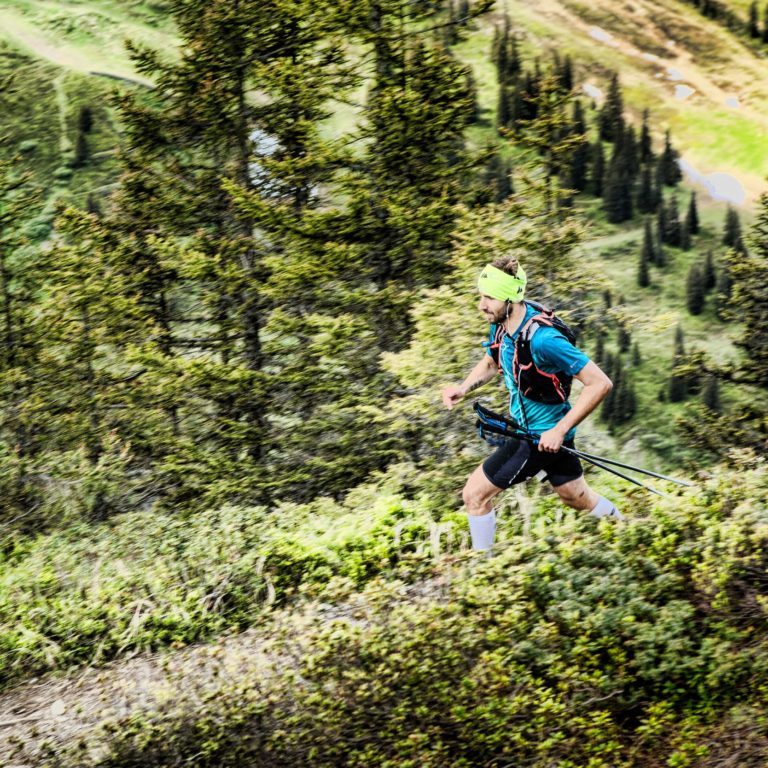
Montafon Totale Trail (c) Stefan Kothner / Silvretta Montafon

Trail Running

Whether strolling, hiking, jogging, high-altitude jogging or trail running – exercising in the fresh air assists the body during training and promotes mental regeneration.

High-altitude running park Lech Zürs am Arlberg

Lech Zürs am Arlberg offers perfect training conditions for runners. They can choose among ten routes of 54km in total, all of which are set in spectacular natural surroundings: four for beginners, two for moderately advanced and two for advanced athletes, a mountain running trail and the “forest mile” for training runs. Runners’ joints will rejoice on foot-friendly ground, from riverside gravel trails to soft meadows and mossy forest paths.

Shaping up combined with absolute well-being – according to the AMAS high-altitude study, moderate sports activities at Lech’s altitude have a proven positive effect on the body. Signage and maps help runners to verify and adhere to their own pace and pulse targets. Further Information

Montafon Totale Trail (c) Stefan Kothner / Silvretta Montafon
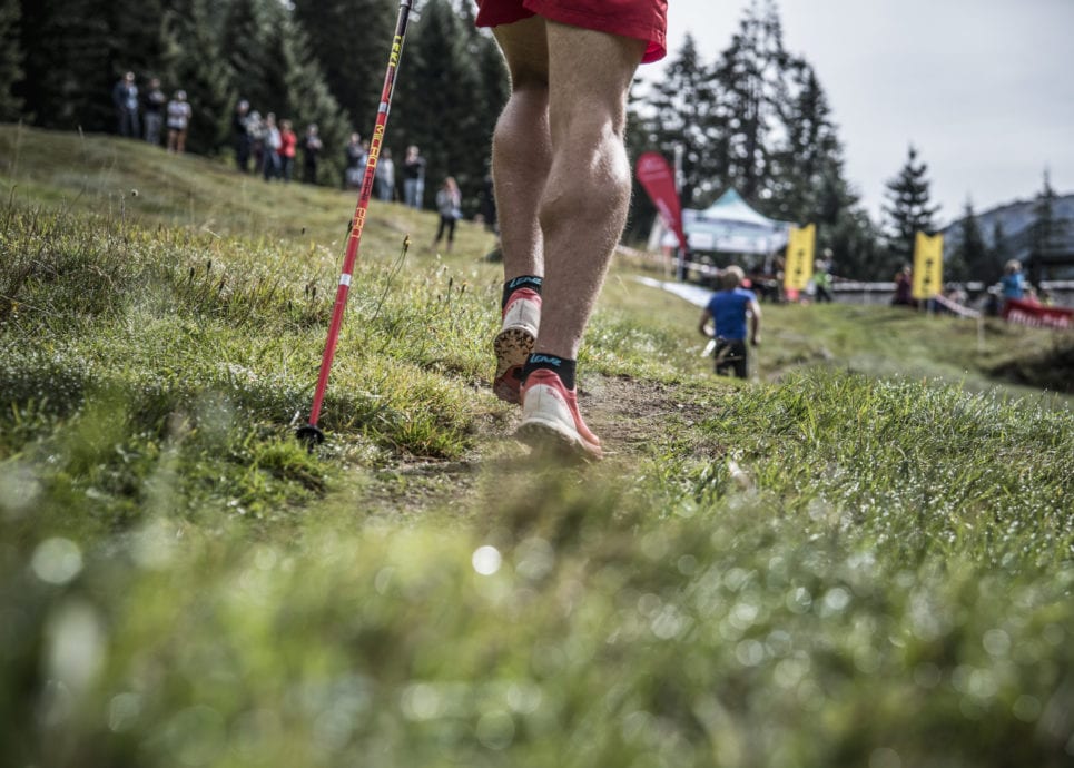
Montafoner Berglauf (c) Patrick Säly Photography

"It is not the mountain we conquer but ourselves." Sir Edmund Hillary

Play
Trail Running in Kleinwalsertal
Trail Running Tracks in Vorarlberg

Online Map

    • __NO_NAME__

      Arlberg Trailrun

      Run and perform yet still take in and enjoy the scenery. This is not…

      • 22.98 km

      • 3.3 h

      • schwer

      Difficulty: schwer
      Distance: 22.98 km
      Ascent: 975 m
      Descent: 975 m
      Duration: 3.3 h
      Deepest point: 1417 m
      Highest point: 2037 m
      Condition:

      Experience:

      Landscape:

      Arlberg Trailrun

      Run and perform yet still take in and enjoy the scenery. This is not a…

      Start of tour

      Sport Park Lech

      End of tour

      Sport Park Lech

      Description

      This running track was the original track of the “Arlberg Runs” running competition until 2018. This is no longer taking place. However, the course is still a highlight for all running enthusiasts.

      Best season
      JAN FEB MAR APR MAY JUN
      JUL AUG SEP OCT NOV DEC
      All route info
    • Run to the Lake Körbersee

      A challenging but incredibly beautiful run to the most beautiful course in Austria. You…

      • 0.02 km

      • 0.1 h

      • schwer

      Difficulty: schwer
      Distance: 0.02 km
      Ascent: 775 m
      Descent: 775 m
      Duration: 0.1 h
      Deepest point: 1396 m
      Highest point: 1800 m
      Condition:

      Experience:

      Landscape:

      Run to the Lake Körbersee

      A challenging but incredibly beautiful run to the most beautiful course in Austria. You will…

      Start of tour

      Lech town centre

      End of tour

      Lech town centre

      Description

      Along the Lech path we reach Bodenalpe. Steeply uphill we cross a meadow until we turn left shortly before the Bürstegg towards Auenfeld and Körbersee. First in serpentines, later flat it goes to the Auenfelder hut. You can also shorten the tour and turn again in the direction of Oberlech shortly before the hut. Or you can walk from the Auenfelder Hütte to the Körbersee, the most beautiful place in…

      Best season
      JAN FEB MAR APR MAY JUN
      JUL AUG SEP OCT NOV DEC
      All route info
    • Zugertal Trail

      A beautiful but strenuous trail run, which leads through the picturesque Zugertal to Lake…

      • 0.03 km

      • 0.1 h

      • schwer

      Difficulty: schwer
      Distance: 0.03 km
      Ascent: 1150 m
      Descent: 1150 m
      Duration: 0.1 h
      Deepest point: 1486 m
      Highest point: 2393 m
      Condition:

      Experience:

      Landscape:

      Zugertal Trail

      A beautiful but strenuous trail run, which leads through the picturesque Zugertal to Lake Formarinsee…

      Start of tour

      Fishpond Zug

      End of tour

      Fishpond Zug

      Description

      There are probably few trails for runners that run on such beautiful paths as the Lechweg and the Steinmayerweg. A stroke of luck if both paths meet at the most beautiful place in Austria and thus make the ideal tour for athletes with strong physical condition. Because this tour is exhausting in any case. But the wild Zugertal and the path along the Lech as well as the beautiful Steinmayerweg…

      Best season
      JAN FEB MAR APR MAY JUN
      JUL AUG SEP OCT NOV DEC
      All route info
    • Stierloch Trail

      Fantastic training run with a magical view to Lech. The track can of course…

      • 0.01 km

      • 0 h

      • mittel

      Difficulty: mittel
      Distance: 0.01 km
      Ascent: 500 m
      Descent: 500 m
      Duration: 0 h
      Deepest point: 1438 m
      Highest point: 1880 m
      Condition:

      Experience:

      Landscape:

      Stierloch Trail

      Fantastic training run with a magical view to Lech. The track can of course be…

      Start of tour

      Lech Zürs Tourist Information

      End of tour

      Lech Zürs Tourist Information

      Description

      This trail running round leads steeply up below the mighty Omeshorn summit massif. Ideal for an intensive training session or an evening run. At the Gstüat Alpe you can enjoy a wonderful view down to Lech before crossing the Stierlochalpe to Zug. The beautiful section from Zug to Lech completes this tour.

      Best season
      JAN FEB MAR APR MAY JUN
      JUL AUG SEP OCT NOV DEC
      All route info
    • __NO_NAME__

      Tannberg Run

      Run and perform yet still take in and enjoy the scenery. This is not…

      • 13.51 km

      • 3 h

      • schwer

      Difficulty: schwer
      Distance: 13.51 km
      Ascent: 838 m
      Descent: 838 m
      Duration: 3 h
      Deepest point: 1417 m
      Highest point: 1808 m
      Condition:

      Experience:

      Landscape:

      Tannberg Run

      Run and perform yet still take in and enjoy the scenery. This is not a…

      Start of tour

      sport.park.lech

      End of tour

      sport.park.lech

      Description

      This running track was the original track of the Tannberglauf running competition until 2018. This is no longer taking place. However, the course is still a highlight for all running enthusiasts.

      Best season
      JAN FEB MAR APR MAY JUN
      JUL AUG SEP OCT NOV DEC
      All route info
    • All around the Rüfikopf Mountain

      A wonderful mountain running tour, which can be started at any point of this…

      • 0.02 km

      • 0.1 h

      • schwer

      Difficulty: schwer
      Distance: 0.02 km
      Ascent: 1000 m
      Descent: 1000 m
      Duration: 0.1 h
      Deepest point: 1456 m
      Highest point: 2263 m
      Condition:

      Experience:

      Landscape:

      All around the Rüfikopf Mountain

      A wonderful mountain running tour, which can be started at any point of this route.…

      Start of tour

      Stubenbach

      End of tour

      Stubenbach

      Description

      The tour starts slowly and on evenly ascending trails in the direction of Zürs. From Zürs it then climbs steeply up to Lake Monzabon. Anyone who has the time should stay here for a while and absorb the mountain atmosphere with a few stretching exercises or some yoga. Especially the view over the lake to Albona stimulates the mind and relaxes the body after the strenuous ascent. If you want…

      Best season
      JAN FEB MAR APR MAY JUN
      JUL AUG SEP OCT NOV DEC
      All route info
    • Around the Omeshorn

      A panoramic and intensive round around the most striking Lech summit, the mighty Omeshorn.…

      • 0.01 km

      • 0 h

      • schwer

      Difficulty: schwer
      Distance: 0.01 km
      Ascent: 1000 m
      Descent: 1000 m
      Duration: 0 h
      Deepest point: 1438 m
      Highest point: 2437 m
      Condition:

      Experience:

      Landscape:

      Around the Omeshorn

      A panoramic and intensive round around the most striking Lech summit, the mighty Omeshorn. The…

      Start of tour

      Lech Zürs Tourist Information

      End of tour

      Lech Zürs Tourist Information

      Description

      The Omeshorn is probably one of the most famous photo motifs in Lech, as it rises above the village to protect it. And in the Lecher mountain summer a hike or a run in this area belongs to the fixed program of many guests. Of course, it is also possible to circumnavigate the Omeshorn.

      Best season
      JAN FEB MAR APR MAY JUN
      JUL AUG SEP OCT NOV DEC
      All route info
    • Trailrunning Auenfeld & Kriegerhorn

      Demanding trail running round with flowing sections and strenuous climbs. Ideal practice lap for…

      • 0.02 km

      • 0.1 h

      • schwer

      Difficulty: schwer
      Distance: 0.02 km
      Ascent: 1025 m
      Descent: 1025 m
      Duration: 0.1 h
      Deepest point: 1396 m
      Highest point: 2167 m
      Condition:

      Experience:

      Landscape:

      Trailrunning Auenfeld & Kriegerhorn

      Demanding trail running round with flowing sections and strenuous climbs. Ideal practice lap for competitions…

      Start of tour

      Lech Zürs Tourist Information

      End of tour

      Lech Zürs Tourist Information

      Description

      This round leads first along the Lechweg to the Bodenalpe. Then follows the Auenfeld, a beautiful and very flowing section, ideal for all runners. The ascent to the summit of the Kriegerhorn, on the other hand, is again very steep and demanding in the end, but the view from the summit is all the more beautiful. The steep descent to Zug is perfect for training the controlled downhill run. Along…

      Best season
      JAN FEB MAR APR MAY JUN
      JUL AUG SEP OCT NOV DEC
      All route info
    • Trailrunning Butzensee & Göppinger Hütte

      One of the most scenically beautiful trail runs on the Arlberg, which is one…

      • 0.03 km

      • 0.1 h

      • schwer

      Difficulty: schwer
      Distance: 0.03 km
      Ascent: 1600 m
      Descent: 1600 m
      Duration: 0.1 h
      Deepest point: 1396 m
      Highest point: 2443 m
      Condition:

      Experience:

      Landscape:

      Trailrunning Butzensee & Göppinger Hütte

      One of the most scenically beautiful trail runs on the Arlberg, which is one of…

      Start of tour

      Lech Zürs Tourist Information

      End of tour

      Lech Zürs Tourist Information

      Description

      From Lech over the beautiful Auenfeld towards Mohnefluh and Butzensee. As picturesquely situated as these two points are, the way to them is as exhausting. Constantly uphill over narrow paths it goes to the Mohnensatell and from there down to the lake. Next is the beautiful traverse to the Göppinger Hütte. Here you have to be free from vertigo and sure-footed, but running is wonderful. At the Göppinger Hütte you…

      Best season
      JAN FEB MAR APR MAY JUN
      JUL AUG SEP OCT NOV DEC
      All route info
    • Trailrunning in Lech Zürs (Trailchallenge)

      Der Weiße Ring – Die Trailchallenge (Great Hero Classification)

      The White Ring - The Trailchallenge leads trail runners, mountain runners and relay teams…

      • 27.88 km

      • 5 h

      • schwer

      Difficulty: schwer
      Distance: 27.88 km
      Ascent: 2300 m
      Descent: 2300 m
      Duration: 5 h
      Deepest point: 1437 m
      Highest point: 2438 m
      Condition:

      Experience:

      Landscape:

      Der Weiße Ring – Die Trailchallenge (Great Hero Classification)

      The White Ring - The Trailchallenge leads trail runners, mountain runners and relay teams along…

      Start of tour

      Schlosskopf

      End of tour

      Schlosskopf

      Description

      The Trailchallenge takes place in August 2024 and is a highlight in the Lecher Alpine Summer. The legendary White Ring – The ski round is mastered on foot in the opposite direction. Experienced trail runners master the Great Hero Championship alone or in teams of three. For hobby runners there is the small hero classification, which leads back to Lech along the Lechweg after the catering station in Zug.

      Lech…

      Best season
      JAN FEB MAR APR MAY JUN
      JUL AUG SEP OCT NOV DEC
      All route info
    • Lech – Zürs – Lech

      A beautiful trail that runs between Lech and Zürs is a popular summer destination…

      • 0.01 km

      • 0 h

      • mittel

      Difficulty: mittel
      Distance: 0.01 km
      Ascent: 300 m
      Descent: 300 m
      Duration: 0 h
      Deepest point: 1438 m
      Highest point: 1728 m
      Condition:

      Experience:

      Landscape:

      Lech – Zürs – Lech

      A beautiful trail that runs between Lech and Zürs is a popular summer destination for…

      Start of tour

      Lech Zürs Tourist Information

      End of tour

      Lech Zürs Tourist Information

      Description

      Gentle climbs and short steep sprints alternate on this lap, ideal for interval and ascent runs. On meadow paths from Lech to Zürs the route continues steadily uphill, in the opposite direction downhill accordingly. Especially if you start in Lech, you can continue walking in Zürs to the Flexenpass, where you can enjoy the magical view over to Albona. From Zürs it goes back the same way / with the…

      Best season
      JAN FEB MAR APR MAY JUN
      JUL AUG SEP OCT NOV DEC
      All route info
    • Around the Mehlsack

      In winter the Mehlsack is a popular destination for ski tourers. In summer a…

      • 0.02 km

      • 0.1 h

      • schwer

      Difficulty: schwer
      Distance: 0.02 km
      Ascent: 600 m
      Descent: 600 m
      Duration: 0.1 h
      Deepest point: 1486 m
      Highest point: 2010 m
      Condition:

      Experience:

      Landscape:

      Around the Mehlsack

      In winter the Mehlsack is a popular destination for ski tourers. In summer a beautiful…

      Start of tour

      Fishpond Zug

      End of tour

      Fishpond Zug

      Description

      The Zugertal is one of the most beautiful hiking regions in Lech Zürs am Arlberg. Always along the mountain streams there is a trail that leads enduring trail runners once around the entire Mehlsack and Spullerschafberg. A strenuous but technically easy run without exposed passages. And the views of the Zugertal, the Stierlochjoch and the Spullersee are worthwhile destinations.

      Best season
      JAN FEB MAR APR MAY JUN
      JUL AUG SEP OCT NOV DEC
      All route info
    • Gstüatalpe training run

      A wonderful trail running route, especially for beginners in trail running. This round is…

      • 0.01 km

      • 0 h

      • mittel

      Difficulty: mittel
      Distance: 0.01 km
      Ascent: 350 m
      Descent: 350 m
      Duration: 0 h
      Deepest point: 1438 m
      Highest point: 1801 m
      Condition:

      Experience:

      Landscape:

      Gstüatalpe training run

      A wonderful trail running route, especially for beginners in trail running. This round is also…

      Start of tour

      Lech Zürs Tourist Information

      End of tour

      Lech Zürs Tourist Information

      Description

      This training round is one of the most popular training rounds of the Lechers. After all, you can not only spend a lot of time on this tour, but at the same time you are in the middle of the most beautiful nature and can enjoy moments of mountain solitude intensively. The view down to Lech von der Gstüat Alpe is unparalleled anyway.

      Best season
      JAN FEB MAR APR MAY JUN
      JUL AUG SEP OCT NOV DEC
      All route info
    • Wanderweg im Kleinwalsertal

      Wildental Trail Round

      Beautiful trail round through the Wildental with the option to extend to the Fiderepasshütte.…

      • 10.47 km

      • 1.8 h

      • mittel

      Difficulty: mittel
      Distance: 10.47 km
      Ascent: 739 m
      Descent: 739 m
      Duration: 1.8 h
      Deepest point: 1155 m
      Highest point: 1834 m
      Condition:

      Experience:

      Landscape:

      Wildental Trail Round

      Beautiful trail round through the Wildental with the option to extend to the Fiderepasshütte.

      In…

      Start of tour

      Mittelberg

      End of tour

      Mittelberg

      Description

      Past the Alps and waterfall up to Wildenalp, where you will find a beautiful, romantic trail. Accompanied by the splashing of the Wildenbach and a magnificent view, you will float through the mountains before returning to the valley, where four refreshments await you as a reward.

      Best season
      JAN FEB MAR APR MAY JUN
      JUL AUG SEP OCT NOV DEC
      All route info
    • Widderstein Trail

      Widderstein Trail

      Advanced, exciting trail (also see Kanzelwand Trail).

      • 15.06 km

      • 3.2 h

      • schwer

      Difficulty: schwer
      Distance: 15.06 km
      Ascent: 904 m
      Descent: 904 m
      Duration: 3.2 h
      Deepest point: 1156 m
      Highest point: 2039 m
      Condition:

      Experience:

      Landscape:

      Widderstein Trail

      Advanced, exciting trail (also see Kanzelwand Trail).

      Start of tour

      Baad

      End of tour

      Baad

      Description

      From Baad alongside river Breitach, pass avalanche galary, till Gemstelboden, turn right, cross Gemsteltal. You can choose two different ways: cross the bridge, walk left and then right alongside Gemstelbach, pass Gemstel-Schönesbodenalpe and cross bridge, go left in direction of Hintere Gemstelhütte or go straight, pass Bernhard’s Gemstel and Hintere Gemstelhütte, then follow steep climb in direction of Gemstelpass till you reach obere Gemstelhütte, walk further straight till Gemstelpass, at…

      Best season
      JAN FEB MAR APR MAY JUN
      JUL AUG SEP OCT NOV DEC
      All route info
    • Walser Ultra Trail

      Walser Ultra Trail

      The Walser Ultra-Trail is part of the Walser Trail Challenge. The route length is…

      • 61.76 km

      • 13.8 h

      • schwer

      Difficulty: schwer
      Distance: 61.76 km
      Ascent: 3716 m
      Descent: 3716 m
      Duration: 13.8 h
      Deepest point: 1060 m
      Highest point: 2199 m
      Condition:

      Experience:

      Landscape:

      Walser Ultra Trail

      The Walser Ultra-Trail is part of the Walser Trail Challenge. The route length is about…

      Start of tour

      Riezlern

      End of tour

      Riezlern

      Description

      The start of the UltraTrails is in Riezlern. From here it goes via Egg, Wäldele and Küren up to the Gottesacker plateau. Over Ifen it carries on into Schwarzwassertal and follows out to the Auenhütte. Continue on a short piece of gravel road to the Upper Walmendinger Alpe and continue on to Walmendingerhorn. Over the Lüchlealpe and the Stierhofalpen in direction Grünhorn. The trail from the Grünhorn to the Starzeljoch…

      Best season
      JAN FEB MAR APR MAY JUN
      JUL AUG SEP OCT NOV DEC
      All route info
    • Kanzelwandtrail

      Kanzelwand Trail

      Difficult, exciting trail (also see Widderstein Trail)

      • 8.42 km

      • 2.7 h

      • schwer

      Difficulty: schwer
      Distance: 8.42 km
      Ascent: 1095 m
      Descent: 238 m
      Duration: 2.7 h
      Deepest point: 1085 m
      Highest point: 2024 m
      Condition:

      Experience:

      Landscape:

      Kanzelwand Trail

      Difficult, exciting trail (also see Widderstein Trail)

      Start of tour

      Riezlern

      End of tour

      Riezlern

      Description

      Walsermuseum Riezlern, alongside Walserstraße, pass the Casino, at Hotel Jagdhof take turn off to Westeggweg and Höhenweg, at the end of Westeggweg turn right, walk alongside Höhenweg till Schwand, advanced climb via Riezler Alpe (Hinterbergtobel), Gundsattel (Kanonenrohr), Zweiländerlift-Talstation, Roßgrund, Kanzelwand-Scharte, Kanzelwand-Bergstation, take cable car down to valley, back to starting point Walsermuseum Riezlern.

      Best season
      JAN FEB MAR APR MAY JUN
      JUL AUG SEP OCT NOV DEC
      All route info
    • __NO_NAME__

      Gehrenspitze Trail

      Crisp run, which is rewarded with a great view.

      • 5.88 km

      • 1.3 h

      • schwer

      Difficulty: schwer
      Distance: 5.88 km
      Ascent: 804 m
      Descent: 803 m
      Duration: 1.3 h
      Deepest point: 1070 m
      Highest point: 1858 m
      Condition:

      Experience:

      Landscape:

      Gehrenspitze Trail

      Crisp run, which is rewarded with a great view.

      Start of tour

      Riezlern

      End of tour

      Riezlern

      Description

      Spread over only 3 km wait here crisp 800 meters. From below, it goes steeply uphill and through the forest over a root path up to the top of the Gehrenspitze, which offers a beautiful view of the Kleinwalsertal and the neighboring Allgäu.

      Best season
      JAN FEB MAR APR MAY JUN
      JUL AUG SEP OCT NOV DEC
      All route info
    • Negrellibrücke Lingenau

      Lingenau | Negrelli’s trail

      This running path is a demanding stretch that passes the mountain of Rotenberg, the…

      • 11.54 km

      • 2 h

      • schwer

      Difficulty: schwer
      Distance: 11.54 km
      Ascent: 435 m
      Descent: 435 m
      Duration: 2 h
      Deepest point: 591 m
      Highest point: 941 m
      Condition:

      Lingenau | Negrelli’s trail

      This running path is a demanding stretch that passes the mountain of Rotenberg, the town…

      Start of tour

      Overview board village center

      End of tour

      Overview board village center

      Description

      The demanding run with an elevation gain of over 400 metres starts from the map in the village square. Via the Oberbuch parcel of land, run up to the Rotenberg and then towards Hittisau. In Tannen, take the path through the forest and meadow down to the A road, and follow it for a short time towards Lingenau.

      On the Tobel parcel of land, an agricultural path branches off to…

      Best season
      JAN FEB MAR APR MAY JUN
      JUL AUG SEP OCT NOV DEC
      All route info
    • Waldweg zur Bezegg

      Bezau | Bezegg Loop

      On this long and challenging trail, you pass four communities of the Bregenzerwald.

      • 16.58 km

      • 1.8 h

      • schwer

      Difficulty: schwer
      Distance: 16.58 km
      Ascent: 364 m
      Descent: 364 m
      Duration: 1.8 h
      Deepest point: 549 m
      Highest point: 793 m
      Condition:

      Bezau | Bezegg Loop

      On this long and challenging trail, you pass four communities of the Bregenzerwald.

      Start of tour

      Overview board Klostergarage

      End of tour

      Overview board Klostergarage

      Description

      You start from the monastery garage in Bezau. Via the Unterdorf parcel of land, you then arrive at the Wilbinger parcel of land where you turn right into the old Bezauer Straße. Via Stallau and Bergle, in Bersbuch you return to the A road and follow the Bregenzerwald cycle path as far as the roundabout. Here, run to the left towards Schwarzenberg. After the bridge, turn left and run down…

      Best season
      JAN FEB MAR APR MAY JUN
      JUL AUG SEP OCT NOV DEC
      All route info
    • Känzele Bezau

      Bezau | Cliff run

      A trail run with an elevation gain of 412 metres on the Känzele and…

      • 10.12 km

      • 1.3 h

      • schwer

      Difficulty: schwer
      Distance: 10.12 km
      Ascent: 412 m
      Descent: 412 m
      Duration: 1.3 h
      Deepest point: 645 m
      Highest point: 897 m
      Condition:

      Bezau | Cliff run

      A trail run with an elevation gain of 412 metres on the Känzele and back…

      Start of tour

      Overview board Klostergarage

      End of tour

      Overview board Klostergarage

      Description

      The demanding trail run starts from the map at the monastery garage in Bezau. From there, run across Greben and the lovely Bezauer Moos via the Schrofenweg to the Känzele. Take a detour of around 10 minutes to the vantage point.

      Via Rimsgrund and Sandriese, return to the starting point.

      Best season
      JAN FEB MAR APR MAY JUN
      JUL AUG SEP OCT NOV DEC
      All route info
    • Blick auf Andelsbuch

      Andelsbuch | Family run

      An eventful run to the Brühlbach waterfalls.

      • 3.19 km

      • 0.6 h

      • Unbekannt

      Distance: 3.19 km
      Ascent: 104 m
      Descent: 104 m
      Duration: 0.6 h
      Deepest point: 552 m
      Highest point: 615 m

      Andelsbuch | Family run

      An eventful run to the Brühlbach waterfalls.

      Start of tour

      Ortsmitte Andelsbuch

      End of tour

      Ortsmitte Andelsbuch

      Description

      Over the course of a very long period of time our village stream, properly named Brühlbach, has eaten its way into the shale. This gave rise to the waterfalls, which are considered particularly lovely spectacles of nature.

      The circular path commences at the church in Andelsbuch. Follow the cycle path towards Egg as far as the Heidegg parcel of land. At the second viaduct, descend to the waterfalls – a…

      Best season
      JAN FEB MAR APR MAY JUN
      JUL AUG SEP OCT NOV DEC
      All route info
    • Blick auf die Kanisfluh

      Andelsbuch | Forest run

      Fairly demanding trail run with an elevation gain of approx. 250 metres from Andelsbuch…

      • 8.35 km

      • 1.5 h

      • Unbekannt

      Distance: 8.35 km
      Ascent: 254 m
      Descent: 254 m
      Duration: 1.5 h
      Deepest point: 615 m
      Highest point: 864 m

      Andelsbuch | Forest run

      Fairly demanding trail run with an elevation gain of approx. 250 metres from Andelsbuch to…

      Start of tour

      Village square Andelsbuch

      End of tour

      Village square Andelsbuch

      Description

      The trail run starts at the village square in Andelsbuch. Via the Bregenzerwald cycle path, you arrive at Andelsbuch football pitch, where the ascent to the Bezegg commences.

      After the Bezegg Sul, you come to a chapel: here, turn right towards Heugut. Via paths through the forest and across meadows, you come back down to Bersbuch to the upper dam. From there, you return via the cycling path to the…

      Best season
      JAN FEB MAR APR MAY JUN
      JUL AUG SEP OCT NOV DEC
      All route info
    • Wanderweg im Schwarzwassertal

      Schwarzwasser trail

      Up along the water. This trail round is also suitable for beginners.

      • 12.19 km

      • 2.4 h

      • mittel

      Difficulty: mittel
      Distance: 12.19 km
      Ascent: 449 m
      Descent: 450 m
      Duration: 2.4 h
      Deepest point: 1008 m
      Highest point: 1323 m
      Condition:

      Experience:

      Landscape:

      Schwarzwasser trail

      Up along the water. This trail round is also suitable for beginners.

      Start of tour

      Riezlern

      End of tour

      Riezlern

      Description

      Just the right turn for all those who have started with trail running. In total, only 450 meters in altitude have to be conquered here. The path leads along the Schwarzwasserbach on the first half. On the way you pass nature highlights such as the natural bridge or the boiler holes and enjoy the view of Riezlern and Hirschegg. 2-3 sections are very steep, these are best for beginners.

      Best season
      JAN FEB MAR APR MAY JUN
      JUL AUG SEP OCT NOV DEC
      All route info