Webcams Current Snow Report Avalanche Report Weather & Traffic
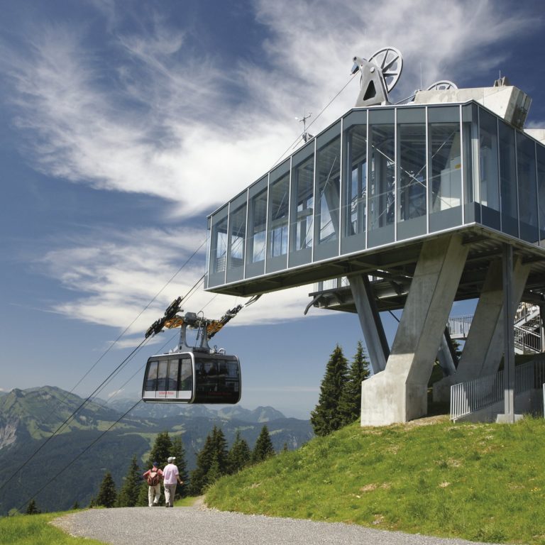
Wandern mit der Seilbahn, Sommerbergbahnen, Bezau Bergstation (c) Seilbahn Bezau / Vorarlberg Tourismus
Journey up or down

Hiking with the cable car

Cable cars make ascending and descending easy

Hiking with the cable car in Vorarlberg: Head up on foot and take the gondola back into the valley. This great way to improve your fitness is easy on the joints. Our recommended tips lead hikers to dramatic gorges, lakes, an echo wall, and to the peaks for outstanding views.

Once up high, mountain inns, often featuring sun terraces, are the perfect places to relax and enjoy. Comfortably return back to the valley with the cableway. Cable cars make returning to the valley easy, especially if you’d prefer to have a pleasant hike at altitude.

Information on the operating hours of the mountain cable cars can be found here.


Here is a selection of hiking tips with cable car:
    • Ausblick am Gipfel Richtung Klostertal mit Roggelskopf und Roter Wand und auf den Abstieg Richtung Kristberg

      Muttjöchle – Kristberg | Dalaas

      Beautiful hike past idyllic high moors and flowering mountain meadows up to Muttjöchle, on…

      • 10.49 km

      • 4.8 h

      • mittel

      Difficulty: mittel
      Distance: 10.49 km
      Ascent: 310 m
      Descent: 1301 m
      Duration: 4.8 h
      Deepest point: 843 m
      Highest point: 2072 m
      Condition:

      Experience:

      Landscape:

      Muttjöchle – Kristberg | Dalaas

      Beautiful hike past idyllic high moors and flowering mountain meadows up to Muttjöchle, on to…

      Start of tour

      Mountain station Sonnenkopfbahn, Wald am Arlberg

      End of tour

      Kristbergsaal, Dalaas

      Description

      After the ascent with the Sonnenkopf cable car, hike from the mountain station past small high moors, continue across flat alpine meadows up to the summit of the Muttjöchle. The descent is via the “gebrünten Rücken”, down to Scheidboden and through the mountain forest to Kristberg. From Kristberg either via the steep forest path or the somewhat longer, but easier, goods path down to Dalaas. You can get back to…

      Best season
      JAN FEB MAR APR MAY JUN
      JUL AUG SEP OCT NOV DEC
      All route info
    • Tafamuntmaisäß

      Tafamuntmaisäß – Gaschurn

      Gaschurn - via Tafamuntmaisäß - summit station Tafamunt

      • 4.32 km

      • 1.8 h

      • mittel

      Difficulty: mittel
      Distance: 4.32 km
      Ascent: 628 m
      Descent: 48 m
      Duration: 1.8 h
      Deepest point: 967 m
      Highest point: 1550 m
      Condition:

      Experience:

      Landscape:

      Tafamuntmaisäß – Gaschurn

      Start of tour

      Gaschurn

      End of tour

      Tafamuntmaisäß

      Description

      Gaschurn – via Tafamuntmaisäß – summit station Tafamunt

      Best season
      JAN FEB MAR APR MAY JUN
      JUL AUG SEP OCT NOV DEC
      All route info
    • Startpunkt der Tour: Bergrestaurant Nova Stoba

      Madrisellaspitze (2466 m)

      • 12.31 km

      • 4.8 h

      • mittel

      Difficulty: mittel
      Distance: 12.31 km
      Ascent: 566 m
      Descent: 1098 m
      Duration: 4.8 h
      Deepest point: 1477 m
      Highest point: 2466 m
      Condition:

      Experience:

      Landscape:

      Madrisellaspitze (2466 m)

      Start of tour

      Bergstation Versettla Bahn

      End of tour

      Bergstation Garfrescha Bahn

      Best season
      JAN FEB MAR APR MAY JUN
      JUL AUG SEP OCT NOV DEC
      All route info
    • Bergbahnen Diedamskopf

      Au-Schoppernau | Diedamskopf mid-station summit station

      Mid-station - Breitenalpe - Kreuzle - Summit station

      • 4.66 km

      • 1.8 h

      • leicht

      Difficulty: leicht
      Distance: 4.66 km
      Ascent: 408 m
      Descent: 60 m
      Duration: 1.8 h
      Deepest point: 1644 m
      Highest point: 2030 m
      Condition:

      Experience:

      Landscape:

      Au-Schoppernau | Diedamskopf mid-station summit station

      Mid-station - Breitenalpe - Kreuzle - Summit station

      Start of tour

      Diedamskopf - mid-station

      End of tour

      Diedamskopf - summit station

      Best season
      JAN FEB MAR APR MAY JUN
      JUL AUG SEP OCT NOV DEC
      All route info
    • Blick vom Pfänder

      Bregenz | Adventure route Pfänder – Hirschberg

      Popular family hike from Pfänder, the local mountain of the inhabitants of Bregenz, across…

      • 11.96 km

      • 3.6 h

      • mittel

      Difficulty: mittel
      Distance: 11.96 km
      Ascent: 210 m
      Descent: 580 m
      Duration: 3.6 h
      Deepest point: 654 m
      Highest point: 1080 m
      Condition:

      Experience:

      Landscape:

      Bregenz | Adventure route Pfänder – Hirschberg

      Popular family hike from Pfänder, the local mountain of the inhabitants of Bregenz, across the…

      Start of tour

      Bregenz, Pfänderbahn summit station

      End of tour

      Langen, Bregenz

      Description

      From the Pfänder you have a wonderful panoramic view over the whole of Lake Constance and the mountain peaks of Switzerland, Liechtenstein and Vorarlberg. Around the mountain station and along the route there are several inns and snack stations to choose from.

      Best season
      JAN FEB MAR APR MAY JUN
      JUL AUG SEP OCT NOV DEC
      All route info
    • Blick auf Alpe Steris

      Alpine Pasture Hike l Sonntag-Stein mid-station – Alpe Steris…

      Very impressive round trip with support of the cableway in the alpine area of…

      • 10.24 km

      • 3.8 h

      • mittel

      Difficulty: mittel
      Distance: 10.24 km
      Ascent: 484 m
      Descent: 484 m
      Duration: 3.8 h
      Deepest point: 1300 m
      Highest point: 1703 m
      Condition:

      Experience:

      Landscape:

      Alpine Pasture Hike l Sonntag-Stein mid-station – Alpe Steris – Oberpartnomalpe – Sonntag-Stein

      Very impressive round trip with support of the cableway in the alpine area of Steris…

      Start of tour

      Sonntag-Stein, Seilbahn Talstation

      End of tour

      Sonntag-Stein, Seilbahn-Talstation

      Description

      From Sonntag-Stein you can take the cableway up to the alpine area. The first bit of the tour takes you to the Alpe Steris und continues past the Oberpartnomalpe and Breithornhütte and back to the cableway and the starting point of the tour.

      The Sennalpe Steris consists of several huts and a chapel. The Schwarzmann family spoils guests with homemade and regional products such as Alpjause (snack), cakes, Kässspätzle…

      Best season
      JAN FEB MAR APR MAY JUN
      JUL AUG SEP OCT NOV DEC
      All route info
    • Blick auf die Wildmoosalpe

      Alpine Pasture Hike l Bezau/Baumgarten – Niedere – Sonderdach

      Upon arrival at the 1660 m high Seehöhe via cableway, you get a chance…

      • 9.83 km

      • 3 h

      • leicht

      Difficulty: leicht
      Distance: 9.83 km
      Ascent: 163 m
      Descent: 571 m
      Duration: 3 h
      Deepest point: 1214 m
      Highest point: 1695 m
      Condition:

      Experience:

      Landscape:

      Alpine Pasture Hike l Bezau/Baumgarten – Niedere – Sonderdach

      Upon arrival at the 1660 m high Seehöhe via cableway, you get a chance to…

      Start of tour

      Bezau, valley station Bezau

      End of tour

      Sonderdach, mid-station of the cableway Bezau

      Description

      After arriving via cableway (there is a new panoramic restaurant at Baumgarten) the first Alpine Pasture is only a few minutes away, the Vordere Niederalpe. You can get something to eat at the Bergrestaurant Niedere. The Feuerstein family offers mountain cheese, yoghurt, fresh milk, butter, Sennsuppe (a typical local soup), drinks and other home cooked meals. If you arrive around 11 o’clock you might get the chance to test a…

      Best season
      JAN FEB MAR APR MAY JUN
      JUL AUG SEP OCT NOV DEC
      All route info
    • __NO_NAME__

      Geology hike ”Rüfikopf”

      This geological tour takes you on a fantastic journey through time – past the…

      • 3.43 km

      • 2.5 h

      • leicht

      Difficulty: leicht
      Distance: 3.43 km
      Ascent: 164 m
      Descent: 165 m
      Duration: 2.5 h
      Deepest point: 2228 m
      Highest point: 2348 m
      Condition:

      Experience:

      Landscape:

      Geology hike ”Rüfikopf”

      This geological tour takes you on a fantastic journey through time – past the ”stone…

      Start of tour

      Rüfiplatz

      End of tour

      Rüfiplatz

      Description

      A hiking trail with many geological and historical highlights in the breathtaking landscape of Lech am Arlberg.

      Best season
      JAN FEB MAR APR MAY JUN
      JUL AUG SEP OCT NOV DEC
      All route info
    • __NO_NAME__

      Hike to Skyspace Lech & via Auenfeld to Bodenalpe

      Skyspace Lech by artist James Turrell has been one of Vorarlberg's cultural highlights since…

      • 10.98 km

      • 3.5 h

      • mittel

      Difficulty: mittel
      Distance: 10.98 km
      Ascent: 425 m
      Descent: 650 m
      Duration: 3.5 h
      Deepest point: 1401 m
      Highest point: 1800 m
      Condition:

      Experience:

      Landscape:

      Hike to Skyspace Lech & via Auenfeld to Bodenalpe

      Skyspace Lech by artist James Turrell has been one of Vorarlberg's cultural highlights since it…

      Start of tour

      Bergbahn Oberlech

      End of tour

      Gasthaus Bodenalpe

      Description

      Skyspace Lech was officially opened in the summer of 2018 and has been open to visitors ever since. With the Skyspace by James Turrel, the dimensions of space, light and time are lifted and newly combined. The intense feeling of space in the midst of the dreamlike mountain world mixes with the equally intense colours of the sky to create an overall experience that opens up to the visitor. Especially…

      Best season
      JAN FEB MAR APR MAY JUN
      JUL AUG SEP OCT NOV DEC
      All route info