Webcams Current Snow Report Avalanche Report Weather & Traffic
Tiefblick von der Kaltenberghütte ins Klostertal. © Peter Freiberger / Vorarlberg Tourismus
Recommendations from Peter Freiberger

Six panoramic hikes

Why do people go into the mountains? To be sure, everyone has their own personal reasons for lacing up their hiking boots and ascending to picturesque places.

Peter Freiberger talks about panoramic hikes: For me, hiking is a form of meditation. Step by step, I become more relaxed as I immerse myself in another world and enjoy the freedom.

The mountains of Vorarlberg are associated with fantastic panoramic views. However, one need not reach the peak in order to truly appreciate the scenery. For example, mountain huts are often easier to reach. They offer spectacular vantage points from which to enjoy panoramic views. Over and over from atop a mountain, I enjoy watching people try to name each peak and valley in every direction. They are fascinated by the wide-ranging views.
I feel exactly the same.

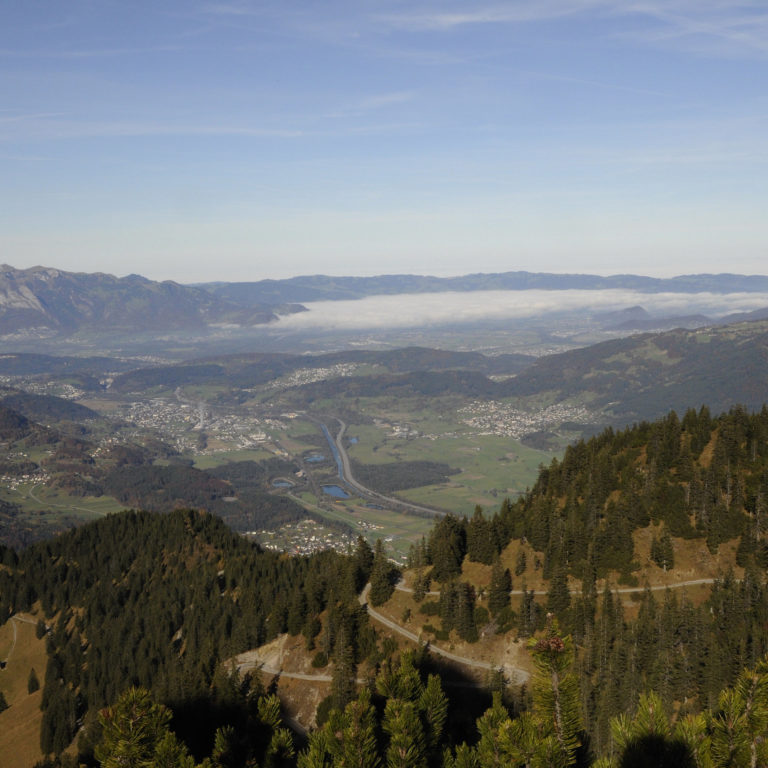
Im Anschluss an die Furklaalpe präsentiert sich ein wunderbarer Blick über den Walgau ins Rheintal © Peter Freiberger / Vorarlberg Tourismus
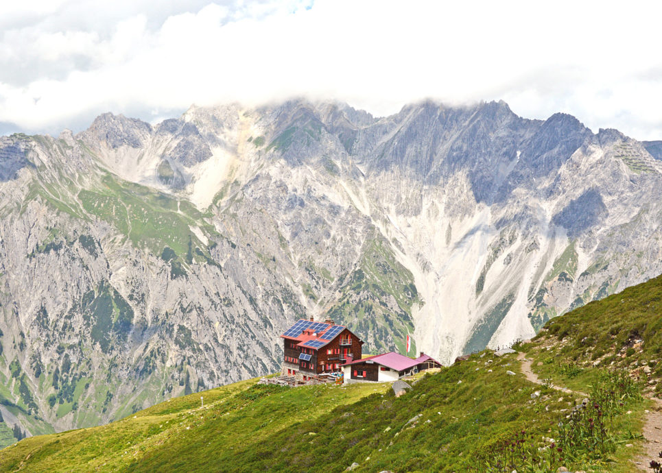
Kaltenberghütte, Lechquellengebirge, Panoramawandern, panoramic hikes © Peter Freiberger / Vorarlberg Tourismus

Author Peter Freiberger has selected six panoramic hikes - tips with wonderful panoramic views located throughout Vorarlberg!

I have selected six panoramic hikes for you that are at the top of my personal list. I really enjoy the Mondspitze and the Schillerkopf for their gentle and rugged landscapes as well as the Alpine character of these tours during different segments. I have never gotten closer to ibex than on the Kanisfluh massif, which also features incredible downward views. Sitting in the rustic atmosphere of the Saarbrücker Hütte mountain hut, I feel a true sense of security and peace, especially as I look to the mighty glacier below the Großes Seehorn. Next to the Kaltenberghütte mountain hut, one can practically bathe in the scenery reflected in the small mountain lake. As a Tyrolean, I enjoy the contrast between the mountains and Lake Constance from the Pfänder. Finally, the view from the ridge of the Fellhorn mountain over the expanse of the Kleinwalsertal is an unforgettable experience (Attention: this hike is not possible in summer 2020 – Söllereck cable car is not operating!).

For me, hiking is a form of meditation. Step by step, I become more relaxed as I immerse myself in another world and enjoy the freedom.

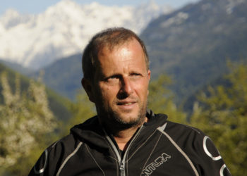
Author Peter Freiberger
Die Flanke hinauf zur Saarbrücker Hütte präsentiert sich im Hochsommer in sattem Grün © Peter Freiberger / Vorarlberg Tourismus
Wie ein begrüntes Hausdach präsentiert sich der Grat am Fellhorn in diesem Abschnitt © Peter Freiberger / Vorarlberg Tourismus
Kaltenberghütte, Lechquellengebirge, Panoramawandern, panoramic hikes © Peter Freiberger / Vorarlberg Tourismus
Nordwestlich unterhalb der Kanisfluh breitet sich Mellau aus, erster Schnee © Peter Freiberger / Vorarlberg Tourismus
Am Gipfel der Mondspitze Rund 1.400 Meter unterhalb breitet sich die Alpenstadt Bludenz aus, das Klostertal schlängelt sich Richtung Arlbergpass. © Peter Freiberger / Vorarlberg Tourismus
Pfänder - Wiesen und Höfe bzw. kleine Siedlungen prägen weite Teile der Wanderung am Pfänderrücken © Peter Freiberger / Vorarlberg Tourismus

The flank extending up to the Saarbrücker Hütte mountain hut is a carpet of lush green in high summer

The ridge of the Fellhorn looks like the green roof of a house in this section

The Kaltenberghütte mountain hut against the backdrop of the Lechquellen range

Mellau opens up to the northwest below the Kanisfluh massif

The peak of the Mondspitze at nearly 1,400 meters. Below the Alpenstadt Bludenz, and the Klostertal winds towards the Arlberg Pass

Pfänder - Meadows, farms and small settlements are characteristic of many sections of the hike on the Pfänder ridge

The huts, Alpine pastures and peaks around Schoppernau were my first connection to the Vorarlberg mountain world. These days, I feel particularly at home in the Rätikon near Lake Lünersee and the Schesaplana and Mottakopf mountains. East of the Arlberg, I can’t hide my preference for the Pitztal and Ötztal valleys. In summer 2017, I can’t wait to ascend my local mountain, the Hohe Munde by Telfs, once more.

I can’t help but visit the Jeitner family at the Schweinfurter Hütte mountain hut in Ötztal. I also can’t wait to finally visit the close-by Mannheimer Hütte mountain hut or to ascend the Piz Buin for another feather in my cap.

When I’m on panoramic hikes, I can enjoy Vorarlberg from above.

Six recommended hiking trails from Peter Freiberger

Panoramic hikes

    • Die Flanke hinauf zur Saarbrücker Hütte präsentiert sich im Hochsommer in sattem Grün.

      Panoramic hike in the Silvretta

      Ice giants within your grasp

      During the hiking tour from the southern end (Seespitz)…

      • 12.76 km

      • 4.3 h

      • mittel

      Difficulty: mittel
      Distance: 12.76 km
      Ascent: 790 m
      Descent: 790 m
      Duration: 4.3 h
      Deepest point: 1753 m
      Highest point: 2541 m
      Condition:

      Experience:

      Landscape:

      Panoramic hike in the Silvretta

      Ice giants within your grasp

      During the hiking tour from the southern end (Seespitz) of…

      Start of tour

      Partenen: Vermuntstausee (Seespitz)

      End of tour

      Partenen: Vermuntstausee (Seespitz)

      Description

      How can the term “panorama” be best defined? “Allround view; view from an elevated point in all directions, over the landscape”, according to the dictionary. Actually lying on the southeastern shoulder of the Kleinlitzner ridge, Saarbrücker Hütte (2538 m) offers the best preconditions for a magnificent panoramic view. But of course, one doesn’t have a free view “over” the mountainscape in all directions. No surprise: In respect of view, the…

      Best season
      JAN FEB MAR APR MAY JUN
      JUL AUG SEP OCT NOV DEC
      All route info
    • Wunderbarer Blick ins Kleine Walsertal und zum Hohen Ifen (links).

      Panoramic hike: hike along the border on Fellhorn ridge

      On a panoramic hike on Fellhorn ridge

      This hike along the border runs on…

      • 8.22 km

      • 4 h

      • mittel

      Difficulty: mittel
      Distance: 8.22 km
      Ascent: 882 m
      Descent: 288 m
      Duration: 4 h
      Deepest point: 1354 m
      Highest point: 2036 m
      Condition:

      Experience:

      Landscape:

      Panoramic hike: hike along the border on Fellhorn ridge

      On a panoramic hike on Fellhorn ridge

      This hike along the border runs on a…

      Start of tour

      Oberstdorf (D), top station of the Söllereck cable car

      End of tour

      Riezlern (A), top station of the Kanzelwand cable car

      Description

      Rigde walk, border tour – this is how the hike beginning in Oberstdorf and ending in Riezlern in the Kleinwalsertal can be best described. Nobody needs to be afraid of crossing the Fellhorn ridge as it is actually a meadowed back of a mountain with quite narrow sections. The 2025 m high Fellhorn with the summit cross on top as part of the ridge is the icing on the cake.…

      Best season
      JAN FEB MAR APR MAY JUN
      JUL AUG SEP OCT NOV DEC
      All route info
    • Tiefblick von der Kaltenberghütte ins Klostertal.

      Panoramic hike on a sun terrace over the Klostertal

      Scenic diversity, views and a bathing lake

      The Kaltenberghütte on a sun terrace above…

      • 10.08 km

      • 1.7 h

      • schwer

      Difficulty: schwer
      Distance: 10.08 km
      Ascent: 718 m
      Descent: 718 m
      Duration: 1.7 h
      Deepest point: 1383 m
      Highest point: 2081 m
      Condition:

      Experience:

      Landscape:

      Panoramic hike on a sun terrace over the Klostertal

      Scenic diversity, views and a bathing lake

      The Kaltenberghütte on a sun terrace above the…

      Start of tour

      Stuben Fuxbau / ticket booth of the mountain railway

      End of tour

      Stuben, Fuxbau / ticket booth of the mountain railway

      Description

      The Klostertal lies virtually at the feet of the mountain refuge, views down there into the depth turn out accordingly impressive. The Lechquellengebirge is another very defining component in regard to scenery and view. With its steep mountain flanks it plants itself dominantly opposite the refuge. The Kaltenberg, from which the refuge has its name, is enthroned in the south, the less spectacular Maroiköpfe rise up in the southeast. In…

      Best season
      JAN FEB MAR APR MAY JUN
      JUL AUG SEP OCT NOV DEC
      All route info
    • Herbststimmung am Pfänder – im Hintergrund Gipfel im Bregenzerwald.

      Panoramic tour along the ridge of the Pfänder above…

      A panoramic view over the contrasts in the border triangle

      Hilly and flat countryside,…

      • 6.95 km

      • 2.5 h

      • leicht

      Difficulty: leicht
      Distance: 6.95 km
      Ascent: 135 m
      Descent: 135 m
      Duration: 2.5 h
      Deepest point: 896 m
      Highest point: 1028 m
      Condition:

      Experience:

      Landscape:

      Panoramic tour along the ridge of the Pfänder above Bregenz

      A panoramic view over the contrasts in the border triangle

      Hilly and flat countryside, gentle…

      Start of tour

      Bregenz, summit station of Pfänder

      End of tour

      Bregenz, summit station of Pfänder

      Description

      Anyone looking for mountain-solitude is not right here. On the first glance, there are large crowds bustling on the local mountain of Bregenz. Of course, the tour leads to more remote corners of the ridge of the Pfänder where there are smaller villages hidden from those who choose to get to the top by cable car. In any case, the cable-car ride to the summit station (1023 m) already gives…

      Best season
      JAN FEB MAR APR MAY JUN
      JUL AUG SEP OCT NOV DEC
      All route info
    • Am Gipfel der Mondspitze. Rund 1.400 Meter unterhalb breitet sich die Alpenstadt Bludenz aus, das Klostertal schlängelt sich Richtung Arlbergpass.

      Panoramic hike Mondspitze and Schillerkopf

      Above valleys, on top of mountains and on Schiller's nose

      Two unequal neighbors tower…

      • 10.6 km

      • 5 h

      • schwer

      Difficulty: schwer
      Distance: 10.6 km
      Ascent: 820 m
      Descent: 820 m
      Duration: 5 h
      Deepest point: 1224 m
      Highest point: 1991 m
      Condition:

      Experience:

      Landscape:

      Panoramic hike Mondspitze and Schillerkopf

      Above valleys, on top of mountains and on Schiller's nose

      Two unequal neighbors tower above…

      Start of tour

      Bürserberg, parking area Rona on the Tschengla

      End of tour

      Bürserberg, parking area Rona

      Description

      An alpine town lying virtually at the feet of the two summits, directly above the point where five valleys converge, and a 360-degree panorama: Could a panoramic hike offer even more? The highlights of the peak round trip, beginning on the quaint Tschengla high plateau, past alpine pastures, across saddles and through charming meadows and forests, are indeed hard to top. And there are also one or two challenges awaiting…

      Best season
      JAN FEB MAR APR MAY JUN
      JUL AUG SEP OCT NOV DEC
      All route info
    • Blick vom Gipfel der Kanisfluh über Au und Schoppernau

      Panoramic hike from Mellau over the Kanisfluh to Au

      To the ibex on the mountain with the two faces

      The Kanisfluh, a freestanding…

      • 12.26 km

      • 5 h

      • schwer

      Difficulty: schwer
      Distance: 12.26 km
      Ascent: 650 m
      Descent: 1265 m
      Duration: 5 h
      Deepest point: 779 m
      Highest point: 2042 m
      Condition:

      Experience:

      Landscape:

      Panoramic hike from Mellau over the Kanisfluh to Au

      To the ibex on the mountain with the two faces

      The Kanisfluh, a freestanding massif…

      Start of tour

      Mellau, summit station of the Mellaubahn (gondola cableway) on the Alpe Roßstellle

      End of tour

      Au (bus stop Jaghausen at the church)

      Description

      When a mountain rises freely, a magnificent panorama seems to be guaranteed. The same is true for the 2044 m high Kanisfluh. The massif itself can hardly be overlooked between other summits in the near and farer surroundings. This is not only due to the fact that it has no immediate neighbors. No, its shape also contributes to this. The Kanisfluh is actually a small, narrow massif, oriented in a…

      Best season
      JAN FEB MAR APR MAY JUN
      JUL AUG SEP OCT NOV DEC
      All route info
Even more selected tips

Hiking in Vorarlberg