Webcams Current Snow Report Avalanche Report Weather & Traffic
Rennrad fahren in Vorarlberg (c) Ludwig Berchtold / Bregenzerwald Tourismus
Speeding down the streets on the narrowest of tires

Road biking

Ready, set, pedal

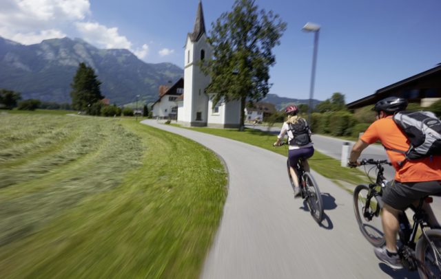
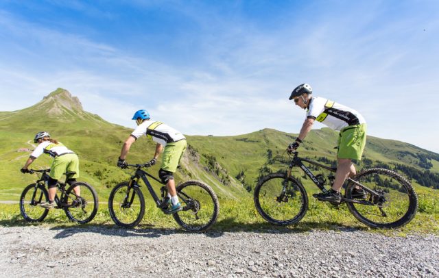
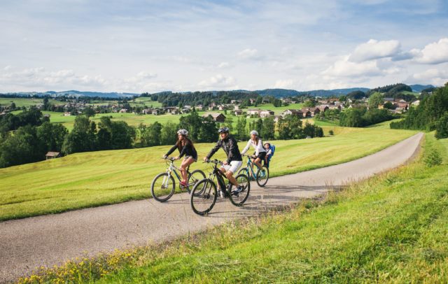
Though a road bike is certainly the fastest way to zoom through the landscape under your own steam, at this pace you’ll still be able to absorb the scenery. Vorarlberg, boasting winding pass roads in top condition, long mountain roads, crisp ups and downs, and plenty of fun places to stop for food or drink, is the perfect place for road bike enthusiasts.

Road bikers will profit from about 24 road bike tours: in particular the pass roads in the Bregenzerwald and Montafon. There are also the classic routes over the Hochtannberg Pass, the Flexen Pass, the Faschinajoch and Furkajoch ridges, the Bödele, the Riedbergpass and over the Silvretta Hochalpenstraße High Alpine Road to the Bielerhöhe. Cross-border tours into Allgäu and the Lechtal and Paznauntal valleys further extend the realm of possibilities.

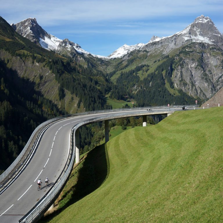
Rennrad fahren in Vorarlberg (c) Ludwig Berchtold / Bregenzerwald Tourismus

Interactive road bike routes – a selection

Online map

  • Ortsteil Britten

    Au-Schoppernau | Circular tour of the Mittelwald

    Take the cycle path as far as the roundabout in Bersbuch. Turn off towards…

    • 61.48 km

    • 3 h

    • leicht

    Difficulty: leicht
    Distance: 61.48 km
    Ascent: 830 m
    Descent: 830 m
    Duration: 3 h
    Deepest point: 523 m
    Highest point: 898 m
    Condition:

    Experience:

    Landscape:

    Au-Schoppernau | Circular tour of the Mittelwald

    Start of tour

    Gemeindeamt Au/Alpenhotel Post

    End of tour

    Gemeindeamt Au/Alpenhotel Post

    Description

    Take the cycle path as far as the roundabout in Bersbuch. Turn off towards Schwarzenberg, cycling through the village centre, past Hotel Hirschen and, after about 300 m, turn right into the narrow road. Now comes a windy, partially steep climb to Brittenberg. There is hardly any traffic on this little road, which affords breathtaking views. At the fountain, turn off to the right, continue on a plateau and stick…

    Best season
    JAN FEB MAR APR MAY JUN
    JUL AUG SEP OCT NOV DEC
    All route info
  • Blick über den Vorderbregenzerwald

    Au-Schoppernau | Circular tour of the Vorderwald

    Take the cycle path to Egg. In Egg, stick to the right towards Großdorf,…

    • 104.97 km

    • 5 h

    • mittel

    Difficulty: mittel
    Distance: 104.97 km
    Ascent: 1505 m
    Descent: 1505 m
    Duration: 5 h
    Deepest point: 542 m
    Highest point: 1015 m
    Condition:

    Experience:

    Landscape:

    Au-Schoppernau | Circular tour of the Vorderwald

    Start of tour

    Gemeindezentrum Schoppernau

    End of tour

    Gemeindezentrum Schoppernau

    Description

    Take the cycle path to Egg. In Egg, stick to the right towards Großdorf, Lingenau and Hittisau. In Hittisau, take the L 205 and then turn off to the right towards Riefensberg, past the turn-off towards the centre. After about 1 km downhill, turn off to the right at the crossroads and continue towards Springen/Aach as far as the turn-off at the golf course. There, turn off to the left.…

    Best season
    JAN FEB MAR APR MAY JUN
    JUL AUG SEP OCT NOV DEC
    All route info
  • Silvretta-Hochalpenstraße

    Au-Schoppernau | Faschina – Silvretta high alpine road –…

    A cycling tour for the real hard core – and it starts with a…

    • 245.81 km

    • 11 h

    • schwer

    Difficulty: schwer
    Distance: 245.81 km
    Ascent: 4750 m
    Descent: 4750 m
    Duration: 11 h
    Deepest point: 535 m
    Highest point: 2038 m
    Condition:

    Experience:

    Landscape:

    Au-Schoppernau | Faschina – Silvretta high alpine road – Hahntenjoch

    Start of tour

    Gemeindeamt Au/Alpenhotel Post

    End of tour

    Gemeindeamt Au/Alpenhotel Post

    Description

    A cycling tour for the real hard core – and it starts with a proverbial cold start! The 15-km long climb to the Faschinajoch (1,486 m) has 16% ramps in some parts of the start phase. From the Faschinajoch, you go down windy roads through the Große Walsertal as far as the Raggal/Bludenz turn-off. From there, turn off to the left and take the road via Raggal to Ludesch. Turn…

    Best season
    JAN FEB MAR APR MAY JUN
    JUL AUG SEP OCT NOV DEC
    All route info
  • Kräfteraubende Strecke von Au nach Damüls mit teilweise 16% Steigung.

    Au-Schoppernau | Furkajoch – Appenzell – Lake Constance

    The tour starts with a proverbial “cold start”. The 18-km long climb to the…

    • 148.73 km

    • 7 h

    • schwer

    Difficulty: schwer
    Distance: 148.73 km
    Ascent: 2538 m
    Descent: 2538 m
    Duration: 7 h
    Deepest point: 392 m
    Highest point: 1767 m
    Condition:

    Experience:

    Landscape:

    Au-Schoppernau | Furkajoch – Appenzell – Lake Constance

    Start of tour

    Gemeindeamt Au/Alpenhotel Post

    End of tour

    Gemeindeamt Au/Alpenhotel Post

    Description

    The tour starts with a proverbial “cold start”. The 18-km long climb to the Furkajoch (1,761 m) has 16% ramps in some parts of the start phase. Every metre higher you go rewards you with an even lovelier view of the valley and the massif. From the Furkajoch a fast, long and technically demanding downhill run awaits, taking you through the Laternsertal as far as Rankweil. In Rankweil, turn off…

    Best season
    JAN FEB MAR APR MAY JUN
    JUL AUG SEP OCT NOV DEC
    All route info
  • Oberdamüls

    Au-Schoppernau | Furkapass Rhine Valley

    The tour starts with a proverbial “cold start”. The 18-km long climb to the…

    • 112.74 km

    • 6 h

    • schwer

    Difficulty: schwer
    Distance: 112.74 km
    Ascent: 2110 m
    Descent: 2110 m
    Duration: 6 h
    Deepest point: 405 m
    Highest point: 1767 m
    Condition:

    Experience:

    Landscape:

    Au-Schoppernau | Furkapass Rhine Valley

    Start of tour

    Gemeindeamt/Tourismusbüro Au

    End of tour

    Gemeindeamt/Tourismusbüro Au

    Description

    The tour starts with a proverbial “cold start”. The 18-km long climb to the Furkajoch (1,761 m) has 16% ramps in some parts of the start phase. Every metre higher you go rewards you with an even lovelier view of the valley and the massif. From the Furkajoch a fast, long and technically demanding downhill run awaits, taking you through the Laternsertal as far as Rankweil. In Rankweil, turn off…

    Best season
    JAN FEB MAR APR MAY JUN
    JUL AUG SEP OCT NOV DEC
    All route info
  • von Lech nach Warth im Hintergrund der Biberkopf

    Au-Schoppernau | Hahntenjoch – Albergpass

    The ride from Au via Schoppernau-Schröcken as far as the Hochtannbergpass (1,676 m) is…

    • 183.24 km

    • 8.5 h

    • schwer

    Difficulty: schwer
    Distance: 183.24 km
    Ascent: 3890 m
    Descent: 3890 m
    Duration: 8.5 h
    Deepest point: 726 m
    Highest point: 1895 m
    Condition:

    Experience:

    Landscape:

    Au-Schoppernau | Hahntenjoch – Albergpass

    Start of tour

    Gemeindeamt/Alpenhotel Post Au

    End of tour

    Gemeindeamt/Alpenhotel Post Au

    Description

    The ride from Au via Schoppernau-Schröcken as far as the Hochtannbergpass (1,676 m) is continuously uphill. However, the 900-metre difference in altitude is spread over 18 km, and the climb comprising a few steep stretches is very even. The ride is accompanied by lovely views in a fascinating alpine world and reveals beautiful views of the valley. In Warth, turn off to the left towards Lechtal and enjoy the downhill…

    Best season
    JAN FEB MAR APR MAY JUN
    JUL AUG SEP OCT NOV DEC
    All route info
  • Blick nach Schröcken

    Au-Schoppernau | Hochtannbergpass – Lech

    The ride from Au via Schoppernau-Schröcken as far as the Hochtannbergpass (1,676 m) is…

    • 61.01 km

    • 3 h

    • mittel

    Difficulty: mittel
    Distance: 61.01 km
    Ascent: 1338 m
    Descent: 1338 m
    Duration: 3 h
    Deepest point: 788 m
    Highest point: 1676 m
    Condition:

    Experience:

    Landscape:

    Au-Schoppernau | Hochtannbergpass – Lech

    Start of tour

    Gemeindeamt/Alpenhotel Post in Au

    End of tour

    Gemeindeamt/Alpenhotel Post in Au

    Description

    The ride from Au via Schoppernau-Schröcken as far as the Hochtannbergpass (1,676 m) is continuously uphill. However, the 900-metre difference in altitude is spread over 18 km, and the climb comprising a few steep stretches is very even. The ride is accompanied by lovely views in a fascinating alpine world and reveals beautiful views of the valley. The descent into Warth is followed by a leisurely, bendy stretch as far…

    Best season
    JAN FEB MAR APR MAY JUN
    JUL AUG SEP OCT NOV DEC
    All route info
  • Bregenzerwälder Bauernhaus

    Au-Schoppernau | Introductory tour on the Schnepfegg

    Take the cycle path to Mellau. When you are leaving Mellau, cross the L…

    • 29.63 km

    • 1.5 h

    • leicht

    Difficulty: leicht
    Distance: 29.63 km
    Ascent: 350 m
    Descent: 447 m
    Duration: 1.5 h
    Deepest point: 645 m
    Highest point: 892 m
    Condition:

    Experience:

    Landscape:

    Au-Schoppernau | Introductory tour on the Schnepfegg

    Start of tour

    Gemeindeamt Au/Alpenhotel Post

    End of tour

    Gemeindeamt Au/Alpenhotel Post

    Description

    Take the cycle path to Mellau. When you are leaving Mellau, cross the L 200 at the Klausbrücke, now comes a short, leisurely climb which rewards you with a lovely view. The downhill run to Reuthe takes you across the company premises of Kaufmann – please adjust your speed accordingly. At the crossroads, turn off to the right, and take the road through the small village of Bizau. At the…

    Best season
    JAN FEB MAR APR MAY JUN
    JUL AUG SEP OCT NOV DEC
    All route info
  • Oberbildstein

    Au-Schoppernau | Lorenapasss – Bildstein – Sulzberg

    Take the cycle path as far as the roundabout in Bersbuch. Turn off towards…

    • 125.22 km

    • 6 h

    • mittel

    Difficulty: mittel
    Distance: 125.22 km
    Ascent: 2330 m
    Descent: 2330 m
    Duration: 6 h
    Deepest point: 414 m
    Highest point: 1066 m
    Condition:

    Experience:

    Landscape:

    Au-Schoppernau | Lorenapasss – Bildstein – Sulzberg

    Start of tour

    Gemeindeamt Au/Alpenhotel Post

    End of tour

    Gemeindeamt Au/Alpenhotel Post

    Description

    Take the cycle path as far as the roundabout in Bersbuch. Turn off towards Schwarzenberg, cycle through the village centre, past Hotel Hirschen and, after about 300 m, turn right into the narrow road. Now comes a windy, partially steep climb to Brittenberg. There is hardly any traffic on this little road, which affords breathtaking views. At the fountain, turn off to the right, continue for about 700 m on…

    Best season
    JAN FEB MAR APR MAY JUN
    JUL AUG SEP OCT NOV DEC
    All route info
  • Haldensee

    Au-Schoppernau | Tannheimer Tal

    Follow the cycle path as far as Egg. There, turn right to Großdorf and…

    • 183.84 km

    • 7.5 h

    • schwer

    Difficulty: schwer
    Distance: 183.84 km
    Ascent: 2430 m
    Descent: 2430 m
    Duration: 7.5 h
    Deepest point: 554 m
    Highest point: 1676 m
    Condition:

    Experience:

    Landscape:

    Au-Schoppernau | Tannheimer Tal

    Start of tour

    Au - Gemeindeamt/Tourismusbüro Au

    End of tour

    Au - Gemeindeamt/Tourismusbüro Au

    Description

    Follow the cycle path as far as Egg. There, turn right to Großdorf and continue as far as Lingenau. At the crossroads, turn right on to the main road to Hittisau/Centre. Pass the church on the L 5 towards Balderschwang and, via the Riedbergpass (1,407 m), Fischen in Allgäu. At the crossroads, go straight ahead and, via the villages Obertalhofen and Untertalhofen, continue to Sonthofen. Leaving Sonthofen, keep right on…

    Best season
    JAN FEB MAR APR MAY JUN
    JUL AUG SEP OCT NOV DEC
    All route info
  • Passstraße zum Hochtannberg

    Au-Schoppernau | Three-pass tour (Hochtannbergpass/Flexenpass/Faschinajoch)

    Au - Schröcken - Hochtannbergpass - Lech - Flexenpass - Alpe Rauz - Klösterle…

    • 106.71 km

    • 6 h

    • schwer

    Difficulty: schwer
    Distance: 106.71 km
    Ascent: 2650 m
    Descent: 2650 m
    Duration: 6 h
    Deepest point: 535 m
    Highest point: 1775 m
    Condition:

    Experience:

    Landscape:

    Au-Schoppernau | Three-pass tour (Hochtannbergpass/Flexenpass/Faschinajoch)

    Au - Schröcken - Hochtannbergpass - Lech - Flexenpass - Alpe Rauz - Klösterle -…

    Start of tour

    Gemeindeamt/Tourismusbüro Au

    End of tour

    Gemeindeamt/Tourismusbüro Au

    Description

    The ride from Au via Schoppernau-Schröcken as far as the Hochtannbergpass (1,676 m) is continuously uphill. However, the 900-metre difference in altitude is spread over 18 km, and the climb comprising a few steep stretches is very even. The ride is accompanied by lovely views of a fascinating alpine world and reveals beautiful views of the valley. The descent into Warth is followed by a leisurely, bendy stretch as far…

    Best season
    JAN FEB MAR APR MAY JUN
    JUL AUG SEP OCT NOV DEC
    All route info
  • Bödele

    Au-Schoppernau | Bödele – Achrain

    Au - on the cycle path to Bersbuch - Schwarzenberg - Bödele - Dornbirn…

    • 89.1 km

    • 4 h

    • mittel

    Difficulty: mittel
    Distance: 89.1 km
    Ascent: 1478 m
    Descent: 1478 m
    Duration: 4 h
    Deepest point: 433 m
    Highest point: 1139 m
    Condition:

    Experience:

    Landscape:

    Au-Schoppernau | Bödele – Achrain

    Au - on the cycle path to Bersbuch - Schwarzenberg - Bödele - Dornbirn -…

    Start of tour

    Gemeindeamt Au/Alpenhotel Post

    End of tour

    Gemeindeamt Au/Alpenhotel Post

    Description

    Take the Bregenzerwald cycle path as far as Bersbuch. Turn off towards Schwarzenberg at the roundabout. In the historically lovely centre of the village of Schwarzenberg, turn off to the left towards the Bödele. The Bödele, also known as the Losenpass, awaits with a difference in altitude of 450 m over 5.7 km. The Bödele represents the direct connection between Dornbirn in the Rhine Valley and the Bregenzerwald. The view…

    Best season
    JAN FEB MAR APR MAY JUN
    JUL AUG SEP OCT NOV DEC
    All route info
  • Alpsee

    Au-Schoppernau | Alpsee

    Take the cycle path as far as Egg. Turn off to the right and…

    • 160.21 km

    • 7 h

    • schwer

    Difficulty: schwer
    Distance: 160.21 km
    Ascent: 2073 m
    Descent: 2073 m
    Duration: 7 h
    Deepest point: 524 m
    Highest point: 1112 m
    Condition:

    Experience:

    Landscape:

    Au-Schoppernau | Alpsee

    Start of tour

    Gemeindeamt/Tourismusbüro Au

    End of tour

    Gemeindeamt/Tourismusbüro Au

    Description

    Take the cycle path as far as Egg. Turn off to the right and follow the road via Großdorf, Lingenau and Hittisau to Sibratsgfäll. In Sibratsgfäll village centre, turn off to the left towards Rohrmoos. The Rohrmoos links the Illertal with the Bregenzerwald. It is particularly pleasing that this road is closed to motorised vehicles of all kinds, meaning that you have the narrow yet well tarmacked road practically to…

    Best season
    JAN FEB MAR APR MAY JUN
    JUL AUG SEP OCT NOV DEC
    All route info

Also interesting: