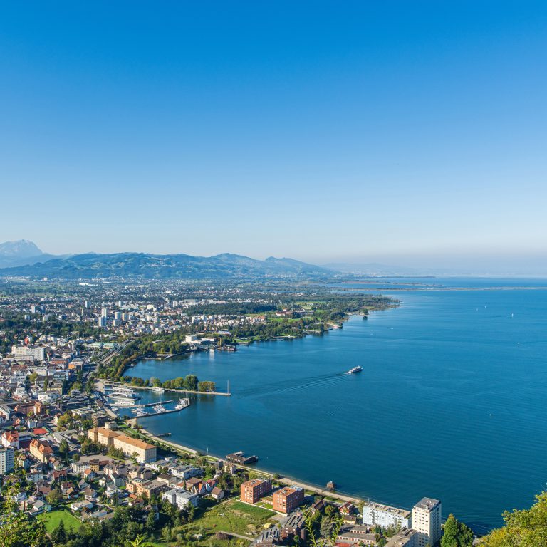
Blick auf die Bregenzer Bucht mit dem blauen Bodensee

Hikes and places to visit around the Bregenzer Festspiele

From leisurely walks along Lake Constance to scenic hikes in the surrounding area – perfect for a varied getaway in Bregenz.

Bregenz is a vibrant festival city known far beyond the region. But Bregenz has much more to offer: nestled between Lake Constance and its local mountain, in the heart of the tri-border region, culture, nature, and active adventures come together. This makes the city the perfect destination for anyone who likes to plan a varied vacation and combine cultural experiences with outdoor activities.

The best way to discover Bregenz’s diversity is on foot. If you’d like to explore the natural surroundings of Bregenz while enjoying spectacular views of Lake Constance, you’ll find numerous varied hiking trails here. The following tours are ideal for getting to know Bregenz and its surroundings step by step.

Hikes around Bregenz

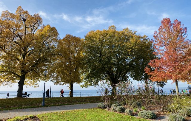
    • Herbststimmung am Pfänder – im Hintergrund Gipfel im Bregenzerwald.

      Panoramic tour along the ridge of the Pfänder above…

      Anyone looking for mountain-solitude is not right here. On the first glance, there are…

      • 6.95 km

      • 2.5 h

      • leicht

      Difficulty: leicht
      Distance: 6.95 km
      Ascent: 135 m
      Descent: 135 m
      Duration: 2.5 h
      Deepest point: 896 m
      Highest point: 1028 m
      Condition:

      Experience:

      Landscape:

      Panoramic tour along the ridge of the Pfänder above Bregenz

      Start of tour

      Bregenz, summit station of Pfänder

      End of tour

      Bregenz, summit station of Pfänder

      Description

      Anyone looking for mountain-solitude is not right here. On the first glance, there are large crowds bustling on the local mountain of Bregenz. Of course, the tour leads to more remote corners of the ridge of the Pfänder where there are smaller villages hidden from those who choose to get to the top by cable car. In any case, the cable-car ride to the summit station (1023 m) already gives…

      Best season
      JAN FEB MAR APR MAY JUN
      JUL AUG SEP OCT NOV DEC
      All route info
    • Blick vom Pfänder

      Bregenz | Adventure route Pfänder – Hirschberg

      From the Pfänder you have a wonderful panoramic view over the whole of Lake…

      • 11.96 km

      • 3.6 h

      • mittel

      Difficulty: mittel
      Distance: 11.96 km
      Ascent: 210 m
      Descent: 580 m
      Duration: 3.6 h
      Deepest point: 654 m
      Highest point: 1080 m
      Condition:

      Experience:

      Landscape:

      Bregenz | Adventure route Pfänder – Hirschberg

      Start of tour

      Bregenz, Pfänderbahn summit station

      End of tour

      Langen, Bregenz

      Description

      From the Pfänder you have a wonderful panoramic view over the whole of Lake Constance and the mountain peaks of Switzerland, Liechtenstein and Vorarlberg. Around the mountain station and along the route there are several inns and snack stations to choose from.

      Best season
      JAN FEB MAR APR MAY JUN
      JUL AUG SEP OCT NOV DEC
      All route info
    • Zisterzienserabtei Mehrerau

      On the Mehrerau Lake Constance Trail

      Bregenz festival hall – Mehrerau – marina – Bregenzerach estuary

      • 6.4 km

      • 1.7 h

      • leicht

      Difficulty: leicht
      Distance: 6.4 km
      Ascent: 10 m
      Descent: 10 m
      Duration: 1.7 h
      Deepest point: 394 m
      Highest point: 399 m
      Condition:

      On the Mehrerau Lake Constance Trail

      Start of tour

      Bregenz festival hall

      End of tour

      Bregenzerach estuary

      Description

      Bregenz festival hall – Mehrerau – marina – Bregenzerach estuary

      Best season
      JAN FEB MAR APR MAY JUN
      JUL AUG SEP OCT NOV DEC
      All route info
    • Aussichtsreiche Talwanderung vom Pfänder über den Känzeleweg

      From the Pfänder via Gebhardsberg to Bregenz

      The Pfänderbahn in Bregenz takes hikers up to the Pfänder (1064 m) in just…

      • 8.54 km

      • 2.5 h

      • mittel

      Difficulty: mittel
      Distance: 8.54 km
      Descent: 600 m
      Duration: 2.5 h
      Deepest point: 418 m
      Highest point: 1020 m
      Condition:

      Experience:

      Landscape:

      From the Pfänder via Gebhardsberg to Bregenz

      Start of tour

      Pfänderbahn Bregenz

      End of tour

      Pfänderbahn Bregenz

      Description

      The Pfänderbahn in Bregenz takes hikers up to the Pfänder (1064 m) in just six minutes. This is where one of the Lake Constance region’s most beautiful vantage points with its magnificent panoramic view over Lake Constance, the Rhine Valley, the Swiss mountains and the Bregenzerwald may be enjoyed.The descent (620 m) follows wide hiking trails, mostly in shady woods. Information boards providing details about the forest nature trail are…

      Best season
      JAN FEB MAR APR MAY JUN
      JUL AUG SEP OCT NOV DEC
      All route info
    • Startpunkt in Eichenberg

      Educational cheese trail along the Pfänder ridge

      The trail was named in recognition of Josef Rupp’s dedication to farming issues.The cheese…

      • 5.36 km

      • 1.5 h

      • leicht

      Difficulty: leicht
      Distance: 5.36 km
      Ascent: 300 m
      Descent: 200 m
      Duration: 1.5 h
      Deepest point: 793 m
      Highest point: 1064 m
      Condition:

      Experience:

      Landscape:

      Educational cheese trail along the Pfänder ridge

      Start of tour

      Eichenberg Dorf

      End of tour

      Eichenberg Lutzenreute

      Description

      The trail was named in recognition of Josef Rupp’s dedication to farming issues.The cheese trail is a family hike with stop-offs and farm shops where refreshments are available. The Jungholz Hinteregg, Lutzenreute and Rucksteig alpine dairies are also located not far from the trail. These hay-milk dairies are among the oldest in Vorarlberg.The Josef Rupp Cheese Hiking Trail takes in the entire Pfänder ridge. From Lochau, Eichenberg and Möggers to…

      Best season
      JAN FEB MAR APR MAY JUN
      JUL AUG SEP OCT NOV DEC
      All route info
    • Talwanderung vom Pfänder

      Bregenz – Pfänderbahn Bergstation – Lohorn – Altreute –…

      • 4 km

      • 1.5 h

      • mittel

      Difficulty: mittel
      Distance: 4 km
      Ascent: 10 m
      Descent: 620 m
      Duration: 1.5 h
      Deepest point: 416 m
      Highest point: 1021 m
      Condition:

      Experience:

      Landscape:

      Bregenz – Pfänderbahn Bergstation – Lohorn – Altreute – Talstation

      Best season
      JAN FEB MAR APR MAY JUN
      JUL AUG SEP OCT NOV DEC
      All route info
    • Eichenberg mit Blick über den Bodensee

      Lochau – Eichenberg – Lochau

      • 9 km

      • 3.3 h

      • leicht

      Difficulty: leicht
      Distance: 9 km
      Ascent: 430 m
      Descent: 430 m
      Duration: 3.3 h
      Deepest point: 415 m
      Highest point: 831 m
      Condition:

      Experience:

      Landscape:

      Lochau – Eichenberg – Lochau

      Best season
      JAN FEB MAR APR MAY JUN
      JUL AUG SEP OCT NOV DEC
      All route info

Places to visit around Bregenz

More tips about Bregenz: