Webcams Current Snow Report Avalanche Report Weather & Traffic
Rodelsafari im Brandnertal, toboggan (c) Dietmar Walser / Alpenregion Bludenz Tourismus
Into the valley on two runners

Tobogganing in Vorarlberg

Fun in the snow

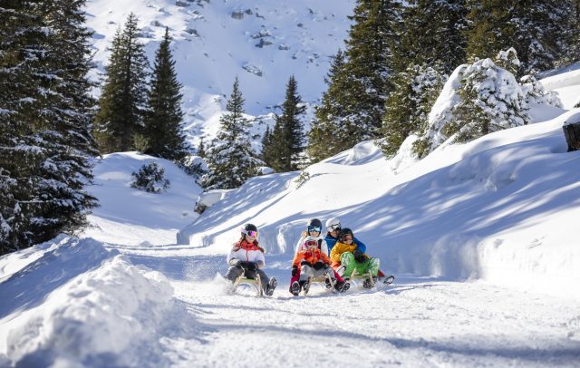
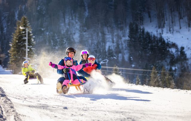
Select from countless sledging tracks or toboggan runs located throughout the Vorarlberg holiday region. Some tracks are even floodlit or illuminated by torchlight. The longest such track is the 5.5-km-long night-sledging track in St. Gallenkirch-Garfrescha in Montafon. Before sledging down, it is important to gather your courage and strength at one of the mountain huts or inns near the sledging tracks. Those without a sledge can rent one at many places.

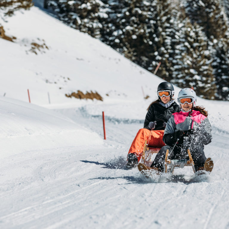
Special Tip: In the Brandnertal there is a toboggan safari, which allows you to enjoy the snowy landscape and breathtaking views during between the fast descents. It leads  from the top station of the Panoramabahn down to Bürserberg, back to the starting point by bus. On Tuesdays, an evening toboggan safari is organised, with participants sporting headlamps as they whizz down the trail. There is always a guide to accompany the party.

Play
Tobogganing fun in Vorarlberg
    • Klettersteig Röbischlucht

      via ferrata Röbischlucht

      Difficulty: B, in 1 to 2 areas C

      • 3.13 km

      • 1 h

      • mittel

      Difficulty: mittel
      Distance: 3.13 km
      Ascent: 227 m
      Descent: 227 m
      Duration: 1 h
      Deepest point: 1382 m
      Highest point: 1593 m
      Condition:

      Experience:

      Landscape:

      via ferrata Röbischlucht

      Start of tour

      Gargellen

      End of tour

      Gargellen

      Description

      Difficulty: B, in 1 to 2 areas C

      Best season
      JAN FEB MAR APR MAY JUN
      JUL AUG SEP OCT NOV DEC
      All route info
    • Gipfelkreuz am Hohen Fraßen

      From Raggal to the Hohe Frassen, 1,979 m |…

      Beautiful circular hike from Raggal over the Klesialpe to the Hohen Frassen and over…

      • 9.69 km

      • 5 h

      • mittel

      Difficulty: mittel
      Distance: 9.69 km
      Ascent: 966 m
      Descent: 966 m
      Duration: 5 h
      Deepest point: 1013 m
      Highest point: 1979 m
      Condition:

      Experience:

      Landscape:

      From Raggal to the Hohe Frassen, 1,979 m | Raggal

      Beautiful circular hike from Raggal over the Klesialpe to the Hohen Frassen and over the…

      Start of tour

      Local center, Raggal

      End of tour

      Local center, Raggal

      Description

      The hike starts in the center of Raggal. From here, the trail leads across meadows and through forests up to the fork. Keep left here and follow the signs to the Klesialpe. From the Klesialpe you now walk the last part uphill to the summit of the Hohen Frassen. At the Hohen Frassen you can enjoy a breathtaking panoramic view of the Große Walsertal, the Walgau and the mountains of…

      Best season
      JAN FEB MAR APR MAY JUN
      JUL AUG SEP OCT NOV DEC
      All route info
    • Brüggelekopf

      Alberschwende | Brüggelekopf

      An easy and scenic hike of about 3 hours from Alberschwende village center to…

      • 7.02 km

      • 3 h

      • mittel

      Difficulty: mittel
      Distance: 7.02 km
      Ascent: 460 m
      Descent: 460 m
      Duration: 3 h
      Deepest point: 718 m
      Highest point: 1183 m
      Condition:

      Experience:

      Landscape:

      Alberschwende | Brüggelekopf

      An easy and scenic hike of about 3 hours from Alberschwende village center to Kaltenbrunnen…

      Start of tour

      Alberschwende cable car station

      End of tour

      Alberschwende cable car station

      Description

      A path full of lovely views takes you to the Tannen plot. From there, an arrow path across the field takes you up to Kaltenbrunnen, where you are rewarded with a fantastic view. At the end of a piece of forest, you reach the alpine area around the Brüggelekopf. You get a magnificent view of Lake Constance from the summit. You return to the valley via cable car.

      Best season
      JAN FEB MAR APR MAY JUN
      JUL AUG SEP OCT NOV DEC
      All route info
    • Mountainbiken und Wandern im Brandnertal (Symbolbild)

      Small Brandnertal Round | Brand-Bürserberg

      Easy MTB tour with start in Brand, which is also very suitable for beginners.

      • 23.56 km

      • 3.5 h

      • leicht

      Difficulty: leicht
      Distance: 23.56 km
      Ascent: 939 m
      Descent: 939 m
      Duration: 3.5 h
      Deepest point: 839 m
      Highest point: 1676 m
      Condition:

      Experience:

      Landscape:

      Small Brandnertal Round | Brand-Bürserberg

      Easy MTB tour with start in Brand, which is also very suitable for beginners.

      Start of tour

      Dorfbahn cableway valley station

      End of tour

      Dorfbahn cableway valley station

      Description

      This easy MTB tour starts at the Dorfbahn valley station and leads via the Eggaweg up to the mountain station of the Dorfbahn. Alternatively, this section of the route can also be conquered with the Dorfbahn. From the Dorfbahn mountain station, head towards the Innere Parpfienzalpe and continue along the Natursprünge trail to the Parpfienzsattel. From the Parpfienzsattel continue cycling towards the Burtschasattel. The tour then leads past the Frööd…

      Best season
      JAN FEB MAR APR MAY JUN
      JUL AUG SEP OCT NOV DEC
      All route info
    • Blick vom Zafernhorn auf den Zitterklapfen

      Damüls Faschina | Sunrise hike to the Zafernhorn

      Probably the best moment of a summer day: the sunrise from Faschina (1,423 m)…

      • 5.71 km

      • 2.3 h

      • schwer

      Difficulty: schwer
      Distance: 5.71 km
      Ascent: 734 m
      Descent: 50 m
      Duration: 2.3 h
      Deepest point: 1373 m
      Highest point: 2107 m
      Condition:

      Experience:

      Landscape:

      Damüls Faschina | Sunrise hike to the Zafernhorn

      Probably the best moment of a summer day: the sunrise from Faschina (1,423 m) to…

      Description

      The Zafernhorn is a panoramic mountain par excellence between the Bregenzerwald and the Großes Walsertal. Once at the top, the view opens up frontally to the imposing Rote Wand and to the south to the Rätikon. Behind the Rote Wand, Silvretta summits with the easily identifiable Piz Buin and glacier reach for the sky. The rustic summit cross on the Zafernhorn and the fantastic sunrise always provide an impressive spectacle.

      Best season
      JAN FEB MAR APR MAY JUN
      JUL AUG SEP OCT NOV DEC
      All route info
    preloader